
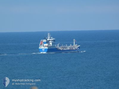
LEXUS
Oil/Chemical Tanker
Current Trip
| Time Travelled | 1 day |
|---|---|
| Remaining Time | 15 h, 4 mins |
| Distance Travelled | 333.29 nm |
| Remaining Distance | 164.97 nm |
| AVG Speed | 11.2 Knop |
| MAX Speed | 14.9 Knop |
| AVG Wind | 7.3 knots |
| MAX Wind | 18 knots |
| MIN Temp | 4°C / 39.2°F |
| MAX Temp | 6.4°C / 43.52°F |
| Djupgående | 5.7 m |
| Position mottagen | Nu |
Current Position
| Longitud | 7.60418° |
|---|---|
| Latitude | 56.47197° |
| Status | Under way using engine |
| Fart | 10.7 Knop |
| Kurs | 30.4° |
| Område | North Sea |
| Station | T-AIS |
| Position mottagen | Nu |
Info
Information
The current position of LEXUS is in North Sea with coordinates 56.47197° / 7.60418° as reported on 2025-02-07 04:39 by AIS to our vessel tracker app. The vessel's current speed is 10.7 Knop and is heading at the port of FREDERIKSHAVN. The estimated time of arrival as calculated by MyShipTracking vessel tracking app is 2025-02-07 19:44 LT
The vessel LEXUS (IMO: 9310317, MMSI: 266472000) is a Oil/Chemical Tanker that was built in 2005 ( 20 År gammal ). It's sailing under the flag of [SE] Sweden.
In this page you can find informations about the vessels current position, last detected port calls, and current voyage information. If the vessels is not in coverage by AIS you will find the latest position.
The current position of LEXUS is detected by our AIS receivers and we are not responsible for the reliability of the data. The last position was recorded while the vessel was in Coverage by the Ais receivers of our vessel tracking app.
The current draught of LEXUS as reported by AIS is 5.7 meters
Weather
| Temperature | 4.3°C / 39.74°F |
|---|---|
| Wind Speed | 13 knots |
| Direction | 96° E |
| Pressure | 1044.5 hPa |
| Humidity | 77.7 % |
| Cloud Coverage | 59 % |
Featured Company
Last Port Calls
| Port | Arrival | Departure | Time In Port |
|---|---|---|---|
| 2025-02-04 20:09 | 2025-02-05 22:09 | 1 d | |
| 2025-01-28 00:17 | 2025-01-28 14:32 | 14 h | |
| 2025-01-26 21:59 | 2025-01-27 19:29 | 21 h | |
| 2025-01-26 05:37 | 2025-01-26 13:09 | 7 h | |
| 2025-01-24 13:11 | 2025-01-25 07:09 | 17 h | |
| 2025-01-24 00:05 | 2025-01-24 06:30 | 6 h | |
| 2025-01-21 09:49 | 2025-01-21 16:49 | 7 h | |
| 2025-01-20 01:04 | 2025-01-20 08:57 | 7 h | |
| 2025-01-20 00:46 | 2025-01-20 00:53 | 6 m | |
| 2025-01-18 16:07 | 2025-01-19 01:30 | 9 h |
Most Visited Ports (Last year)
| Port | Arrivals | |
|---|---|---|
| 77 | ||
| 22 | ||
| 16 | ||
| 9 | ||
| 8 | ||
| 6 |
Last Trips
| Origin | Departure | Destination | Arrival | Distance | |
|---|---|---|---|---|---|
| 2025-01-28 15:32 | 2025-02-04 21:09 | 580.37 nm | |||
| 2025-01-27 20:29 | 2025-01-28 01:17 | 55.56 nm | |||
| 2025-01-26 14:09 | 2025-01-26 22:59 | 106.68 nm | |||
| 2025-01-25 08:09 | 2025-01-26 06:37 | 225.94 nm | |||
| 2025-01-24 07:30 | 2025-01-24 14:11 | 53.39 nm | |||
| 2025-01-21 17:49 | 2025-01-24 01:05 | 434.67 nm | |||
| 2025-01-20 09:57 | 2025-01-21 10:49 | 191.69 nm | |||
| 2025-01-20 01:53 | 2025-01-20 02:04 | 0.25 nm | |||
| 2025-01-19 02:30 | 2025-01-20 01:46 | 80.72 nm | |||
| 2025-01-18 06:59 | 2025-01-18 17:07 | 119.97 nm |
Events
| Tid | Event | Detaljer | Position / Dest | Information |
|---|---|---|---|---|
| 2025-02-06 23:12 | Byter havsområde | Danish part of the North Sea Dutch part of the North Sea |
55.70468 / 6.56840
North Sea
DKFDH
|
Fart: 10.5 kn Kurs: 39.9° |
| 2025-02-06 23:12 | Status ändrad | Under way using engine Default |
55.70468 / 6.56840
DKFDH
|
Fart: 10.5 kn Kurs: 26° |
| 2025-02-06 23:12 | I täckningsområde |
55.70468 / 6.56840
North Sea
DKFDH
|
Fart: 10.5 kn Kurs: 39.9° |
|
| 2025-02-06 10:22 | Status ändrad | Default Under way using engine |
53.63082 / 4.86330
DKFDH
|
Fart: 11.8 kn Kurs: 24.8° |
| 2025-02-06 10:04 | UTANFÖR täckningsområde |
53.57832 / 4.82166
North Sea
DKFDH
|
Fart: 11.8 kn Kurs: 24.8° |
|
| 2025-02-06 10:01 | Status ändrad | Under way using engine Default |
53.56898 / 4.81435
DKFDH
|
Fart: 11.7 kn Kurs: 25° |
| 2025-02-06 09:40 | Status ändrad | Default Under way using engine |
53.50700 / 4.76636
DKFDH
|
Fart: 11.6 kn Kurs: 24.4° |
| 2025-02-06 08:46 | Status ändrad | Under way using engine Default |
53.34728 / 4.65053
DKFDH
|
Fart: 11.5 kn Kurs: 22° |
| 2025-02-06 07:52 | Status ändrad | Default Under way using engine |
53.19180 / 4.53091
DKFDH
|
Fart: 11.3 kn Kurs: 32.4° |
| 2025-02-06 07:44 | Status ändrad | Under way using engine Default |
53.17190 / 4.50949
DKFDH
|
Fart: 11.4 kn Kurs: 32° |