
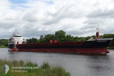
LONGVIKING
General Cargo
Current Trip
| Time Travelled | 2 days |
|---|---|
| Remaining Time | -19 mins |
| Distance Travelled | 599.81 nm |
| Remaining Distance | 25.87 nm |
| AVG Speed | 11.4 Knop |
| MAX Speed | 13.3 Knop |
| AVG Wind | 7.3 knots |
| MAX Wind | 17 knots |
| MIN Temp | -0.8°C / 30.56°F |
| MAX Temp | 3.2°C / 37.76°F |
| Djupgående | 4.4 m |
| Position mottagen | 1 d sen |
Current Position
| Longitud | 16.56508° |
|---|---|
| Latitude | 55.99545° |
| Status | Under way using engine |
| Fart | 12.2 Knop |
| Kurs | 60° |
| Område | Baltic Sea |
| Station | T-AIS |
| Position mottagen | 1 d sen |
Info
Information
The current position of LONGVIKING is in Baltic Sea with coordinates 55.99545° / 16.56508° as reported on 2025-02-03 19:55 by AIS to our vessel tracker app. The vessel's current speed is 12.2 Knop and is heading at the port of RIGA. The estimated time of arrival as calculated by MyShipTracking vessel tracking app is 2025-02-05 19:34 LT
The vessel LONGVIKING (IMO: 9547324, MMSI: 245901000) is a General Cargo that was built in 2010 ( 15 År gammal ). It's sailing under the flag of [NL] Netherlands.
In this page you can find informations about the vessels current position, last detected port calls, and current voyage information. If the vessels is not in coverage by AIS you will find the latest position.
The current position of LONGVIKING is detected by our AIS receivers and we are not responsible for the reliability of the data. The last position was recorded while the vessel was in Coverage by the Ais receivers of our vessel tracking app.
The current draught of LONGVIKING as reported by AIS is 4.4 meters
Weather
| Temperature | 2.2°C / 35.96°F |
|---|---|
| Wind Speed | 17 knots |
| Direction | 183° S |
| Pressure | 1029.4 hPa |
| Humidity | 87 % |
| Cloud Coverage | 100 % |
Featured Company
Last Port Calls
| Port | Arrival | Departure | Time In Port |
|---|---|---|---|
| 2025-02-02 06:34 | 2025-02-02 20:04 | 13 h | |
| 2025-01-27 11:48 | 2025-01-28 16:14 | 1 d | |
| 2025-01-23 23:12 | |||
| 2025-01-19 08:02 | 2025-01-20 19:37 | 1 d | |
| 2025-01-15 17:59 | 2025-01-16 14:02 | 20 h | |
| 2025-01-11 20:34 | 2025-01-13 11:44 | 1 d | |
| 2025-01-09 01:26 | 2025-01-09 17:44 | 16 h | |
| 2025-01-05 07:16 | 2025-01-05 21:12 | 13 h | |
| 2024-12-31 09:40 | 2025-01-03 07:30 | 2 d | |
| 2024-12-28 09:25 | 2024-12-30 05:21 | 1 d |
Most Visited Ports (Last year)
| Port | Arrivals | |
|---|---|---|
| 15 | ||
| 9 | ||
| 6 | ||
| 5 | ||
| 4 | ||
| 4 |
Last Trips
| Origin | Departure | Destination | Arrival | Distance | |
|---|---|---|---|---|---|
| 2025-01-28 17:14 | 2025-02-02 07:34 | 950.33 nm | |||
| 2025-01-24 01:12 | 2025-01-27 12:48 | 419.91 nm | |||
| 2025-01-16 16:02 | 2025-01-19 09:02 | 604.88 nm | |||
| 2025-01-13 12:44 | 2025-01-15 19:59 | 606.80 nm | |||
| 2025-01-09 19:44 | 2025-01-11 21:34 | 567.94 nm | |||
| 2025-01-05 22:12 | 2025-01-09 03:26 | 541.39 nm | |||
| 2025-01-03 09:30 | 2025-01-05 08:16 | 430.93 nm | |||
| 2024-12-30 06:21 | 2024-12-31 11:40 | 315.08 nm | |||
| 2024-12-24 15:58 | 2024-12-28 10:25 | 317.81 nm | |||
| 2024-12-21 12:58 | 2024-12-23 08:05 | 446.12 nm |
Events
| Tid | Event | Detaljer | Position / Dest | Information |
|---|---|---|---|---|
| 2025-02-05 15:13 | STARTAR förflyttning | 4.85 nm, North of RIGA |
57.02857 / 24.08288
LV RIX
|
Fart: 5.1 kn Kurs: 348° |
| 2025-02-04 20:41 | STOPPAR förflyttning | 4.66 nm, North of RIGA |
57.02538 / 24.08380
LV RIX
|
Fart: 0.1 kn Kurs: 344° |
| 2025-02-03 20:01 | Status ändrad | Default Under way using engine |
56.00565 / 16.59613
LV RIX
|
Fart: 12.2 kn Kurs: 60° |
| 2025-02-03 19:55 | Status ändrad | Under way using engine Default |
55.99545 / 16.56508
LV RIX
|
Fart: 12.2 kn Kurs: 60° |
| 2025-02-03 19:55 | UTANFÖR täckningsområde |
55.99545 / 16.56508
Baltic Sea
LV RIX
|
Fart: 12.2 kn Kurs: 60° |
|
| 2025-02-03 19:53 | Status ändrad | Default Under way using engine |
55.99200 / 16.55418
LV RIX
|
Fart: 12.1 kn Kurs: 60° |
| 2025-02-03 16:07 | Byter havsområde | Swedish part of the Baltic Sea Danish part of the Kattegat |
55.61985 / 15.38282
Baltic Sea
LV RIX
|
Fart: 12.1 kn Kurs: 60° |
| 2025-02-03 12:24 | Byter havsområde | Danish part of the Kattegat Swedish part of the Baltic Sea |
55.18607 / 14.29378
Kattegat
LV RIX
|
Fart: 12.1 kn Kurs: 69° |
| 2025-02-03 07:43 | Byter havsområde | Swedish part of the Baltic Sea Danish part of the Baltic Sea |
55.30207 / 12.64932
Baltic Sea
LV RIX
|
Fart: 12.1 kn Kurs: 112° |
| 2025-02-03 07:34 | Byter havsområde | Danish part of the Baltic Sea Danish part of the Kattegat |
55.32645 / 12.63778
Baltic Sea
LV RIX
|
Fart: 11.9 kn Kurs: 189° |