
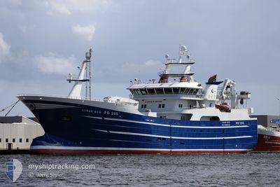
LUNAR BOW
Fishing
Current Trip
Current Position
| Longitud | -1.77502° |
|---|---|
| Latitude | 57.50103° |
| Status | Default |
| Fart | |
| Kurs | 250° |
| Område | North Sea |
| Station | T-AIS |
| Position mottagen | Nu |
Info
Information
The current position of LUNAR BOW is in North Sea with coordinates 57.50103° / -1.77502° as reported on 2025-03-21 21:52 by AIS to our vessel tracker app. The vessel's current speed is 0 Knop and is currently inside the port of PETERHEAD.
The vessel LUNAR BOW (IMO: 9842009, MMSI: 232025939) is a Fishing It's sailing under the flag of [GB] United Kingdom.
In this page you can find informations about the vessels current position, last detected port calls, and current voyage information. If the vessels is not in coverage by AIS you will find the latest position.
The current position of LUNAR BOW is detected by our AIS receivers and we are not responsible for the reliability of the data. The last position was recorded while the vessel was in Coverage by the Ais receivers of our vessel tracking app.
Weather
| Temperature | 6.9°C / 44.42°F |
|---|---|
| Wind Speed | 21 knots |
| Direction | 123° ESE |
| Pressure | 1008.4 hPa |
| Humidity | 84.3 % |
| Cloud Coverage | 100 % |
Featured Company
Last Port Calls
| Port | Arrival | Departure | Time In Port |
|---|---|---|---|
| 2025-03-20 13:02 | |||
| 2025-03-03 08:13 | 2025-03-07 14:02 | 4 d | |
| 2025-02-20 18:03 | 2025-02-23 21:40 | 3 d | |
| 2025-01-31 13:40 | 2025-02-07 11:15 | 6 d | |
| 2025-01-24 04:39 | 2025-01-29 23:07 | 5 d | |
| 2025-01-16 07:42 | 2025-01-22 19:27 | 6 d | |
| 2025-01-10 07:58 | 2025-01-14 20:33 | 4 d | |
| 2025-01-08 18:50 |
Last Trips
| Origin | Departure | Destination | Arrival | Distance | |
|---|---|---|---|---|---|
| 2025-03-07 14:02 | 2025-03-20 13:02 | 239.03 nm | |||
| 2025-02-23 21:40 | 2025-03-03 08:13 | 253.48 nm | |||
| 2025-02-07 11:15 | 2025-02-20 18:03 | 240.95 nm | |||
| 2025-01-29 23:07 | 2025-01-31 13:40 | 245.68 nm | |||
| 2025-01-22 19:27 | 2025-01-24 04:39 | 8.87 nm | |||
| 2025-01-14 20:33 | 2025-01-16 07:42 | 236.27 nm | |||
| 2025-01-08 18:50 | 2025-01-10 07:58 | 36.50 nm |
Events
| Tid | Event | Detaljer | Position / Dest | Information |
|---|---|---|---|---|
| 2025-03-20 13:11 | STOPPAR förflyttning |
57.50145 / -1.77562
[GB] PETERHEAD
|
Fart: 0.3 kn Kurs: 112° |
|
| 2025-03-20 13:02 | ANLÄNDER HAMN |
|
57.49652 / -1.77200
[GB] PETERHEAD
|
Fart: 11.1 kn Kurs: 295.7° |
| 2025-03-20 12:29 | I täckningsområde |
57.60657 / -1.74578
North Sea
|
Fart: 14.6 kn Kurs: 176.1° |
|
| 2025-03-20 07:11 | UTANFÖR täckningsområde |
58.62350 / -2.96848
North Sea
|
Fart: 12.3 kn Kurs: 149.7° |
|
| 2025-03-20 05:52 | Upptäckt i hav | United Kingdom part of the North Sea |
58.68869 / -3.40233
North Sea
|
Fart: 11.6 kn Kurs: 88.7° |
| 2025-03-20 04:01 | I täckningsområde |
58.68030 / -4.18190
North Atlantic Ocean
|
Fart: 13.9 kn Kurs: 88.8° |