

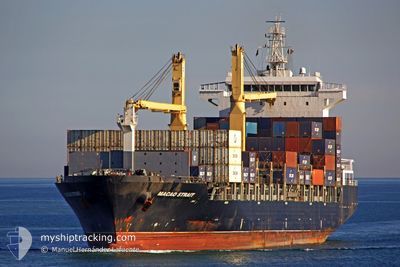
MACAO
Container Ship

Current Trip
| Trip Time | 1 day |
|---|---|
| Trip Distance | 534.45 nm |
| AVG Speed | 12.9 Knop |
| MAX Speed | 14.2 Knop |
| Djupgående | 10.2 m |
| AVG Wind | 7.9 knots |
| MAX Wind | 17.8 knots |
| MIN Temp | 20.4°C / 68.72°F |
| MAX Temp | 27.9°C / 82.22°F |
| Position mottagen | 1 m sen |
Current Position
| Longitud | 33.01292° |
|---|---|
| Latitude | 34.64767° |
| Status | Moored |
| Fart | |
| Kurs | 89° |
| Område | Mediterranean Sea - Eastern Basin |
| Station | T-AIS |
| Position mottagen | 1 m sen |
Information
The current position of MACAO is in Mediterranean Sea - Eastern Basin with coordinates 34.64767° / 33.01292° as reported on 2025-05-25 10:44 by AIS to our vessel tracker app. The vessel's current speed is 0 Knop and is currently inside the port of LIMASSOL.
The vessel MACAO (IMO: 9362724, MMSI: 255805611) is a Container Ship that was built in 2008 ( 17 År gammal ). It's sailing under the flag of [PT] Portugal.
In this page you can find informations about the vessels current position, last detected port calls, and current voyage information. If the vessels is not in coverage by AIS you will find the latest position.
The current position of MACAO is detected by our AIS receivers and we are not responsible for the reliability of the data. The last position was recorded while the vessel was in Coverage by the Ais receivers of our vessel tracking app.
The current draught of MACAO as reported by AIS is 10.2 meters
Weather
| Temperature | 30.9°C / 87.62°F |
|---|---|
| Wind Speed | 7 knots |
| Direction | 186° S |
| Pressure | 1011 hPa |
| Humidity | 30.1 % |
| Cloud Coverage | 14 % |


Featured Company
Last Port Calls
| Port | Arrival | Departure | Time In Port |
|---|---|---|---|
| 2025-05-25 06:13 | |||
| 2025-05-22 08:31 | 2025-05-23 14:11 | 1 d | |
| 2025-05-18 06:19 | 2025-05-19 07:10 | 1 d | |
| 2025-05-14 03:16 | 2025-05-15 12:15 | 1 d | |
| 2025-05-10 18:00 | 2025-05-13 02:35 | 2 d | |
| 2025-05-08 07:06 | 2025-05-10 01:28 | 1 d | |
| 2025-05-02 05:56 | 2025-05-03 14:11 | 1 d | |
| 2025-04-29 18:06 | 2025-04-30 06:38 | 12 h | |
| 2025-04-28 08:02 | 2025-04-28 21:14 | 13 h | |
| 2025-04-27 04:01 | 2025-04-27 19:35 | 15 h |
Most Visited Ports (Last year)
| Port | Arrivals | |
|---|---|---|
| 16 | ||
| 6 | ||
| 6 | ||
| 6 | ||
| 6 | ||
| 6 |
Last Trips
| Origin | Departure | Destination | Arrival | Distance | |
|---|---|---|---|---|---|
| 2025-05-23 14:11 | 2025-05-25 06:13 | 534.45 nm | |||
| 2025-05-19 07:10 | 2025-05-22 08:31 | 308.05 nm | |||
| 2025-05-15 12:15 | 2025-05-18 06:19 | 733.38 nm | |||
| 2025-05-13 02:35 | 2025-05-14 03:16 | 213.12 nm | |||
| 2025-05-10 01:28 | 2025-05-10 18:00 | 211.12 nm | |||
| 2025-05-03 14:11 | 2025-05-08 07:06 | 1216.04 nm | |||
| 2025-04-30 06:38 | 2025-05-02 05:56 | 141.09 nm | |||
| 2025-04-28 21:14 | 2025-04-29 18:06 | 261.49 nm | |||
| 2025-04-27 19:35 | 2025-04-28 08:02 | 205.01 nm | |||
| 2025-04-23 23:11 | 2025-04-27 04:01 | 590.39 nm |
Events
| Tid | Event | Detaljer | Position / Dest | Information |
|---|---|---|---|---|
| 2025-05-25 10:46 | Destination ändrad | CYLMS>>EGDAM GRPIR>>CYLMS |
34.64767 / 33.01292
[CY] LIMASSOL
|
Fart: Kurs: 89° |
| 2025-05-25 03:47 | Status ändrad | Moored Under way using engine |
34.64766 / 33.01290
[CY] LIMASSOL
|
Fart: Kurs: 89° |
| 2025-05-25 03:38 | STOPPAR förflyttning |
34.64731 / 33.01300
[CY] LIMASSOL
|
Fart: 0.3 kn Kurs: 90° |
|
| 2025-05-25 03:13 | ANLÄNDER HAMN |
|
34.65370 / 33.03562
[CY] LIMASSOL
|
Fart: 6.2 kn Kurs: 245.5° |
| 2025-05-25 02:31 | I täckningsområde |
34.60325 / 33.12931
Mediterranean Sea - Eastern Basin
GRPIR>>CYLMS
|
Fart: 3.6 kn Kurs: 341.6° |
|
| 2025-05-25 00:54 | UTANFÖR täckningsområde |
34.48952 / 32.85804
Mediterranean Sea - Eastern Basin
GRPIR>>CYLMS
|
Fart: 13.4 kn Kurs: 87.7° |
|
| 2025-05-24 23:56 | STARTAR förflyttning | 16.63 nm, South East of PAPHOS |
34.52298 / 32.59983
GRPIR>>CYLMS
|
Fart: 13.2 kn Kurs: 107.8° |
| 2025-05-24 23:55 | STOPPAR förflyttning | 16.55 nm, South East of PAPHOS |
34.52309 / 32.59715
GRPIR>>CYLMS
|
Fart: Kurs: 107° |
| 2025-05-24 21:28 | Status ändrad | Under way using engine Default |
34.68751 / 31.97603
GRPIR>>CYLMS
|
Fart: 12.6 kn Kurs: 108° |
| 2025-05-24 21:19 | Status ändrad | Default Under way using engine |
34.69725 / 31.94021
GRPIR>>CYLMS
|
Fart: 12.6 kn Kurs: 107.8° |