
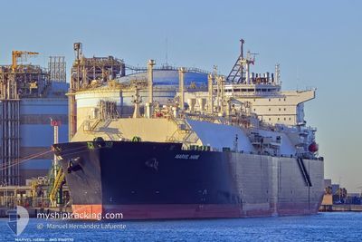
MARVEL HAWK
Tanker D
Current Trip
...
| Time Travelled | 5 h, 31 mins |
|---|---|
| Remaining Time | --- |
| Distance Travelled | 93.59 nm |
| Remaining Distance | --- |
| AVG Speed | 17.2 Knop |
| MAX Speed | 18 Knop |
| AVG Wind | 6.2 knots |
| MAX Wind | 10 knots |
| MIN Temp | 12.9°C / 55.22°F |
| MAX Temp | 15.4°C / 59.72°F |
| Djupgående | 8.9 m |
| Position mottagen | 22 m sen |
Current Position
| Longitud | 0.66741° |
|---|---|
| Latitude | 38.45112° |
| Status | Under way using engine |
| Fart | 17.8 Knop |
| Kurs | 204.3° |
| Område | Mediterranean Sea - Western Basin |
| Station | T-AIS |
| Position mottagen | 22 m sen |
Info
Information
The current position of MARVEL HAWK is in Mediterranean Sea - Western Basin with coordinates 38.45112° / 0.66741° as reported on 2025-02-15 03:57 by AIS to our vessel tracker app. The vessel's current speed is 17.8 Knop
The vessel MARVEL HAWK (IMO: 9760770, MMSI: 563063200) is a Tanker D It's sailing under the flag of [SG] Singapore.
In this page you can find informations about the vessels current position, last detected port calls, and current voyage information. If the vessels is not in coverage by AIS you will find the latest position.
The current position of MARVEL HAWK is detected by our AIS receivers and we are not responsible for the reliability of the data. The last position was recorded while the vessel was in Coverage by the Ais receivers of our vessel tracking app.
The current draught of MARVEL HAWK as reported by AIS is 8.9 meters
Weather
| Temperature | 15.6°C / 60.08°F |
|---|---|
| Wind Speed | 10 knots |
| Direction | 239° WSW |
| Pressure | 1014.3 hPa |
| Humidity | 76 % |
| Cloud Coverage | 5 % |
Featured Company
Most Visited Ports (Last year)
| Port | Arrivals | |
|---|---|---|
| 1 | ||
| 1 | ||
| 1 |
Last Trips
| Origin | Departure | Destination | Arrival | Distance |
|---|
Events
| Tid | Event | Detaljer | Position / Dest | Information |
|---|---|---|---|---|
| 2025-02-15 04:05 | Status ändrad | Default Under way using engine |
38.41417 / .64631
...
|
Fart: 17.8 kn Kurs: 204.3° |
| 2025-02-15 03:04 | Byter havsområde | Spanish part of the Mediterranean Sea - Western Basin Spanish part of the Balearic Sea |
38.69898 / .76466
Mediterranean Sea - Western Basin
...
|
Fart: 17.3 kn Kurs: 188.8° |
| 2025-02-14 22:49 | AVGÅTT HAMN |
|
39.62742 / -.20861
...
|
Fart: 6 kn Kurs: 158° |
| 2025-02-14 22:43 | STARTAR förflyttning |
39.63513 / -.20849
[ES] SAGUNTO
|
Fart: 3.1 kn Kurs: 183° |
|
| 2025-02-14 22:23 | Djupgående ändrat | 8.9 10.7 |
39.63695 / -.21466
[ES] SAGUNTO
|
Fart: 1.2 kn Kurs: 42° |
| 2025-02-14 22:23 | Destination ändrad | ... ESSAG |
39.63695 / -.21466
[ES] SAGUNTO
|
Fart: 1.2 kn Kurs: 42° |
| 2025-02-14 22:23 | ETA ändrat | 2025/03/01 00:01 2025/02/13 23:01 |
39.63695 / -.21466
[ES] SAGUNTO
|
Fart: 1.2 kn Kurs: 42° |
| 2025-02-14 22:20 | Status ändrad | Under way using engine Moored |
39.63634 / -.21405
[ES] SAGUNTO
|
Fart: Kurs: 38° |
| 2025-02-14 22:06 | Status ändrad | Moored Default |
39.63634 / -.21402
[ES] SAGUNTO
|
Fart: Kurs: 38° |
| 2025-02-14 22:06 | I täckningsområde |
39.63634 / -.21402
Balearic Sea
[ES] SAGUNTO
|
Fart: Kurs: 143.2° |