
MAYA
Other Type
Current Trip
| Trip Time | 1 day |
|---|---|
| Trip Distance | 165.54 nm |
| AVG Speed | 17.1 Knop |
| MAX Speed | 21.9 Knop |
| Djupgående | 0 m |
| AVG Wind | 18.6 knots |
| MAX Wind | 23.7 knots |
| MIN Temp | 15.9°C / 60.62°F |
| MAX Temp | 18.5°C / 65.3°F |
| Position mottagen | 3 d sen |
Current Position
| Longitud | 139.65273° |
|---|---|
| Latitude | 35.28908° |
| Status | Default |
| Fart | |
| Kurs | 29° |
| Område | North Pacific Ocean |
| Station | T-AIS |
| Position mottagen | 3 d sen |
Information
The current position of MAYA is in North Pacific Ocean with coordinates 35.28908° / 139.65273° as reported on 2025-05-09 23:45 by AIS to our vessel tracker app. The vessel's current speed is 0 Knop and is currently inside the port of YOKOSUKA.
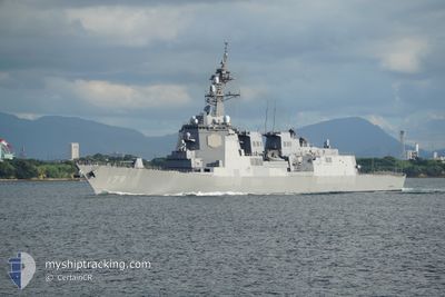
The vessel MAYA (MMSI: 431999501) is a Other Type It's sailing under the flag of [JP] Japan.
In this page you can find informations about the vessels current position, last detected port calls, and current voyage information. If the vessels is not in coverage by AIS you will find the latest position.
The current position of MAYA is detected by our AIS receivers and we are not responsible for the reliability of the data. The last position was recorded while the vessel was in Coverage by the Ais receivers of our vessel tracking app.
Weather
| Temperature | 18.6°C / 65.48°F |
|---|---|
| Wind Speed | 25 knots |
| Direction | 162° SSE |
| Pressure | 1004.4 hPa |
| Humidity | 93.3 % |
| Cloud Coverage | 100 % |
Featured Company
Events
| Tid | Event | Detaljer | Position / Dest | Information |
|---|---|---|---|---|
| 2025-05-09 23:45 | UTANFÖR täckningsområde |
35.28908 / 139.65273
North Pacific Ocean
[JP] YOKOSUKA
|
Fart: Kurs: 67.1° |
|
| 2025-05-09 22:49 | STOPPAR förflyttning |
35.28892 / 139.65284
[JP] YOKOSUKA
|
Fart: 0.3 kn Kurs: 28° |
|
| 2025-05-09 21:56 | ANLÄNDER HAMN |
|
35.31580 / 139.68373
[JP] YOKOSUKA
|
Fart: 10.2 kn Kurs: 264.9° |
| 2025-05-09 20:53 | I täckningsområde |
35.15389 / 139.77159
North Pacific Ocean
|
Fart: 12.3 kn Kurs: 8.7° |
|
| 2025-05-09 19:40 | UTANFÖR täckningsområde |
34.78786 / 139.68466
North Pacific Ocean
|
Fart: 17.7 kn Kurs: 0.9° |
|
| 2025-05-09 19:11 | I täckningsområde |
34.63916 / 139.68564
North Pacific Ocean
|
Fart: 18.5 kn Kurs: 357.8° |
|
| 2025-05-08 03:19 | UTANFÖR täckningsområde |
34.52529 / 140.60906
North Pacific Ocean
|
Fart: 19.2 kn Kurs: 114.4° |
|
| 2025-05-08 01:05 | I täckningsområde |
34.83061 / 139.73641
North Pacific Ocean
|
Fart: 20 kn Kurs: 118.4° |
|
| 2025-05-07 23:47 | UTANFÖR täckningsområde |
35.22439 / 139.77240
North Pacific Ocean
|
Fart: 12.5 kn Kurs: 180.5° |
|
| 2025-05-07 23:11 | AVGÅTT HAMN |
|
35.31245 / 139.69135
|
Fart: 8 kn Kurs: 79° |