

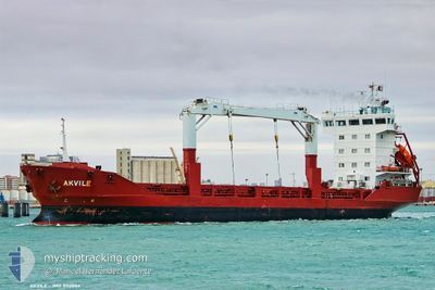
MEDKON KRM
General Cargo

Current Trip
| Time Travelled | 3 days |
|---|---|
| Remaining Time | --- |
| Distance Travelled | 211.51 nm |
| Remaining Distance | --- |
| AVG Speed | 3.4 Knop |
| MAX Speed | 4.7 Knop |
| AVG Wind | 11.9 knots |
| MAX Wind | 26 knots |
| MIN Temp | 10.4°C / 50.72°F |
| MAX Temp | 21.7°C / 71.06°F |
| Djupgående | 4.5 m |
| Position mottagen | 1 h, 30 m sen |
Current Position
| Longitud | 32.72621° |
|---|---|
| Latitude | 34.48988° |
| Status | Under way using engine |
| Fart | 3.5 Knop |
| Kurs | 274° |
| Område | Mediterranean Sea - Eastern Basin |
| Station | T-AIS |
| Position mottagen | 1 h, 30 m sen |
Information
The current position of MEDKON KRM is in Mediterranean Sea - Eastern Basin with coordinates 34.48988° / 32.72621° as reported on 2025-03-31 09:58 by AIS to our vessel tracker app. The vessel's current speed is 3.5 Knop and is heading at the port of ISTANBUL. The estimated time of arrival as calculated by MyShipTracking vessel tracking app is 2025-04-15 12:00 LT
The vessel MEDKON KRM (IMO: 9113044, MMSI: 352978270) is a General Cargo that was built in 1997 ( 28 År gammal ). It's sailing under the flag of [PA] Panama.
In this page you can find informations about the vessels current position, last detected port calls, and current voyage information. If the vessels is not in coverage by AIS you will find the latest position.
The current position of MEDKON KRM is detected by our AIS receivers and we are not responsible for the reliability of the data. The last position was recorded while the vessel was in Coverage by the Ais receivers of our vessel tracking app.
The current draught of MEDKON KRM as reported by AIS is 4.5 meters
Weather
| Temperature | 18.2°C / 64.76°F |
|---|---|
| Wind Speed | 17 knots |
| Direction | 103° ESE |
| Pressure | 1012.4 hPa |
| Humidity | 76.5 % |
| Cloud Coverage | 83 % |


Featured Company
Last Port Calls
| Port | Arrival | Departure | Time In Port |
|---|---|---|---|
| 2025-03-27 04:28 | 2025-03-27 15:20 | 10 h | |
| 2025-03-21 10:19 | 2025-03-22 17:46 | 1 d | |
| 2025-03-06 19:43 | 2025-03-07 20:34 | 1 d | |
| 2025-02-25 19:43 | 2025-02-26 04:48 | 9 h | |
| 2025-02-23 11:35 | 2025-02-24 04:03 | 16 h | |
| 2025-02-16 23:07 | 2025-02-17 12:09 | 13 h | |
| 2025-02-15 05:19 | 2025-02-16 01:28 | 20 h | |
| 2025-02-11 05:53 | 2025-02-11 14:10 | 8 h | |
| 2025-02-09 03:08 | 2025-02-09 20:15 | 17 h | |
| 2025-01-30 04:43 | 2025-01-30 12:21 | 7 h |
Last Trips
| Origin | Departure | Destination | Arrival | Distance | |
|---|---|---|---|---|---|
| 2025-03-22 20:46 | 2025-03-27 06:28 | 268.76 nm | |||
| 2025-03-07 22:34 | 2025-03-21 13:19 | 375.16 nm | |||
| 2025-02-26 06:48 | 2025-03-06 21:43 | 270.74 nm | |||
| 2025-02-24 07:03 | 2025-02-25 21:43 | 201.17 nm | |||
| 2025-02-17 14:09 | 2025-02-23 14:35 | 448.03 nm | |||
| 2025-02-16 03:28 | 2025-02-17 01:07 | 135.38 nm | |||
| 2025-02-11 16:10 | 2025-02-15 07:19 | 261.28 nm | |||
| 2025-02-09 23:15 | 2025-02-11 07:53 | 188.76 nm | |||
| 2025-01-30 14:21 | 2025-02-09 06:08 | 196.37 nm | |||
| 2025-01-28 11:35 | 2025-01-30 06:43 | 255.30 nm |
Events
| Tid | Event | Detaljer | Position / Dest | Information |
|---|---|---|---|---|
| 2025-03-31 10:05 | Status ändrad | Default Under way using engine |
34.49149 / 32.71730
TRIST
|
Fart: 3.5 kn Kurs: 274° |
| 2025-03-31 09:58 | UTANFÖR täckningsområde |
34.48988 / 32.72621
Mediterranean Sea - Eastern Basin
TRIST
|
Fart: 3.5 kn Kurs: 284.2° |
|
| 2025-03-31 02:15 | STARTAR förflyttning | 6.07 nm, East of AKROTIRI |
34.59658 / 33.15162
TRIST
|
Fart: 3.2 kn Kurs: 165° |
| 2025-03-31 00:07 | Destination ändrad | TRIST CLYMS |
34.66654 / 33.08625
TRIST
|
Fart: 2.4 kn Kurs: 112° |
| 2025-03-31 00:07 | ETA ändrat | 2025/04/15 12:00 2025/03/30 16:30 |
34.66654 / 33.08625
TRIST
|
Fart: 2.4 kn Kurs: 112° |
| 2025-03-30 23:59 | Status ändrad | Under way using engine At anchor |
34.66890 / 33.08183
CLYMS
|
Fart: 1.6 kn Kurs: 112° |
| 2025-03-30 18:18 | Status ändrad | At anchor Under way using engine |
34.66903 / 33.08009
CLYMS
|
Fart: 0.3 kn Kurs: 309° |
| 2025-03-30 18:17 | STOPPAR förflyttning | 2.69 nm, East of LIMASSOL |
34.66908 / 33.08019
CLYMS
|
Fart: 0.3 kn Kurs: 304° |
| 2025-03-30 07:07 | STARTAR förflyttning | 8.9 nm, South of VASSILIKO |
34.57133 / 33.27611
CLYMS
|
Fart: 3.1 kn Kurs: 185° |
| 2025-03-30 01:15 | STOPPAR förflyttning | 6.56 nm, South of VASSILIKO |
34.61617 / 33.33965
CLYMS
|
Fart: 0.3 kn Kurs: 2° |