
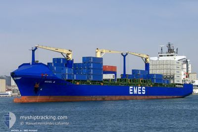
MICHEL A
Container Ship
Current Trip
| Time Travelled | 2 days |
|---|---|
| Remaining Time | 3 h, 29 mins |
| Distance Travelled | 918.42 nm |
| Remaining Distance | 97.53 nm |
| AVG Speed | 15.2 Knop |
| MAX Speed | 17.5 Knop |
| AVG Wind | 16.1 knots |
| MAX Wind | 35.6 knots |
| MIN Temp | 9.2°C / 48.56°F |
| MAX Temp | 16.2°C / 61.16°F |
| Djupgående | 8.9 m |
| Position mottagen | 3 h, 0 m sen |
Current Position
| Longitud | 15.38218° |
|---|---|
| Latitude | 38.96624° |
| Status | Under way using engine |
| Fart | 16.6 Knop |
| Kurs | 338° |
| Område | Tyrrhenian Sea |
| Station | T-AIS |
| Position mottagen | 3 h, 0 m sen |
Info
Information
The current position of MICHEL A is in Tyrrhenian Sea with coordinates 38.96624° / 15.38218° as reported on 2025-02-08 02:01 by AIS to our vessel tracker app. The vessel's current speed is 16.6 Knop and is heading at the port of SALERNO. The estimated time of arrival as calculated by MyShipTracking vessel tracking app is 2025-02-08 08:31 LT
The vessel MICHEL A (IMO: 9379349, MMSI: 215417000) is a Container Ship that was built in 2007 ( 18 År gammal ). It's sailing under the flag of [MT] Malta.
In this page you can find informations about the vessels current position, last detected port calls, and current voyage information. If the vessels is not in coverage by AIS you will find the latest position.
The current position of MICHEL A is detected by our AIS receivers and we are not responsible for the reliability of the data. The last position was recorded while the vessel was in Coverage by the Ais receivers of our vessel tracking app.
The current draught of MICHEL A as reported by AIS is 8.9 meters
Weather
| Temperature | 13.5°C / 56.3°F |
|---|---|
| Wind Speed | 24 knots |
| Direction | 127° SE |
| Pressure | 1025.1 hPa |
| Humidity | 85.8 % |
| Cloud Coverage | 100 % |
Featured Company
Last Port Calls
| Port | Arrival | Departure | Time In Port |
|---|---|---|---|
| 2025-02-04 13:01 | 2025-02-05 12:09 | 23 h | |
| 2025-02-02 05:38 | 2025-02-03 07:23 | 1 d | |
| 2025-02-01 07:26 | 2025-02-01 20:33 | 13 h | |
| 2025-01-30 23:53 | 2025-01-31 18:25 | 18 h | |
| 2025-01-28 02:37 | 2025-01-28 13:37 | 10 h | |
| 2025-01-21 04:43 | 2025-01-21 13:19 | 8 h | |
| 2025-01-19 02:37 | 2025-01-20 00:31 | 21 h | |
| 2025-01-17 00:36 | 2025-01-17 19:28 | 18 h | |
| 2025-01-15 05:24 | 2025-01-16 08:23 | 1 d | |
| 2025-01-10 13:57 | 2025-01-11 18:58 | 1 d |
Most Visited Ports (Last year)
| Port | Arrivals | |
|---|---|---|
| 16 | ||
| 16 | ||
| 16 | ||
| 9 | ||
| 8 | ||
| 8 |
Last Trips
| Origin | Departure | Destination | Arrival | Distance | |
|---|---|---|---|---|---|
| 2025-02-03 09:23 | 2025-02-04 15:01 | 400.79 nm | |||
| 2025-02-01 22:33 | 2025-02-02 07:38 | 130.88 nm | |||
| 2025-01-31 21:25 | 2025-02-01 09:26 | 200.52 nm | |||
| 2025-01-28 15:37 | 2025-01-31 02:53 | 701.97 nm | |||
| 2025-01-21 14:19 | 2025-01-28 04:37 | 784.12 nm | |||
| 2025-01-20 01:31 | 2025-01-21 05:43 | 364.30 nm | |||
| 2025-01-17 20:28 | 2025-01-19 03:37 | 59.27 nm | |||
| 2025-01-16 09:23 | 2025-01-17 01:36 | 224.14 nm | |||
| 2025-01-11 18:58 | 2025-01-15 06:24 | 1028.72 nm | |||
| 2025-01-09 22:46 | 2025-01-10 13:57 | 231.09 nm |
Events
| Tid | Event | Detaljer | Position / Dest | Information |
|---|---|---|---|---|
| 2025-02-08 02:09 | Status ändrad | Default Under way using engine |
38.99745 / 15.36675
ITSAL
|
Fart: 16.6 kn Kurs: 338° |
| 2025-02-08 02:01 | UTANFÖR täckningsområde |
38.96624 / 15.38218
Tyrrhenian Sea
ITSAL
|
Fart: 16.6 kn Kurs: 338° |
|
| 2025-02-07 23:11 | Byter havsområde | Italian part of the Tyrrhenian Sea Italian part of the Ionian Sea |
38.25081 / 15.66459
Tyrrhenian Sea
ITSAL
|
Fart: 16.7 kn Kurs: 59° |
| 2025-02-07 20:04 | Upptäckt i hav | Italian part of the Ionian Sea |
37.68342 / 16.17697
Ionian Sea
ITSAL
|
Fart: 16.3 kn Kurs: 296.1° |
| 2025-02-07 20:04 | Djupgående ändrat | 8.9 8.3 |
37.68322 / 16.17752
ITSAL
|
Fart: 16.2 kn Kurs: 296° |
| 2025-02-07 20:04 | Destination ändrad | ITSAL SYLTK |
37.68322 / 16.17752
ITSAL
|
Fart: 16.2 kn Kurs: 296° |
| 2025-02-07 20:04 | ETA ändrat | 2025/02/08 09:00 2025/02/01 04:30 |
37.68322 / 16.17752
ITSAL
|
Fart: 16.2 kn Kurs: 296° |
| 2025-02-07 20:02 | Status ändrad | Under way using engine Default |
37.67827 / 16.19051
SYLTK
|
Fart: 16.2 kn Kurs: 296° |
| 2025-02-07 20:02 | I täckningsområde |
37.68342 / 16.17697
Ionian Sea
ITSAL
|
Fart: 16.3 kn Kurs: 296.1° |
|
| 2025-02-06 21:24 | UTANFÖR täckningsområde |
34.91693 / 23.00166
Mediterranean Sea - Eastern Basin
|
Fart: 15.1 kn Kurs: 285.9° |