

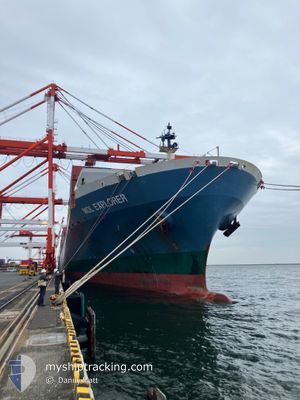
MOL EXPLORER
Container Ship

Current Trip
| Time Travelled | 21 days |
|---|---|
| Remaining Time | --- |
| Distance Travelled | 976.00 nm |
| Remaining Distance | 31.06 nm |
| AVG Speed | 11.6 Knop |
| MAX Speed | 19.4 Knop |
| AVG Wind | 13.1 knots |
| MAX Wind | 30.8 knots |
| MIN Temp | 15.9°C / 60.62°F |
| MAX Temp | 23.5°C / 74.3°F |
| Djupgående | 8.9 m |
| Position mottagen | 20 d sen |
Current Position
| Longitud | 134.87867° |
|---|---|
| Latitude | 34.00033° |
| Status | Under way using engine |
| Fart | 14.2 Knop |
| Kurs | 175.3° |
| Område | Philippine Sea |
| Station | T-AIS |
| Position mottagen | 20 d sen |
Information
The current position of MOL EXPLORER is in Philippine Sea with coordinates 34.00033° / 134.87867° as reported on 2025-05-19 12:06 by AIS to our vessel tracker app. The vessel's current speed is 14.2 Knop and is heading at the port of YANGSHAN. The estimated time of arrival as calculated by MyShipTracking vessel tracking app is 2025-05-21 19:00 LT
The vessel MOL EXPLORER (IMO: 9333826, MMSI: 372827000) is a Container Ship that was built in 2007 ( 18 År gammal ). It's sailing under the flag of [PA] Panama.
In this page you can find informations about the vessels current position, last detected port calls, and current voyage information. If the vessels is not in coverage by AIS you will find the latest position.
The current position of MOL EXPLORER is detected by our AIS receivers and we are not responsible for the reliability of the data. The last position was recorded while the vessel was in Coverage by the Ais receivers of our vessel tracking app.
The current draught of MOL EXPLORER as reported by AIS is 8.9 meters
Weather
| Temperature | 24.8°C / 76.64°F |
|---|---|
| Wind Speed | 3 knots |
| Direction | 303° WNW |
| Pressure | 1003.7 hPa |
| Humidity | 91.9 % |
| Cloud Coverage | 100 % |


Featured Company
Last Trips
| Origin | Departure | Destination | Arrival | Distance | |
|---|---|---|---|---|---|
| 2025-05-18 05:37 | 2025-05-19 07:12 | 370.77 nm | |||
| 2025-05-03 01:19 | 2025-05-17 07:41 | 4381.72 nm | |||
| 2025-04-27 13:21 | 2025-05-01 14:28 | 212.82 nm | |||
| 2025-04-03 01:50 | 2025-04-23 04:32 | 5831.33 nm | |||
| 2025-03-25 21:53 | 2025-04-02 05:02 | 1564.33 nm |
Events
| Tid | Event | Detaljer | Position / Dest | Information |
|---|---|---|---|---|
| 2025-06-05 08:51 | STOPPAR förflyttning | 8.99 nm, North of ZHOUSHAN |
30.11603 / 122.18014
CN YSA
|
Fart: Kurs: -1° |
| 2025-06-05 08:23 | STARTAR förflyttning | 8.41 nm, South West of JINHAI HEAVY INDUSTR |
30.12766 / 122.18266
CN YSA
|
Fart: 3.5 kn Kurs: -1° |
| 2025-06-05 07:55 | STOPPAR förflyttning | 8.11 nm, South West of JINHAI HEAVY INDUSTR |
30.13114 / 122.18797
CN YSA
|
Fart: 0.3 kn Kurs: -1° |