

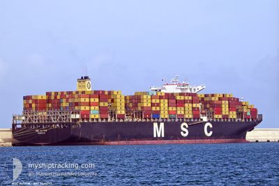
MSC ALTAIR
Container Ship

Current Trip
TGLFW>INTRV
| Time Travelled | 12 days |
|---|---|
| Remaining Time | --- |
| Distance Travelled | 3665.36 nm |
| Remaining Distance | --- |
| AVG Speed | 13.2 Knop |
| MAX Speed | 19.2 Knop |
| AVG Wind | 12.4 knots |
| MAX Wind | 24 knots |
| MIN Temp | 13.6°C / 56.48°F |
| MAX Temp | 28.7°C / 83.66°F |
| Djupgående | 15.9 m |
| Position mottagen | 13 h, 19 m sen |
Current Position
| Longitud | 31.85674° |
|---|---|
| Latitude | -29.43055° |
| Status | Under way using engine |
| Fart | 17 Knop |
| Kurs | 45.9° |
| Område | Indian Ocean |
| Station | T-AIS |
| Position mottagen | 13 h, 19 m sen |
Information
The current position of MSC ALTAIR is in Indian Ocean with coordinates -29.43055° / 31.85674° as reported on 2025-06-07 02:12 by AIS to our vessel tracker app. The vessel's current speed is 17 Knop
The vessel MSC ALTAIR (IMO: 9465277, MMSI: 636015604) is a Container Ship that was built in 2012 ( 13 År gammal ). It's sailing under the flag of [LR] Liberia.
In this page you can find informations about the vessels current position, last detected port calls, and current voyage information. If the vessels is not in coverage by AIS you will find the latest position.
The current position of MSC ALTAIR is detected by our AIS receivers and we are not responsible for the reliability of the data. The last position was recorded while the vessel was in Coverage by the Ais receivers of our vessel tracking app.
The current draught of MSC ALTAIR as reported by AIS is 15.9 meters
Weather
| Temperature | 24.2°C / 75.56°F |
|---|---|
| Wind Speed | 14 knots |
| Direction | 45° NE |
| Pressure | 1017.4 hPa |
| Humidity | 71 % |
| Cloud Coverage | --- |


Featured Company
Last Port Calls
| Port | Arrival | Departure | Time In Port |
|---|---|---|---|
| 2025-05-24 08:06 | 2025-05-26 08:06 | 2 d | |
| 2025-05-21 15:24 | 2025-05-22 17:24 | 1 d | |
| 2025-05-09 15:13 | 2025-05-10 04:54 | 13 h | |
| 2025-05-07 10:00 | 2025-05-08 10:30 | 1 d | |
| 2025-05-04 22:02 | 2025-05-05 19:05 | 21 h | |
| 2025-05-01 00:14 | 2025-05-02 09:11 | 1 d | |
| 2025-04-26 21:02 | 2025-04-29 02:44 | 2 d | |
| 2025-04-23 23:59 | 2025-04-25 13:23 | 1 d | |
| 2025-04-14 21:21 | 2025-04-15 16:23 | 19 h | |
| 2025-04-13 11:04 | 2025-04-14 00:52 | 13 h |
Most Visited Ports (Last year)
| Port | Arrivals | |
|---|---|---|
| 7 | ||
| 6 | ||
| 4 | ||
| 4 | ||
| 4 | ||
| 3 |
Last Trips
| Origin | Departure | Destination | Arrival | Distance | |
|---|---|---|---|---|---|
| 2025-05-22 17:24 | 2025-05-24 08:06 | 405.17 nm | |||
| 2025-05-10 06:54 | 2025-05-21 15:24 | 3004.80 nm | |||
| 2025-05-08 12:30 | 2025-05-09 17:13 | 356.98 nm | |||
| 2025-05-05 21:05 | 2025-05-07 12:00 | 174.91 nm | |||
| 2025-05-02 11:11 | 2025-05-05 00:02 | 689.39 nm | |||
| 2025-04-29 05:44 | 2025-05-01 02:14 | 769.65 nm | |||
| 2025-04-25 16:23 | 2025-04-27 00:02 | 314.50 nm | |||
| 2025-04-15 18:23 | 2025-04-24 02:59 | 1583.91 nm | |||
| 2025-04-14 01:52 | 2025-04-14 23:21 | 370.69 nm | |||
| 2025-03-14 23:04 | 2025-04-13 12:04 | 9775.96 nm |
Events
| Tid | Event | Detaljer | Position / Dest | Information |
|---|---|---|---|---|
| 2025-06-07 02:18 | Status ändrad | Default Under way using engine |
-29.41138 / 31.87861
TGLFW>INTRV
|
Fart: 17 kn Kurs: 45.9° |
| 2025-06-07 02:12 | Status ändrad | Under way using engine Default |
-29.43055 / 31.85674
TGLFW>INTRV
|
Fart: 17.1 kn Kurs: 44° |
| 2025-06-07 02:12 | UTANFÖR täckningsområde |
-29.43055 / 31.85674
Indian Ocean
TGLFW>INTRV
|
Fart: 17 kn Kurs: 45.9° |
|
| 2025-06-07 02:06 | Status ändrad | Default Under way using engine |
-29.45172 / 31.83277
TGLFW>INTRV
|
Fart: 18.1 kn Kurs: 44° |
| 2025-06-07 01:39 | Status ändrad | Under way using engine Default |
-29.54693 / 31.72548
TGLFW>INTRV
|
Fart: 17.8 kn Kurs: 44° |
| 2025-06-07 01:38 | Status ändrad | Default Under way using engine |
-29.55191 / 31.71993
TGLFW>INTRV
|
Fart: 17.9 kn Kurs: 42.5° |
| 2025-06-06 22:35 | Status ändrad | Under way using engine Default |
-30.28464 / 31.11260
TGLFW>INTRV
|
Fart: 17.8 kn Kurs: 34° |
| 2025-06-06 22:16 | Status ändrad | Default Under way using engine |
-30.36107 / 31.04467
TGLFW>INTRV
|
Fart: 18 kn Kurs: 42° |
| 2025-06-06 22:10 | Byter havsområde | South African part of the Indian Ocean South African part of the South Atlantic Ocean |
-30.38237 / 31.02292
Indian Ocean
TGLFW>INTRV
|
Fart: 17.9 kn Kurs: 39.9° |
| 2025-06-06 22:10 | Status ändrad | Under way using engine Default |
-30.38237 / 31.02292
TGLFW>INTRV
|
Fart: 17.7 kn Kurs: 40° |