

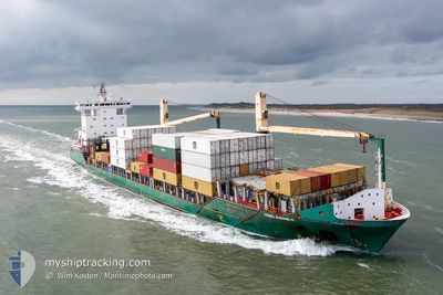
MSC ANNE F
Container Ship
Current Trip
| Trip Time | 3 days |
|---|---|
| Trip Distance | 878.57 nm |
| AVG Speed | 12 Knop |
| MAX Speed | 15.6 Knop |
| Djupgående | 7.6 m |
| AVG Wind | 15.2 knots |
| MAX Wind | 30.3 knots |
| MIN Temp | 7°C / 44.6°F |
| MAX Temp | 14.2°C / 57.56°F |
| Position mottagen | 5 m sen |
Current Position
| Longitud | 8.53566° |
|---|---|
| Latitude | 53.57811° |
| Status | Moored |
| Fart | |
| Kurs | 331° |
| Område | North Sea |
| Station | T-AIS |
| Position mottagen | 5 m sen |
Information
The current position of MSC ANNE F is in North Sea with coordinates 53.57811° / 8.53566° as reported on 2025-06-06 12:39 by AIS to our vessel tracker app. The vessel's current speed is 0 Knop and is currently inside the port of BREMERHAVEN.
The vessel MSC ANNE F (IMO: 9347803, MMSI: 255806190) is a Container Ship that was built in 2006 ( 19 År gammal ). It's sailing under the flag of [PT] Portugal.
In this page you can find informations about the vessels current position, last detected port calls, and current voyage information. If the vessels is not in coverage by AIS you will find the latest position.
The current position of MSC ANNE F is detected by our AIS receivers and we are not responsible for the reliability of the data. The last position was recorded while the vessel was in Coverage by the Ais receivers of our vessel tracking app.
The current draught of MSC ANNE F as reported by AIS is 7.6 meters
Weather
| Temperature | 17.4°C / 63.32°F |
|---|---|
| Wind Speed | 19 knots |
| Direction | 252° WSW |
| Pressure | 1005.6 hPa |
| Humidity | 68.1 % |
| Cloud Coverage | 34 % |
Featured Company
Last Port Calls
| Port | Arrival | Departure | Time In Port |
|---|---|---|---|
| 2025-06-06 05:15 | |||
| 2025-06-02 06:46 | 2025-06-02 19:10 | 12 h | |
| 2025-06-01 06:12 | 2025-06-01 19:37 | 13 h | |
| 2025-05-30 05:01 | 2025-05-31 07:35 | 1 d | |
| 2025-05-25 00:08 | 2025-05-25 14:24 | 14 h | |
| 2025-05-24 12:29 | 2025-05-24 21:43 | 9 h | |
| 2025-05-23 12:32 | 2025-05-23 23:39 | 11 h | |
| 2025-05-20 20:50 | 2025-05-22 12:19 | 1 d | |
| 2025-05-15 11:12 | 2025-05-16 06:24 | 19 h | |
| 2025-05-14 09:48 | 2025-05-15 00:13 | 14 h |
Most Visited Ports (Last year)
| Port | Arrivals | |
|---|---|---|
| 38 | ||
| 36 | ||
| 31 | ||
| 29 | ||
| 15 | ||
| 2 |
Last Trips
| Origin | Departure | Destination | Arrival | Distance | |
|---|---|---|---|---|---|
| 2025-06-02 19:10 | 2025-06-06 05:15 | 878.57 nm | |||
| 2025-06-01 19:37 | 2025-06-02 06:46 | 152.66 nm | |||
| 2025-05-31 07:35 | 2025-06-01 06:12 | 293.77 nm | |||
| 2025-05-25 14:24 | 2025-05-30 05:01 | 862.85 nm | |||
| 2025-05-24 21:43 | 2025-05-25 00:08 | 27.17 nm | |||
| 2025-05-23 23:39 | 2025-05-24 12:29 | 130.51 nm | |||
| 2025-05-22 12:19 | 2025-05-23 12:32 | 295.21 nm | |||
| 2025-05-16 06:24 | 2025-05-20 20:50 | 998.64 nm | |||
| 2025-05-15 00:13 | 2025-05-15 11:12 | 130.22 nm | |||
| 2025-05-14 07:40 | 2025-05-14 09:48 | 27.88 nm |
Events
| Tid | Event | Detaljer | Position / Dest | Information |
|---|---|---|---|---|
| 2025-06-06 03:47 | Status ändrad | Moored Under way using engine |
53.57809 / 8.53566
[DE] BREMERHAVEN
|
Fart: Kurs: 329° |
| 2025-06-06 03:41 | STOPPAR förflyttning |
53.57804 / 8.53551
[DE] BREMERHAVEN
|
Fart: 0.3 kn Kurs: 330° |
|
| 2025-06-06 03:15 | ANLÄNDER HAMN |
|
53.60350 / 8.50113
[DE] BREMERHAVEN
|
Fart: 7.7 kn Kurs: 133.5° |
| 2025-06-05 23:34 | Upptäckt i hav | German part of the North Sea |
54.01595 / 7.57384
North Sea
DEBRV
|
Fart: 10.8 kn Kurs: 152.8° |
| 2025-06-05 23:33 | Status ändrad | Under way using engine Default |
54.01865 / 7.57139
DEBRV
|
Fart: 12.9 kn Kurs: 152° |
| 2025-06-05 23:24 | I täckningsområde |
54.01595 / 7.57384
North Sea
DEBRV
|
Fart: 10.8 kn Kurs: 152.8° |
|
| 2025-06-05 09:42 | Status ändrad | Default Under way using engine |
56.63447 / 5.75543
DEBRV
|
Fart: 11.9 kn Kurs: 159.6° |
| 2025-06-05 09:34 | UTANFÖR täckningsområde |
56.65963 / 5.73768
North Sea
DEBRV
|
Fart: 11.9 kn Kurs: 159.6° |
|
| 2025-06-05 09:01 | Byter havsområde | Danish part of the North Sea Norwegian part of the North Sea |
56.76192 / 5.66585
North Sea
DEBRV
|
Fart: 12 kn Kurs: 153.7° |
| 2025-06-05 07:49 | Status ändrad | Under way using engine Default |
56.99163 / 5.50523
DEBRV
|
Fart: 12.3 kn Kurs: 160° |