
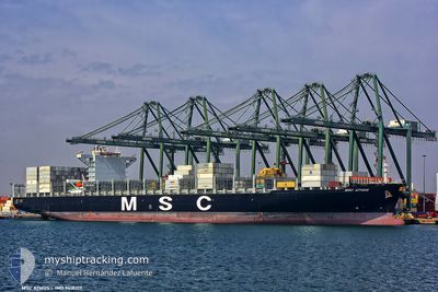
MSC ATHOS
Container Ship
Current Trip
| Time Travelled | 1 day |
|---|---|
| Remaining Time | 3 h, 5 mins |
| Distance Travelled | 509.44 nm |
| Remaining Distance | 18.52 nm |
| AVG Speed | 13.5 Knop |
| MAX Speed | 19.8 Knop |
| AVG Wind | 9.8 knots |
| MAX Wind | 14.8 knots |
| MIN Temp | 5.8°C / 42.44°F |
| MAX Temp | 16.1°C / 60.98°F |
| Djupgående | 10.3 m |
| Position mottagen | Nu |
Current Position
| Longitud | 0.08150° |
|---|---|
| Latitude | 39.45987° |
| Status | Under way using engine |
| Fart | 0.5 Knop |
| Kurs | 162° |
| Område | Balearic Sea |
| Station | T-AIS |
| Position mottagen | Nu |
Info
Information
The current position of MSC ATHOS is in Balearic Sea with coordinates 39.45987° / 0.08150° as reported on 2025-02-14 16:48 by AIS to our vessel tracker app. The vessel's current speed is 0.5 Knop and is heading at the port of VALENCIA. The estimated time of arrival as calculated by MyShipTracking vessel tracking app is 2025-02-14 20:54 LT
The vessel MSC ATHOS (IMO: 9618317, MMSI: 256871000) is a Container Ship that was built in 2013 ( 12 År gammal ). It's sailing under the flag of [MT] Malta.
In this page you can find informations about the vessels current position, last detected port calls, and current voyage information. If the vessels is not in coverage by AIS you will find the latest position.
The current position of MSC ATHOS is detected by our AIS receivers and we are not responsible for the reliability of the data. The last position was recorded while the vessel was in Coverage by the Ais receivers of our vessel tracking app.
The current draught of MSC ATHOS as reported by AIS is 10.3 meters
Weather
| Temperature | 15.4°C / 59.72°F |
|---|---|
| Wind Speed | 11 knots |
| Direction | 146° SE |
| Pressure | 1014.4 hPa |
| Humidity | 74.8 % |
| Cloud Coverage | 4 % |
Featured Company
Last Port Calls
| Port | Arrival | Departure | Time In Port |
|---|---|---|---|
| 2025-02-11 05:17 | 2025-02-13 06:32 | 2 d | |
| 2025-02-08 14:27 | 2025-02-10 12:47 | 1 d | |
| 2025-02-05 02:21 | 2025-02-06 07:16 | 1 d | |
| 2025-02-02 19:13 | 2025-02-03 21:29 | 1 d | |
| 2025-01-30 09:23 | 2025-01-31 23:13 | 1 d | |
| 2025-01-17 16:05 | 2025-01-17 17:05 | 59 m | |
| 2025-01-12 10:57 | 2025-01-13 06:36 | 19 h | |
| 2025-01-10 01:01 | 2025-01-10 23:17 | 22 h | |
| 2025-01-08 01:20 | 2025-01-09 03:05 | 1 d | |
| 2024-12-24 11:08 | 2024-12-26 18:33 | 2 d |
Last Trips
| Origin | Departure | Destination | Arrival | Distance | |
|---|---|---|---|---|---|
| 2025-02-10 12:47 | 2025-02-11 05:17 | 99.07 nm | |||
| 2025-02-06 07:16 | 2025-02-08 14:27 | 423.92 nm | |||
| 2025-02-03 21:29 | 2025-02-05 02:21 | 491.14 nm | |||
| 2025-01-31 23:13 | 2025-02-02 19:13 | 773.12 nm | |||
| 2025-01-17 17:05 | 2025-01-30 09:23 | 3809.45 nm | |||
| 2025-01-13 06:36 | 2025-01-17 16:05 | 209.49 nm | |||
| 2025-01-10 23:17 | 2025-01-12 10:57 | 72.59 nm | |||
| 2025-01-09 03:05 | 2025-01-10 01:01 | 172.58 nm | |||
| 2024-12-26 18:33 | 2025-01-08 01:20 | 1596.92 nm | |||
| 2024-12-14 05:21 | 2024-12-24 11:08 | 3572.08 nm |
Events
| Tid | Event | Detaljer | Position / Dest | Information |
|---|---|---|---|---|
| 2025-02-14 16:08 | STARTAR förflyttning | 16.54 nm, South East of SAGUNTO |
39.49869 / .09628
ESVLC
|
Fart: 3.1 kn Kurs: 189° |
| 2025-02-14 11:53 | STOPPAR förflyttning | 18.15 nm, South East of SAGUNTO |
39.44017 / .08369
ESVLC
|
Fart: 0.3 kn Kurs: 200° |
| 2025-02-14 08:06 | ETA ändrat | 2025/02/14 13:00 2025/02/14 09:30 |
39.83836 / 1.01678
ESVLC
|
Fart: 15.8 kn Kurs: 237.1° |
| 2025-02-14 07:57 | Status ändrad | Under way using engine Default |
39.85891 / 1.05870
ESVLC
|
Fart: 15.7 kn Kurs: 237° |
| 2025-02-14 07:57 | I täckningsområde |
39.85612 / 1.05296
Balearic Sea
ESVLC
|
Fart: 15.9 kn Kurs: 237.9° |
|
| 2025-02-14 06:47 | Status ändrad | Default Under way using engine |
40.03678 / 1.39467
ESVLC
|
Fart: 16.6 kn Kurs: 233.7° |
| 2025-02-14 06:43 | UTANFÖR täckningsområde |
40.04590 / 1.41051
Balearic Sea
ESVLC
|
Fart: 16.6 kn Kurs: 233.7° |
|
| 2025-02-14 05:18 | Status ändrad | Under way using engine Default |
40.27692 / 1.82163
ESVLC
|
Fart: 15.8 kn Kurs: 236° |
| 2025-02-14 04:51 | Status ändrad | Default Under way using engine |
40.34345 / 1.95362
ESVLC
|
Fart: 15.6 kn Kurs: 237.5° |
| 2025-02-14 04:33 | Status ändrad | Under way using engine Default |
40.38583 / 2.03957
ESVLC
|
Fart: 15.1 kn Kurs: 237° |