
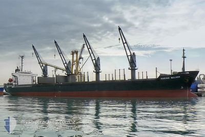
M.V OCEAN WIT
Bulk Carrier
Current Trip
DAR ES SALAAM
| Time Travelled | 5 days |
|---|---|
| Remaining Time | --- |
| Distance Travelled | 1325.55 nm |
| Remaining Distance | --- |
| AVG Speed | 9.5 Knop |
| MAX Speed | 11.6 Knop |
| AVG Wind | 10.3 knots |
| MAX Wind | 22.3 knots |
| MIN Temp | 25.3°C / 77.54°F |
| MAX Temp | 29.1°C / 84.38°F |
| Djupgående | 10.1 m |
| Position mottagen | 2025-01-08 09:48 |
Current Position
| Longitud | 39.29244° |
|---|---|
| Latitude | -6.83115° |
| Status | Moored |
| Fart | |
| Kurs | 306° |
| Område | Malacca Strait |
| Station | T-AIS |
| Position mottagen | 2025-01-08 09:48 |
Info
Information
The current position of M.V OCEAN WIT is in Malacca Strait with coordinates -6.83115° / 39.29244° as reported on 2025-01-08 09:48 by AIS to our vessel tracker app. The vessel's current speed is 0 Knop
The vessel M.V OCEAN WIT (IMO: 9139971, MMSI: 356881000) is a Bulk Carrier that was built in 1996 ( 29 År gammal ). It's sailing under the flag of [PA] Panama.
In this page you can find informations about the vessels current position, last detected port calls, and current voyage information. If the vessels is not in coverage by AIS you will find the latest position.
The current position of M.V OCEAN WIT is detected by our AIS receivers and we are not responsible for the reliability of the data. The last position was recorded while the vessel was in Coverage by the Ais receivers of our vessel tracking app.
The current draught of M.V OCEAN WIT as reported by AIS is 10.1 meters
Weather
| Temperature | 28.5°C / 83.3°F |
|---|---|
| Wind Speed | 10 knots |
| Direction | 271° W |
| Pressure | 1009.5 hPa |
| Humidity | 74.5 % |
| Cloud Coverage | 8 % |
Featured Company
Last Port Calls
| Port | Arrival | Departure | Time In Port |
|---|---|---|---|
| 2025-02-04 06:02 | 2025-02-06 18:34 | 2 d | |
| 2024-12-26 08:24 | 2025-01-09 19:01 | 14 d |
Most Visited Ports (Last year)
| Port | Arrivals | |
|---|---|---|
| 2 | ||
| 2 | ||
| 2 | ||
| 1 |
Last Trips
| Origin | Departure | Destination | Arrival | Distance | |
|---|---|---|---|---|---|
| 2025-01-09 22:01 | 2025-02-04 08:02 | 1094.60 nm | |||
| 2024-11-13 08:52 | 2024-12-26 11:24 | 6968.60 nm |
Events
| Tid | Event | Detaljer | Position / Dest | Information |
|---|---|---|---|---|
| 2025-02-06 18:34 | AVGÅTT HAMN |
|
-19.83350 / 34.82755
DAR ES SALAAM
|
Fart: 5.6 kn Kurs: 199° |
| 2025-02-06 18:27 | STARTAR förflyttning |
-19.82297 / 34.83177
[MZ] BEIRA
|
Fart: 4.9 kn Kurs: 195° |
|
| 2025-02-04 06:02 | STOPPAR förflyttning |
-19.80778 / 34.83310
[MZ] BEIRA
|
Fart: 0.3 kn Kurs: 161° |
|
| 2025-02-04 06:02 | ANLÄNDER HAMN |
|
-19.80778 / 34.83310
[MZ] BEIRA
|
Fart: 1.2 kn Kurs: 159° |
| 2025-02-04 03:21 | STARTAR förflyttning | 12.62 nm, South East of BEIRA |
-19.90818 / 35.03345
DAR ES SALAAM
|
Fart: 7.2 kn Kurs: 289° |
| 2025-02-03 17:44 | STOPPAR förflyttning | 13.16 nm, South East of BEIRA |
-19.90668 / 35.04466
DAR ES SALAAM
|
Fart: 0.1 kn Kurs: 142° |
| 2025-02-03 14:19 | STARTAR förflyttning | 19.58 nm, South East of BEIRA |
-19.97035 / 35.13796
DAR ES SALAAM
|
Fart: 3.2 kn Kurs: 220° |