
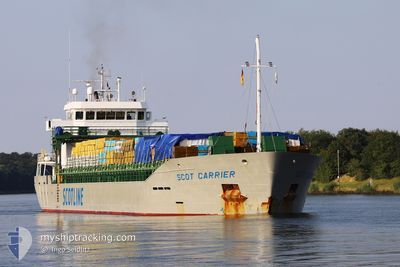
MV SCOT CARRIER
Cargo
Current Trip
| Trip Time | 4 days |
|---|---|
| Trip Distance | 922.84 nm |
| AVG Speed | 10 Knop |
| MAX Speed | 15.5 Knop |
| Djupgående | 5.6 m |
| AVG Wind | 16.7 knots |
| MAX Wind | 26 knots |
| MIN Temp | 0.8°C / 33.44°F |
| MAX Temp | 6.8°C / 44.24°F |
| Position mottagen | 4 h, 15 m sen |
Current Position
| Longitud | -6.06059° |
|---|---|
| Latitude | 54.01497° |
| Status | At anchor |
| Fart | 12.4 Knop |
| Kurs | 311.4° |
| Område | Irish Sea and St. George's Channel |
| Station | T-AIS |
| Position mottagen | 4 h, 15 m sen |
Info
Information
The current position of MV SCOT CARRIER is in Irish Sea and St. George's Channel with coordinates 54.01497° / -6.06059° as reported on 2025-02-12 20:45 by AIS to our vessel tracker app. The vessel's current speed is 12.4 Knop and is currently inside the port of WARRENPOINT.
The vessel MV SCOT CARRIER (IMO: 9841782, MMSI: 232018267) is a Cargo It's sailing under the flag of [GB] United Kingdom.
In this page you can find informations about the vessels current position, last detected port calls, and current voyage information. If the vessels is not in coverage by AIS you will find the latest position.
The current position of MV SCOT CARRIER is detected by our AIS receivers and we are not responsible for the reliability of the data. The last position was recorded while the vessel was in Coverage by the Ais receivers of our vessel tracking app.
The current draught of MV SCOT CARRIER as reported by AIS is 5.6 meters
Weather
| Temperature | 5.5°C / 41.9°F |
|---|---|
| Wind Speed | 14 knots |
| Direction | 114° ESE |
| Pressure | 1023 hPa |
| Humidity | 73 % |
| Cloud Coverage | 100 % |
Featured Company
Last Port Calls
| Port | Arrival | Departure | Time In Port |
|---|---|---|---|
| 2025-02-12 21:31 | |||
| 2025-02-08 01:00 | 2025-02-08 19:03 | 18 h | |
| 2025-02-05 15:16 | 2025-02-07 16:52 | 2 d | |
| 2025-02-03 15:00 | 2025-02-04 17:31 | 1 d | |
| 2025-01-31 00:51 | 2025-02-02 01:45 | 2 d | |
| 2025-01-20 20:46 | 2025-01-20 21:37 | 50 m | |
| 2025-01-17 05:26 | 2025-01-20 16:10 | 3 d | |
| 2025-01-17 00:22 | 2025-01-17 00:48 | 25 m | |
| 2025-01-10 20:51 | 2025-01-13 11:15 | 2 d | |
| 2024-12-29 07:48 | 2025-01-02 09:15 | 4 d |
Most Visited Ports (Last year)
| Port | Arrivals | |
|---|---|---|
| 18 | ||
| 11 | ||
| 5 | ||
| 4 | ||
| 3 | ||
| 3 |
Last Trips
| Origin | Departure | Destination | Arrival | Distance | |
|---|---|---|---|---|---|
| 2025-02-08 20:03 | 2025-02-12 21:31 | 922.84 nm | |||
| 2025-02-07 17:52 | 2025-02-08 02:00 | 103.46 nm | |||
| 2025-02-04 18:31 | 2025-02-05 16:16 | 231.13 nm | |||
| 2025-02-02 01:45 | 2025-02-03 16:00 | 408.64 nm | |||
| 2025-01-20 22:37 | 2025-01-31 00:51 | 1796.42 nm | |||
| 2025-01-20 17:10 | 2025-01-20 21:46 | 48.50 nm | |||
| 2025-01-17 01:48 | 2025-01-17 06:26 | 49.49 nm | |||
| 2025-01-13 11:15 | 2025-01-17 01:22 | 889.72 nm | |||
| 2025-01-02 10:15 | 2025-01-10 20:51 | 690.25 nm | |||
| 2024-12-18 20:55 | 2024-12-29 08:48 | 1283.12 nm |
Events
| Tid | Event | Detaljer | Position / Dest | Information |
|---|---|---|---|---|
| 2025-02-12 21:54 | STOPPAR förflyttning |
54.09959 / -6.25977
[GB] WARRENPOINT
|
Fart: Kurs: 130° |
|
| 2025-02-12 21:31 | ANLÄNDER HAMN |
|
54.09704 / -6.25730
[GB] WARRENPOINT
|
Fart: 4.3 kn Kurs: 310° |
| 2025-02-12 20:49 | Status ändrad | Default At anchor |
54.02490 / -6.08627
GBWPT
|
Fart: 12.4 kn Kurs: 311.4° |
| 2025-02-12 20:45 | UTANFÖR täckningsområde |
54.01497 / -6.06059
Irish Sea and St. George's Channel
[GB] WARRENPOINT
|
Fart: 12.4 kn Kurs: 311.4° |
|
| 2025-02-12 20:43 | Status ändrad | At anchor Default |
54.01167 / -6.05408
GBWPT
|
Fart: 7 kn Kurs: 306° |
| 2025-02-12 20:28 | Status ändrad | Default At anchor |
53.99605 / -6.02197
GBWPT
|
Fart: 6.2 kn Kurs: 356.7° |
| 2025-02-12 20:13 | Status ändrad | At anchor Default |
53.97288 / -6.01971
GBWPT
|
Fart: 4.3 kn Kurs: 38° |
| 2025-02-12 20:13 | STARTAR förflyttning | 4.88 nm, South East of GREENCASTLE |
53.97288 / -6.01971
GBWPT
|
Fart: 7.1 kn Kurs: 17.2° |
| 2025-02-12 20:11 | Status ändrad | Default At anchor |
53.96986 / -6.02188
GBWPT
|
Fart: 3.4 kn Kurs: 42° |
| 2025-02-12 20:04 | Status ändrad | At anchor Default |
53.97005 / -6.02216
GBWPT
|
Fart: 0.1 kn Kurs: 119° |