
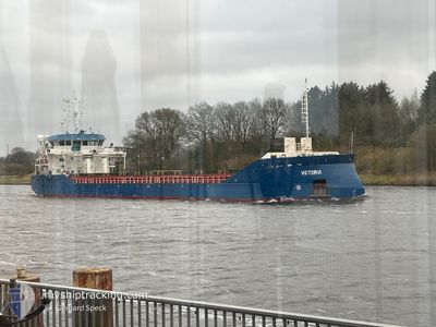
MV.VICTORIA
Cargo
Current Trip
| Trip Time | 6 days |
|---|---|
| Trip Distance | 1439.84 nm |
| AVG Speed | 9.1 Knop |
| MAX Speed | 14.1 Knop |
| Djupgående | 5 m |
| AVG Wind | 12.4 knots |
| MAX Wind | 35.3 knots |
| MIN Temp | -2.4°C / 27.68°F |
| MAX Temp | 14.4°C / 57.92°F |
| Position mottagen | 1 m sen |
Current Position
| Longitud | 10.49419° |
|---|---|
| Latitude | 59.41426° |
| Status | Under way using engine |
| Fart | |
| Kurs | 336° |
| Område | Skaggerak |
| Station | T-AIS |
| Position mottagen | 1 m sen |
Info
Information
The current position of MV.VICTORIA is in Skaggerak with coordinates 59.41426° / 10.49419° as reported on 2025-02-08 12:53 by AIS to our vessel tracker app. The vessel's current speed is 0 Knop and is currently inside the port of HORTEN.
The vessel MV.VICTORIA (IMO: 9978913, MMSI: 304877000) is a Cargo It's sailing under the flag of [AG] Antigua Barbuda.
In this page you can find informations about the vessels current position, last detected port calls, and current voyage information. If the vessels is not in coverage by AIS you will find the latest position.
The current position of MV.VICTORIA is detected by our AIS receivers and we are not responsible for the reliability of the data. The last position was recorded while the vessel was in Coverage by the Ais receivers of our vessel tracking app.
The current draught of MV.VICTORIA as reported by AIS is 5 meters
Weather
| Temperature | -0.7°C / 30.74°F |
|---|---|
| Wind Speed | 6 knots |
| Direction | 73° ENE |
| Pressure | 1038.1 hPa |
| Humidity | 95.1 % |
| Cloud Coverage | 100 % |
Featured Company
Last Port Calls
| Port | Arrival | Departure | Time In Port |
|---|---|---|---|
| 2025-02-07 11:30 | |||
| 2025-01-30 17:54 | 2025-01-31 21:44 | 1 d | |
| 2025-01-26 11:30 | 2025-01-27 23:20 | 1 d | |
| 2025-01-24 00:42 | 2025-01-24 23:39 | 22 h | |
| 2025-01-21 07:26 | 2025-01-21 08:03 | 37 m | |
| 2025-01-09 09:30 | 2025-01-10 22:33 | 1 d | |
| 2025-01-03 08:39 | 2025-01-05 09:39 | 2 d | |
| 2024-12-22 10:04 | 2024-12-28 03:49 | 5 d | |
| 2024-12-09 21:38 | 2024-12-12 08:28 | 2 d | |
| 2024-12-07 13:21 | 2024-12-09 18:41 | 2 d |
Most Visited Ports (Last year)
| Port | Arrivals | |
|---|---|---|
| 2 | ||
| 2 | ||
| 2 | ||
| 2 | ||
| 1 | ||
| 1 |
Last Trips
| Origin | Departure | Destination | Arrival | Distance | |
|---|---|---|---|---|---|
| 2025-01-31 21:44 | 2025-02-07 12:30 | 1439.84 nm | |||
| 2025-01-27 23:20 | 2025-01-30 17:54 | 297.75 nm | |||
| 2025-01-25 00:39 | 2025-01-26 11:30 | 341.83 nm | |||
| 2025-01-21 09:03 | 2025-01-24 01:42 | 270.13 nm | |||
| 2025-01-10 23:33 | 2025-01-21 08:26 | 1371.59 nm | |||
| 2025-01-05 09:39 | 2025-01-09 10:30 | 502.85 nm | |||
| 2024-12-28 05:49 | 2025-01-03 08:39 | 1063.94 nm | |||
| 2024-12-12 09:28 | 2024-12-22 12:04 | 1186.99 nm | |||
| 2024-12-09 19:41 | 2024-12-09 22:38 | 30.89 nm | |||
| 2024-11-26 12:20 | 2024-12-07 14:21 | 2427.15 nm |
Events
| Tid | Event | Detaljer | Position / Dest | Information |
|---|---|---|---|---|
| 2025-02-07 11:38 | STOPPAR förflyttning |
59.41428 / 10.49423
[NO] HORTEN
|
Fart: 0.3 kn Kurs: 333° |
|
| 2025-02-07 11:30 | ANLÄNDER HAMN |
|
59.41233 / 10.49609
[NO] HORTEN
|
Fart: 2.4 kn Kurs: 339° |
| 2025-02-06 20:41 | Byter havsområde | Norwegian part of the Skaggerak Danish part of the Skaggerak |
57.64834 / 8.61386
Skaggerak
NOHOR
|
Fart: 9.2 kn Kurs: 31° |
| 2025-02-06 18:19 | Byter havsområde | Danish part of the Skaggerak Danish part of the North Sea |
57.34170 / 8.22903
Skaggerak
NOHOR
|
Fart: 9.7 kn Kurs: 38° |
| 2025-02-06 11:27 | Status ändrad | Under way using engine Default |
56.48168 / 7.18829
NOHOR
|
Fart: 9.1 kn Kurs: 50° |
| 2025-02-06 11:21 | Status ändrad | Default Under way using engine |
56.47088 / 7.16552
NOHOR
|
Fart: 9.1 kn Kurs: 49° |
| 2025-02-06 09:59 | Status ändrad | Under way using engine Default |
56.33428 / 6.88942
NOHOR
|
Fart: 9.2 kn Kurs: 45° |
| 2025-02-06 09:45 | Status ändrad | Default Under way using engine |
56.30887 / 6.84429
NOHOR
|
Fart: 9.1 kn Kurs: 45° |
| 2025-02-06 09:03 | Status ändrad | Under way using engine Default |
56.22906 / 6.71953
NOHOR
|
Fart: 9.1 kn Kurs: 31° |
| 2025-02-06 09:03 | I täckningsområde |
56.23264 / 6.72330
North Sea
NOHOR
|
Fart: 9 kn Kurs: 30° |