
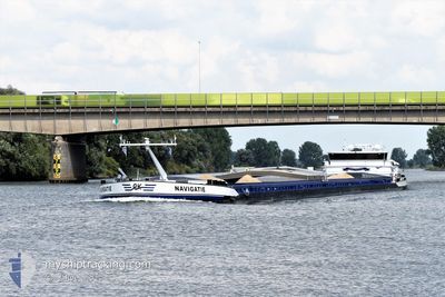
NAVIGATIE
Cargo
Current Trip
| Time Travelled | 11 h, 51 mins |
|---|---|
| Remaining Time | 4 h, 55 mins |
| Distance Travelled | 10.87 nm |
| Remaining Distance | 33.24 nm |
| AVG Speed | 6.2 Knop |
| MAX Speed | 6.9 Knop |
| AVG Wind | 13.5 knots |
| MAX Wind | 14 knots |
| MIN Temp | 10.1°C / 50.18°F |
| MAX Temp | 12.8°C / 55.04°F |
| Djupgående | 0.1 m |
| Position mottagen | 11 m sen |
Current Position
| Longitud | 4.63069° |
|---|---|
| Latitude | 51.71684° |
| Status | Under way using engine |
| Fart | 5.8 Knop |
| Kurs | 249.5° |
| Område | North Sea |
| Station | T-AIS |
| Position mottagen | 11 m sen |
Info
Information
The current position of NAVIGATIE is in North Sea with coordinates 51.71684° / 4.63069° as reported on 2025-02-22 08:59 by AIS to our vessel tracker app. The vessel's current speed is 5.8 Knop and is heading at the port of ANTWERP. The estimated time of arrival as calculated by MyShipTracking vessel tracking app is 2025-02-22 14:05 LT
The vessel NAVIGATIE (MMSI: 244710186) is a Cargo It's sailing under the flag of [NL] Netherlands.
In this page you can find informations about the vessels current position, last detected port calls, and current voyage information. If the vessels is not in coverage by AIS you will find the latest position.
The current position of NAVIGATIE is detected by our AIS receivers and we are not responsible for the reliability of the data. The last position was recorded while the vessel was in Coverage by the Ais receivers of our vessel tracking app.
The current draught of NAVIGATIE as reported by AIS is 0.1 meters
Weather
| Temperature | 10.1°C / 50.18°F |
|---|---|
| Wind Speed | 12 knots |
| Direction | 175° S |
| Pressure | 1012.2 hPa |
| Humidity | 91.6 % |
| Cloud Coverage | 100 % |
Featured Company
Last Port Calls
| Port | Arrival | Departure | Time In Port |
|---|---|---|---|
| 2025-02-21 20:16 | 2025-02-21 21:19 | 1 h | |
| 2025-02-21 16:28 | 2025-02-21 16:44 | 15 m | |
| 2025-02-21 14:13 | 2025-02-21 15:19 | 1 h | |
| 2025-02-21 00:36 | 2025-02-21 10:41 | 10 h | |
| 2025-02-20 13:41 | 2025-02-20 16:12 | 2 h | |
| 2025-02-19 13:15 | 2025-02-19 15:39 | 2 h | |
| 2025-02-18 16:46 | 2025-02-18 17:10 | 24 m | |
| 2025-02-18 14:20 | 2025-02-18 16:38 | 2 h | |
| 2025-02-14 04:34 | 2025-02-14 08:15 | 3 h | |
| 2025-02-13 21:55 | 2025-02-13 22:07 | 12 m |
Last Trips
| Origin | Departure | Destination | Arrival | Distance | |
|---|---|---|---|---|---|
| 2025-02-21 17:44 | 2025-02-21 21:16 | 28.76 nm | |||
| 2025-02-21 16:19 | 2025-02-21 17:28 | 11.40 nm | |||
| 2025-02-21 11:41 | 2025-02-21 15:13 | 17.88 nm | |||
| 2025-02-20 17:12 | 2025-02-21 01:36 | 61.65 nm | |||
| 2025-02-19 16:39 | 2025-02-20 14:41 | 90.52 nm | |||
| 2025-02-18 18:10 | 2025-02-19 14:15 | 22.41 nm | |||
| 2025-02-18 17:38 | 2025-02-18 17:46 | 0.94 nm | |||
| 2025-02-14 09:15 | 2025-02-18 15:20 | 45.53 nm | |||
| 2025-02-13 23:07 | 2025-02-14 05:34 | 43.69 nm | |||
| 2025-02-13 18:47 | 2025-02-13 22:55 | 40.24 nm |
Events
| Tid | Event | Detaljer | Position / Dest | Information |
|---|---|---|---|---|
| 2025-02-22 09:10 | Status ändrad | Under way using engine Default |
51.71117 / 4.60189
BRUSSEL
|
Fart: 6.3 kn Kurs: 253° |
| 2025-02-22 09:05 | Status ändrad | Default Under way using engine |
51.71350 / 4.61337
BRUSSEL
|
Fart: 5.8 kn Kurs: 249.5° |
| 2025-02-22 08:43 | Status ändrad | Under way using engine Default |
51.72350 / 4.67106
BRUSSEL
|
Fart: 6.2 kn Kurs: 247° |
| 2025-02-22 08:43 | I täckningsområde |
51.72350 / 4.67106
North Sea
BRUSSEL
|
Fart: 6.1 kn Kurs: 255.3° |
|
| 2025-02-22 07:45 | Status ändrad | Default Under way using engine |
51.79713 / 4.78166
BRUSSEL
|
Fart: 6.7 kn Kurs: 271.4° |
| 2025-02-22 07:37 | UTANFÖR täckningsområde |
51.80109 / 4.80560
North Sea
BRUSSEL
|
Fart: 6.7 kn Kurs: 271.4° |
|
| 2025-02-22 07:36 | Status ändrad | Under way using engine Default |
51.80104 / 4.80715
BRUSSEL
|
Fart: 6.9 kn Kurs: 290° |
| 2025-02-22 07:25 | Status ändrad | Default Under way using engine |
51.79781 / 4.83976
BRUSSEL
|
Fart: 6.2 kn Kurs: 233.9° |
| 2025-02-22 07:13 | STARTAR förflyttning | 0.3 nm, West of WERKENDAM |
51.80839 / 4.86909
BRUSSEL
|
Fart: 4.2 kn Kurs: 215° |
| 2025-02-22 07:11 | Status ändrad | Under way using engine Moored |
51.80987 / 4.87047
BRUSSEL
|
Fart: Kurs: 225° |