
NCC NASMA
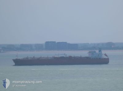
Oil/Chemical Tanker
Current Trip
| Trip Time | 5 days |
|---|---|
| Trip Distance | 610.45 nm |
| AVG Speed | 6.6 Knop |
| MAX Speed | 13.3 Knop |
| Djupgående | 7.2 m |
| AVG Wind | 16.3 knots |
| MAX Wind | 21 knots |
| MIN Temp | 18.6°C / 65.48°F |
| MAX Temp | 24.1°C / 75.38°F |
| Position mottagen | 10 d sen |
Current Position
| Longitud | 39.16201° |
|---|---|
| Latitude | 21.45773° |
| Status | Moored |
| Fart | |
| Kurs | 171° |
| Område | Red Sea |
| Station | T-AIS |
| Position mottagen | 10 d sen |
Info
Information
The current position of NCC NASMA is in Red Sea with coordinates 21.45773° / 39.16201° as reported on 2025-02-03 17:56 by AIS to our vessel tracker app. The vessel's current speed is 0 Knop and is currently inside the port of YANBU.
The vessel NCC NASMA (IMO: 9459008, MMSI: 403515001) is a Oil/Chemical Tanker that was built in 2011 ( 14 År gammal ). It's sailing under the flag of [SA] Saudi Arabia.
In this page you can find informations about the vessels current position, last detected port calls, and current voyage information. If the vessels is not in coverage by AIS you will find the latest position.
The current position of NCC NASMA is detected by our AIS receivers and we are not responsible for the reliability of the data. The last position was recorded while the vessel was in Coverage by the Ais receivers of our vessel tracking app.
The current draught of NCC NASMA as reported by AIS is 7.2 meters
Weather
| Temperature | 18.9°C / 66.02°F |
|---|---|
| Wind Speed | 6 knots |
| Direction | 118° ESE |
| Pressure | 1014.2 hPa |
| Humidity | 54.2 % |
| Cloud Coverage | 14 % |
Featured Company
Last Trips
| Origin | Departure | Destination | Arrival | Distance | |
|---|---|---|---|---|---|
| 2025-02-07 01:49 | 2025-02-12 02:22 | 610.45 nm | |||
| 2025-02-02 16:06 | 2025-02-03 12:15 | 219.93 nm | |||
| 2025-01-29 22:11 | 2025-02-01 02:03 | 497.72 nm | |||
| 2025-01-19 22:52 | 2025-01-28 12:02 | 638.16 nm | |||
| 2024-11-03 14:28 | 2025-01-17 20:54 | 8846.96 nm |
Events
| Tid | Event | Detaljer | Position / Dest | Information |
|---|---|---|---|---|
| 2025-02-11 23:22 | STOPPAR förflyttning |
23.95123 / 38.23449
[SA] YANBU
|
Fart: 0.1 kn Kurs: 267° |
|
| 2025-02-11 23:22 | ANLÄNDER HAMN |
|
23.95123 / 38.23449
[SA] YANBU
|
Fart: 0.8 kn Kurs: 265° |
| 2025-02-11 22:35 | STARTAR förflyttning | 0.68 nm, West of YANBU |
23.94808 / 38.19826
SAJED
|
Fart: 3.8 kn Kurs: 93° |
| 2025-02-11 16:11 | STOPPAR förflyttning | 0.91 nm, South West of YANBU |
23.94402 / 38.19582
SAJED
|
Fart: 0.3 kn Kurs: 281° |
| 2025-02-06 22:49 | AVGÅTT HAMN |
|
21.47023 / 39.10141
SAJED
|
Fart: 8.3 kn Kurs: 280° |
| 2025-02-06 22:26 | STARTAR förflyttning |
21.46456 / 39.16014
[SA] JEDDAH
|
Fart: 6.9 kn Kurs: 285° |