
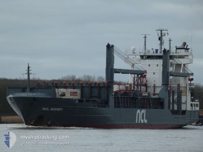
NCL AVEROY
Container Ship
Current Trip
| Time Travelled | 19 h, 7 mins |
|---|---|
| Remaining Time | 12 h, 55 mins |
| Distance Travelled | 258.61 nm |
| Remaining Distance | 211.10 nm |
| AVG Speed | 13.6 Knop |
| MAX Speed | 14.9 Knop |
| AVG Wind | 23.1 knots |
| MAX Wind | 28 knots |
| MIN Temp | 6.1°C / 42.98°F |
| MAX Temp | 8.1°C / 46.58°F |
| Djupgående | 8.2 m |
| Position mottagen | 1 h, 31 m sen |
Current Position
| Longitud | 5.23531° |
|---|---|
| Latitude | 55.11977° |
| Status | Under way using engine |
| Fart | 14.8 Knop |
| Kurs | 190.1° |
| Område | North Sea |
| Station | T-AIS |
| Position mottagen | 1 h, 31 m sen |
Info
Information
The current position of NCL AVEROY is in North Sea with coordinates 55.11977° / 5.23531° as reported on 2025-02-05 08:27 by AIS to our vessel tracker app. The vessel's current speed is 14.8 Knop and is heading at the port of MAASVLAKTE - ROTTERDAM. The estimated time of arrival as calculated by MyShipTracking vessel tracking app is 2025-02-05 22:53 LT
The vessel NCL AVEROY (IMO: 9326990, MMSI: 255805587) is a Container Ship that was built in 2006 ( 19 År gammal ). It's sailing under the flag of [PT] Portugal.
In this page you can find informations about the vessels current position, last detected port calls, and current voyage information. If the vessels is not in coverage by AIS you will find the latest position.
The current position of NCL AVEROY is detected by our AIS receivers and we are not responsible for the reliability of the data. The last position was recorded while the vessel was in Coverage by the Ais receivers of our vessel tracking app.
The current draught of NCL AVEROY as reported by AIS is 8.2 meters
Weather
| Temperature | 6.6°C / 43.88°F |
|---|---|
| Wind Speed | 16 knots |
| Direction | 267° W |
| Pressure | 1029.9 hPa |
| Humidity | 87.5 % |
| Cloud Coverage | --- |
Featured Company
Last Port Calls
| Port | Arrival | Departure | Time In Port |
|---|---|---|---|
| 2025-02-04 10:33 | 2025-02-04 14:51 | 4 h | |
| 2025-02-03 13:07 | 2025-02-03 16:26 | 3 h | |
| 2025-02-03 05:46 | 2025-02-03 07:07 | 1 h | |
| 2025-02-02 05:12 | 2025-02-02 10:19 | 5 h | |
| 2025-02-01 06:58 | 2025-02-01 11:57 | 4 h | |
| 2025-01-29 23:59 | 2025-01-30 09:08 | 9 h | |
| 2025-01-28 22:02 | 2025-01-29 03:06 | 5 h | |
| 2025-01-27 22:04 | 2025-01-28 16:38 | 18 h | |
| 2025-01-27 00:59 | 2025-01-27 03:49 | 2 h | |
| 2025-01-26 13:48 | 2025-01-26 20:23 | 6 h |
Last Trips
| Origin | Departure | Destination | Arrival | Distance | |
|---|---|---|---|---|---|
| 2025-02-03 17:26 | 2025-02-04 11:33 | 207.36 nm | |||
| 2025-02-03 08:07 | 2025-02-03 14:07 | 86.75 nm | |||
| 2025-02-02 11:19 | 2025-02-03 06:46 | 170.94 nm | |||
| 2025-02-01 12:57 | 2025-02-02 06:12 | 270.62 nm | |||
| 2025-01-30 10:08 | 2025-02-01 07:58 | 602.04 nm | |||
| 2025-01-29 04:06 | 2025-01-30 00:59 | 345.97 nm | |||
| 2025-01-28 17:38 | 2025-01-28 23:02 | 90.95 nm | |||
| 2025-01-27 04:49 | 2025-01-27 23:04 | 230.15 nm | |||
| 2025-01-26 21:23 | 2025-01-27 01:59 | 75.99 nm | |||
| 2025-01-26 12:59 | 2025-01-26 14:48 | 27.08 nm |
Events
| Tid | Event | Detaljer | Position / Dest | Information |
|---|---|---|---|---|
| 2025-02-05 08:29 | Status ändrad | Default Under way using engine |
55.11146 / 5.23298
NLMSV
|
Fart: 14.8 kn Kurs: 190.1° |
| 2025-02-05 08:27 | UTANFÖR täckningsområde |
55.11977 / 5.23531
North Sea
NLMSV
|
Fart: 14.8 kn Kurs: 190.1° |
|
| 2025-02-05 07:56 | Byter havsområde | German part of the North Sea Danish part of the North Sea |
55.24869 / 5.27023
North Sea
NLMSV
|
Fart: 14.8 kn Kurs: 188.3° |
| 2025-02-05 02:03 | Byter havsområde | Danish part of the North Sea Norwegian part of the North Sea |
56.62883 / 5.22219
North Sea
NLMSV
|
Fart: 13.1 kn Kurs: 180.3° |
| 2025-02-05 02:03 | Status ändrad | Under way using engine Default |
56.62883 / 5.22219
NLMSV
|
Fart: 11.5 kn Kurs: 181° |
| 2025-02-05 02:03 | I täckningsområde |
56.62883 / 5.22219
North Sea
NLMSV
|
Fart: 13.1 kn Kurs: 180.3° |
|
| 2025-02-04 23:23 | Status ändrad | Default Under way using engine |
57.18055 / 5.20267
NLMSV
|
Fart: 11.6 kn Kurs: 177.1° |
| 2025-02-04 23:16 | UTANFÖR täckningsområde |
57.20489 / 5.20012
North Sea
NLMSV
|
Fart: 11.6 kn Kurs: 177.1° |
|
| 2025-02-04 14:51 | AVGÅTT HAMN |
|
58.93087 / 5.56912
NLMSV
|
Fart: 12.1 kn Kurs: 289° |
| 2025-02-04 14:43 | STARTAR förflyttning |
58.92236 / 5.58598
[NO] TANANGER
|
Fart: 4.5 kn Kurs: 188° |