
NEW ENDEAVOR
Cargo
Current Trip
| Time Travelled | 8 days |
|---|---|
| Remaining Time | --- |
| Distance Travelled | 1415.35 nm |
| Remaining Distance | 41.76 nm |
| AVG Speed | 18.2 Knop |
| MAX Speed | 18.2 Knop |
| AVG Wind | 14.9 knots |
| MAX Wind | 33 knots |
| MIN Temp | -6.4°C / 20.48°F |
| MAX Temp | 8.9°C / 48.02°F |
| Djupgående | 7.6 m |
| Position mottagen | 1 m sen |
Current Position
| Longitud | 28.75617° |
|---|---|
| Latitude | 60.31891° |
| Status | Under way using engine |
| Fart | 54 Knop |
| Kurs | 215.8° |
| Område | Gulf of Finland |
| Station | T-AIS |
| Position mottagen | 1 m sen |
Info
Information
The current position of NEW ENDEAVOR is in Gulf of Finland with coordinates 60.31891° / 28.75617° as reported on 2026-01-06 03:04 by AIS to our vessel tracker app. The vessel's current speed is 54 Knop and is heading at the port of UST-LUGA. The estimated time of arrival as calculated by MyShipTracking vessel tracking app is 2026-01-03 02:00 LT
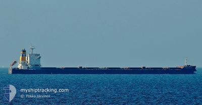
The vessel NEW ENDEAVOR (IMO: 9579638, MMSI: 352246000) is a Cargo It's sailing under the flag of [PA] Panama.
In this page you can find informations about the vessels current position, last detected port calls, and current voyage information. If the vessels is not in coverage by AIS you will find the latest position.
The current position of NEW ENDEAVOR is detected by our AIS receivers and we are not responsible for the reliability of the data. The last position was recorded while the vessel was in Coverage by the Ais receivers of our vessel tracking app.
The current draught of NEW ENDEAVOR as reported by AIS is 7.6 meters
Weather
| Temperature | -2.8°C / 26.96°F |
|---|---|
| Wind Speed | 11 knots |
| Direction | 252° WSW |
| Pressure | 1020.9 hPa |
| Humidity | 68.4 % |
| Cloud Coverage | 97 % |
Featured Company
Last Port Calls
| Port | Arrival | Departure | Time In Port |
|---|---|---|---|
| 2025-12-29 00:56 | 2025-12-29 01:40 | 44 m | |
| 2025-12-24 09:45 | 2025-12-29 00:01 | 4 d | |
| 2025-11-30 10:36 | 2025-12-02 23:58 | 2 d | |
| 2025-11-11 16:33 | 2025-11-13 14:42 | 1 d |
Most Visited Ports (Last year)
| Port | Arrivals | |
|---|---|---|
| 2 | ||
| 2 | ||
| 2 | ||
| 1 | ||
| 1 | ||
| 1 |
Last Trips
| Origin | Departure | Destination | Arrival | Distance | |
|---|---|---|---|---|---|
| 2025-12-29 00:01 | 2025-12-29 00:56 | 4.64 nm | |||
| 2025-12-02 23:58 | 2025-12-24 09:45 | 5447.85 nm | |||
| 2025-11-13 14:42 | 2025-11-30 10:36 | 4894.27 nm | |||
| 2025-10-12 16:55 | 2025-11-11 16:33 | 6117.54 nm |
Events
| Tid | Event | Detaljer | Position / Dest | Information |
|---|---|---|---|---|
| 2026-01-06 00:10 | Status ändrad | Under way using engine Default |
60.31874 / 28.76090
RU ULU
|
Fart: 52.8 kn Kurs: 4° |
| 2026-01-05 23:58 | Status ändrad | Default Under way using engine |
60.31824 / 28.76157
RU ULU
|
Fart: 52.1 kn Kurs: 219.8° |
| 2026-01-05 17:16 | Byter havsområde | Russian part of the Gulf of Finland Estonian part of the Gulf of Finland |
59.95750 / 26.40777
Gulf of Finland
|
Fart: 11.5 kn Kurs: 69.5° |
| 2026-01-05 15:33 | STARTAR förflyttning | 15.84 nm, North of LOKSA |
59.83380 / 25.86263
RU ULU
|
Fart: 3.1 kn Kurs: 0° |
| 2026-01-05 15:25 | Status ändrad | Under way using engine At anchor |
59.83228 / 25.86907
RU ULU
|
Fart: 0.5 kn Kurs: 253° |
| 2026-01-05 15:15 | Status ändrad | At anchor Default |
59.83292 / 25.87070
RU ULU
|
Fart: 0.5 kn Kurs: 282° |
| 2026-01-05 15:03 | Status ändrad | Default At anchor |
59.83261 / 25.86838
RU ULU
|
Fart: 0.8 kn Kurs: 289° |
| 2026-01-05 14:39 | Status ändrad | At anchor Default |
59.83315 / 25.87041
RU ULU
|
Fart: 0.2 kn Kurs: 270° |
| 2026-01-05 14:33 | Status ändrad | Default At anchor |
59.83304 / 25.87012
RU ULU
|
Fart: 0.2 kn Kurs: 274° |
| 2026-01-05 14:18 | Status ändrad | At anchor Default |
59.83269 / 25.87036
RU ULU
|
Fart: 0.1 kn Kurs: 266° |