

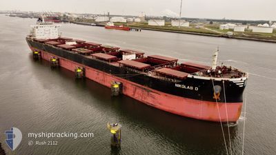
NIKOLAS D
Cargo

Current Trip
| Time Travelled | 18 days |
|---|---|
| Remaining Time | --- |
| Distance Travelled | 4597.53 nm |
| Remaining Distance | --- |
| AVG Speed | 10.6 Knop |
| MAX Speed | 14 Knop |
| AVG Wind | 11.4 knots |
| MAX Wind | 21.9 knots |
| MIN Temp | 16.9°C / 62.42°F |
| MAX Temp | 28.1°C / 82.58°F |
| Djupgående | 14.3 m |
| Position mottagen | 4 d sen |
Current Position
| Longitud | -34.61984° |
|---|---|
| Latitude | -8.35347° |
| Status | Under way using engine |
| Fart | 10.3 Knop |
| Kurs | 195.8° |
| Område | South Atlantic Ocean |
| Station | T-AIS |
| Position mottagen | 4 d sen |
Information
The current position of NIKOLAS D is in South Atlantic Ocean with coordinates -8.35347° / -34.61984° as reported on 2025-05-29 13:45 by AIS to our vessel tracker app. The vessel's current speed is 10.3 Knop
The vessel NIKOLAS D (IMO: 9474723, MMSI: 352993000) is a Cargo It's sailing under the flag of [PA] Panama.
In this page you can find informations about the vessels current position, last detected port calls, and current voyage information. If the vessels is not in coverage by AIS you will find the latest position.
The current position of NIKOLAS D is detected by our AIS receivers and we are not responsible for the reliability of the data. The last position was recorded while the vessel was in Coverage by the Ais receivers of our vessel tracking app.
The current draught of NIKOLAS D as reported by AIS is 14.3 meters
Weather
| Temperature | 24.3°C / 75.74°F |
|---|---|
| Wind Speed | 13 knots |
| Direction | 182° S |
| Pressure | 1021.8 hPa |
| Humidity | 77.5 % |
| Cloud Coverage | 57 % |


Featured Company
Most Visited Ports (Last year)
| Port | Arrivals | |
|---|---|---|
| 1 | ||
| 1 | ||
| 1 | ||
| 1 | ||
| 1 | ||
| 1 |
Last Trips
| Origin | Departure | Destination | Arrival | Distance | |
|---|---|---|---|---|---|
| 2025-04-28 19:36 | 2025-05-13 02:06 | 3751.60 nm | |||
| 2025-04-24 10:10 | 2025-04-26 23:27 | 711.74 nm | |||
| 2025-04-12 11:33 | 2025-04-19 10:50 | 711.49 nm | |||
| 2025-04-01 15:46 | 2025-04-09 14:51 | 1890.70 nm |
Events
| Tid | Event | Detaljer | Position / Dest | Information |
|---|---|---|---|---|
| 2025-06-01 16:11 | STOPPAR förflyttning | 3.75 nm, South East of JARDIM CAMBURI |
-20.31723 / -40.19378
BR PRM
|
Fart: 0.1 kn Kurs: 174° |
| 2025-05-29 13:54 | Status ändrad | Default Under way using engine |
-8.38162 / -34.62780
BR PRM
|
Fart: 10.3 kn Kurs: 195.8° |
| 2025-05-29 13:45 | UTANFÖR täckningsområde |
-8.35347 / -34.61984
South Atlantic Ocean
BR PRM
|
Fart: 10.3 kn Kurs: 195.8° |
|
| 2025-05-29 12:27 | ETA ändrat | 2025/06/01 15:00 |
-8.13623 / -34.56517
BR PRM
|
Fart: 10.2 kn Kurs: 194.4° |
| 2025-05-29 12:24 | Status ändrad | Under way using engine Default |
-8.12653 / -34.56280
BR PRM
|
Fart: 10.3 kn Kurs: 193° |
| 2025-05-29 12:18 | Status ändrad | Default Under way using engine |
-8.11228 / -34.55928
BR PRM
|
Fart: 10.3 kn Kurs: 195.3° |
| 2025-05-29 12:14 | Status ändrad | Under way using engine Default |
-8.10113 / -34.55635
BR PRM
|
Fart: 10.3 kn Kurs: 197° |
| 2025-05-29 12:09 | Status ändrad | Default Under way using engine |
-8.08770 / -34.55281
BR PRM
|
Fart: 10.2 kn Kurs: 196.6° |
| 2025-05-29 11:44 | Status ändrad | Under way using engine Default |
-8.01960 / -34.53111
BR PRM
|
Fart: 10 kn Kurs: 202° |
| 2025-05-29 11:31 | Status ändrad | Default Under way using engine |
-7.98488 / -34.51826
BR PRM
|
Fart: 9.8 kn Kurs: 199.1° |