
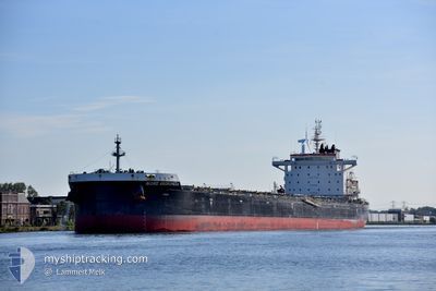
NORD ANDROMEDA
Cargo
Current Trip
| Time Travelled | 10 days |
|---|---|
| Remaining Time | 58 mins |
| Distance Travelled | 3227.29 nm |
| Remaining Distance | 10.11 nm |
| AVG Speed | 11.9 Knop |
| MAX Speed | 16 Knop |
| AVG Wind | 12.6 knots |
| MAX Wind | 24 knots |
| MIN Temp | 15.5°C / 59.9°F |
| MAX Temp | 29.1°C / 84.38°F |
| Djupgående | 12.9 m |
| Position mottagen | Nu |
Current Position
| Longitud | 118.05198° |
|---|---|
| Latitude | -35.08084° |
| Status | Under way using engine |
| Fart | 6 Knop |
| Kurs | 284.7° |
| Område | Great Australian Bight |
| Station | T-AIS |
| Position mottagen | Nu |
Info
Information
The current position of NORD ANDROMEDA is in Great Australian Bight with coordinates -35.08084° / 118.05198° as reported on 2025-03-04 21:20 by AIS to our vessel tracker app. The vessel's current speed is 6 Knop and is heading at the port of ALBANY. The estimated time of arrival as calculated by MyShipTracking vessel tracking app is 2025-03-04 22:19 LT
The vessel NORD ANDROMEDA (IMO: 9929390, MMSI: 563141900) is a Cargo It's sailing under the flag of [SG] Singapore.
In this page you can find informations about the vessels current position, last detected port calls, and current voyage information. If the vessels is not in coverage by AIS you will find the latest position.
The current position of NORD ANDROMEDA is detected by our AIS receivers and we are not responsible for the reliability of the data. The last position was recorded while the vessel was in Coverage by the Ais receivers of our vessel tracking app.
The current draught of NORD ANDROMEDA as reported by AIS is 12.9 meters
Weather
| Temperature | 15.5°C / 59.9°F |
|---|---|
| Wind Speed | 9 knots |
| Direction | 90° E |
| Pressure | 1028.1 hPa |
| Humidity | 63.5 % |
| Cloud Coverage | 10 % |
Featured Company
Last Trips
| Origin | Departure | Destination | Arrival | Distance | |
|---|---|---|---|---|---|
| 2025-01-03 14:53 | 2025-02-14 16:43 | 10079.48 nm | |||
| 2024-12-24 03:05 | 2025-01-01 12:25 | 1206.13 nm |
Events
| Tid | Event | Detaljer | Position / Dest | Information |
|---|---|---|---|---|
| 2025-03-04 19:47 | Byter havsområde | Australian part of the Great Australian Bight Australian part of the Indian Ocean |
-35.25321 / 118.00124
Great Australian Bight
ALBANY
|
Fart: 9.5 kn Kurs: 57.8° |
| 2025-03-04 14:55 | ETA ändrat | 2025/03/05 00:00 2025/03/04 22:00 |
-35.49658 / 116.93361
ALBANY
|
Fart: 11 kn Kurs: 74.8° |
| 2025-03-04 14:30 | Status ändrad | Under way using engine Default |
-35.51624 / 116.84806
ALBANY
|
Fart: 10.4 kn Kurs: 74° |
| 2025-03-04 14:28 | Status ändrad | Default Under way using engine |
-35.51815 / 116.84000
ALBANY
|
Fart: 10.3 kn Kurs: 77.7° |
| 2025-03-04 14:20 | Status ändrad | Under way using engine Default |
-35.52363 / 116.81439
ALBANY
|
Fart: 10.3 kn Kurs: 76° |
| 2025-03-04 14:04 | I täckningsområde |
-35.52246 / 116.82005
Indian Ocean
ALBANY
|
Fart: 10.3 kn Kurs: 77.7° |
|
| 2025-03-03 02:16 | Status ändrad | Default Under way using engine |
-29.38898 / 112.66996
ALBANY
|
Fart: 10.7 kn Kurs: 159° |
| 2025-03-03 02:11 | UTANFÖR täckningsområde |
-29.37588 / 112.66396
Indian Ocean
ALBANY
|
Fart: 10.7 kn Kurs: 159° |
|
| 2025-03-03 01:48 | Status ändrad | Under way using engine Default |
-29.31282 / 112.63330
ALBANY
|
Fart: 10.5 kn Kurs: 155° |
| 2025-03-03 01:40 | Status ändrad | Default Under way using engine |
-29.29243 / 112.62274
ALBANY
|
Fart: 10.5 kn Kurs: 156.8° |