
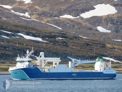
NYKSUND
Cargo
Current Trip
FISHFARMS
| Time Travelled | 2 days |
|---|---|
| Remaining Time | --- |
| Distance Travelled | 484.86 nm |
| Remaining Distance | --- |
| AVG Speed | 11.3 Knop |
| MAX Speed | 14.2 Knop |
| AVG Wind | 10.6 knots |
| MAX Wind | 24 knots |
| MIN Temp | 6.2°C / 43.16°F |
| MAX Temp | 10.8°C / 51.44°F |
| Djupgående | 5.3 m |
| Position mottagen | 7 m sen |
Current Position
| Longitud | 10.32170° |
|---|---|
| Latitude | 64.25261° |
| Status | Under way using engine |
| Fart | 10.8 Knop |
| Kurs | 227.2° |
| Område | Norwegian Sea |
| Station | T-AIS |
| Position mottagen | 7 m sen |
Information
The current position of NYKSUND is in Norwegian Sea with coordinates 64.25261° / 10.32170° as reported on 2025-05-29 15:24 by AIS to our vessel tracker app. The vessel's current speed is 10.8 Knop
The vessel NYKSUND (IMO: 9803534, MMSI: 257178000) is a Cargo It's sailing under the flag of [NO] Norway.
In this page you can find informations about the vessels current position, last detected port calls, and current voyage information. If the vessels is not in coverage by AIS you will find the latest position.
The current position of NYKSUND is detected by our AIS receivers and we are not responsible for the reliability of the data. The last position was recorded while the vessel was in Coverage by the Ais receivers of our vessel tracking app.
The current draught of NYKSUND as reported by AIS is 5.3 meters
Weather
| Temperature | 8.7°C / 47.66°F |
|---|---|
| Wind Speed | 10 knots |
| Direction | 231° SW |
| Pressure | 1011 hPa |
| Humidity | 83.1 % |
| Cloud Coverage | 13 % |
Featured Company
Last Port Calls
| Port | Arrival | Departure | Time In Port |
|---|---|---|---|
| 2025-05-25 15:50 | 2025-05-26 18:19 | 1 d | |
| 2025-05-23 11:04 | 2025-05-23 13:42 | 2 h | |
| 2025-05-20 06:14 | 2025-05-20 11:21 | 5 h | |
| 2025-05-18 07:50 | 2025-05-19 20:37 | 1 d | |
| 2025-05-14 06:32 | 2025-05-14 08:55 | 2 h | |
| 2025-05-13 08:17 | 2025-05-13 23:51 | 15 h | |
| 2025-05-13 05:46 | 2025-05-13 07:51 | 2 h | |
| 2025-05-12 08:06 | 2025-05-13 00:28 | 16 h | |
| 2025-05-09 14:44 | 2025-05-09 15:30 | 46 m | |
| 2025-05-07 23:38 | 2025-05-08 02:26 | 2 h |
Last Trips
| Origin | Departure | Destination | Arrival | Distance | |
|---|---|---|---|---|---|
| 2025-05-23 15:42 | 2025-05-25 17:50 | 551.35 nm | |||
| 2025-05-20 13:21 | 2025-05-23 13:04 | 584.80 nm | |||
| 2025-05-19 22:37 | 2025-05-20 08:14 | 114.37 nm | |||
| 2025-05-14 10:55 | 2025-05-18 09:50 | 851.93 nm | |||
| 2025-05-14 01:51 | 2025-05-14 08:32 | 76.70 nm | |||
| 2025-05-13 09:51 | 2025-05-13 10:17 | 4.21 nm | |||
| 2025-05-13 02:28 | 2025-05-13 07:46 | 69.41 nm | |||
| 2025-05-09 17:30 | 2025-05-12 10:06 | 643.81 nm | |||
| 2025-05-08 04:26 | 2025-05-09 16:44 | 289.14 nm | |||
| 2025-05-07 19:02 | 2025-05-08 01:38 | 76.69 nm |
Events
| Tid | Event | Detaljer | Position / Dest | Information |
|---|---|---|---|---|
| 2025-05-29 14:32 | Status ändrad | Under way using engine Default |
64.39312 / 10.44008
FISHFARMS
|
Fart: 10.4 kn Kurs: 156° |
| 2025-05-29 14:30 | Status ändrad | Default Under way using engine |
64.39869 / 10.43347
FISHFARMS
|
Fart: 11.4 kn Kurs: 198° |
| 2025-05-29 13:32 | Status ändrad | Under way using engine Default |
64.53884 / 10.60994
FISHFARMS
|
Fart: 9.4 kn Kurs: 209° |
| 2025-05-29 13:30 | Status ändrad | Default Under way using engine |
64.54369 / 10.61566
FISHFARMS
|
Fart: 8.9 kn Kurs: 228.6° |
| 2025-05-29 12:42 | STARTAR förflyttning | 18.5 nm, South West of ROERVIK |
64.59822 / 10.85206
FISHFARMS
|
Fart: 7.5 kn Kurs: 165.6° |
| 2025-05-29 12:40 | Status ändrad | Under way using engine Default |
64.60097 / 10.85014
FISHFARMS
|
Fart: 1.4 kn Kurs: 95° |
| 2025-05-29 12:38 | Status ändrad | Default Under way using engine |
64.60132 / 10.85032
FISHFARMS
|
Fart: 1.4 kn Kurs: 87° |
| 2025-05-29 11:22 | Status ändrad | Under way using engine Default |
64.60192 / 10.85036
FISHFARMS
|
Fart: 0.1 kn Kurs: 351° |
| 2025-05-29 11:18 | Status ändrad | Default Under way using engine |
64.60184 / 10.85041
FISHFARMS
|
Fart: Kurs: 351° |
| 2025-05-29 10:27 | STOPPAR förflyttning | 18.34 nm, South West of ROERVIK |
64.60192 / 10.85040
FISHFARMS
|
Fart: 0.3 kn Kurs: 348° |