
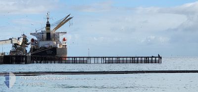
OCEAN ACE
Bulk Carrier
Current Trip
ADANG BAY
| Time Travelled | 9 h, 39 mins |
|---|---|
| Remaining Time | --- |
| Distance Travelled | 69.85 nm |
| Remaining Distance | --- |
| AVG Speed | 11.5 Knop |
| MAX Speed | 12.4 Knop |
| AVG Wind | 5.5 knots |
| MAX Wind | 8.6 knots |
| MIN Temp | 8.3°C / 46.94°F |
| MAX Temp | 9.9°C / 49.82°F |
| Djupgående | 10 m |
| Position mottagen | 5 h, 39 m sen |
Current Position
| Longitud | 129.19267° |
|---|---|
| Latitude | 34.75618° |
| Status | Under way using engine |
| Fart | 11.7 Knop |
| Kurs | 213° |
| Område | Japan Sea |
| Station | T-AIS |
| Position mottagen | 5 h, 39 m sen |
Info
Information
The current position of OCEAN ACE is in Japan Sea with coordinates 34.75618° / 129.19267° as reported on 2025-02-14 13:24 by AIS to our vessel tracker app. The vessel's current speed is 11.7 Knop
The vessel OCEAN ACE (IMO: 9303027, MMSI: 566926000) is a Bulk Carrier that was built in 2005 ( 20 År gammal ). It's sailing under the flag of [SG] Singapore.
In this page you can find informations about the vessels current position, last detected port calls, and current voyage information. If the vessels is not in coverage by AIS you will find the latest position.
The current position of OCEAN ACE is detected by our AIS receivers and we are not responsible for the reliability of the data. The last position was recorded while the vessel was in Coverage by the Ais receivers of our vessel tracking app.
The current draught of OCEAN ACE as reported by AIS is 10 meters
Weather
| Temperature | 9.1°C / 48.38°F |
|---|---|
| Wind Speed | 8 knots |
| Direction | 282° WNW |
| Pressure | 1019.8 hPa |
| Humidity | 55.8 % |
| Cloud Coverage | 70 % |
Featured Company
Last Port Calls
| Port | Arrival | Departure | Time In Port |
|---|---|---|---|
| 2025-01-30 17:32 | 2025-02-14 18:25 | 15 d | |
| 2025-01-11 22:06 | 2025-01-13 20:02 | 1 d | |
| 2024-12-27 09:26 | 2024-12-29 06:56 | 1 d |
Last Trips
| Origin | Departure | Destination | Arrival | Distance | |
|---|---|---|---|---|---|
| 2025-01-13 20:02 | 2025-01-30 17:32 | 3793.57 nm | |||
| 2024-12-29 06:56 | 2025-01-11 22:06 | 3660.29 nm |
Events
| Tid | Event | Detaljer | Position / Dest | Information |
|---|---|---|---|---|
| 2025-02-14 13:29 | Status ändrad | Default Under way using engine |
34.74155 / 129.18059
ADANG BAY
|
Fart: 11.7 kn Kurs: 213° |
| 2025-02-14 13:24 | UTANFÖR täckningsområde |
34.75618 / 129.19267
Japan Sea
|
Fart: 11.7 kn Kurs: 213° |
|
| 2025-02-14 13:07 | Status ändrad | Under way using engine Default |
34.80102 / 129.22982
ADANG BAY
|
Fart: 11.4 kn Kurs: 217° |
| 2025-02-14 13:05 | Status ändrad | Default Under way using engine |
34.80602 / 129.23439
ADANG BAY
|
Fart: 11.4 kn Kurs: 219° |
| 2025-02-14 12:49 | Status ändrad | Under way using engine Default |
34.84798 / 129.27232
ADANG BAY
|
Fart: 11.7 kn Kurs: 203° |
| 2025-02-14 12:41 | Status ändrad | Default Under way using engine |
34.87160 / 129.28526
ADANG BAY
|
Fart: 11.9 kn Kurs: 203° |
| 2025-02-14 12:33 | Byter havsområde | Japanese part of the Japan Sea South Korean part of the Japan Sea |
34.89545 / 129.29815
Japan Sea
|
Fart: 11.9 kn Kurs: 203° |
| 2025-02-14 12:33 | Status ändrad | Under way using engine Default |
34.89545 / 129.29815
ADANG BAY
|
Fart: 12 kn Kurs: 202° |
| 2025-02-14 12:13 | Status ändrad | Default Under way using engine |
34.95933 / 129.32327
ADANG BAY
|
Fart: 12.3 kn Kurs: 193° |
| 2025-02-14 11:19 | Status ändrad | Under way using engine Default |
35.13202 / 129.38312
ADANG BAY
|
Fart: 11.6 kn Kurs: 199° |