

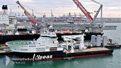
OCEANIC
Other Type

Current Trip
TROLL FIELD
| Time Travelled | 4 days |
|---|---|
| Remaining Time | --- |
| Distance Travelled | 152.15 nm |
| Remaining Distance | --- |
| AVG Speed | 8.7 Knop |
| MAX Speed | 12.6 Knop |
| AVG Wind | 18.7 knots |
| MAX Wind | 28.8 knots |
| MIN Temp | 3.3°C / 37.94°F |
| MAX Temp | 7.9°C / 46.22°F |
| Djupgående | 6.9 m |
| Position mottagen | 2 m sen |
Current Position
| Longitud | 3.53503° |
|---|---|
| Latitude | 60.79790° |
| Status | Restricted manoeuverability |
| Fart | 0.3 Knop |
| Kurs | 300° |
| Område | North Sea |
| Station | T-AIS |
| Position mottagen | 2 m sen |
Information
The current position of OCEANIC is in North Sea with coordinates 60.79790° / 3.53503° as reported on 2025-03-31 00:50 by AIS to our vessel tracker app. The vessel's current speed is 0.3 Knop
The vessel OCEANIC (IMO: 9703382, MMSI: 249903000) is a Other Type It's sailing under the flag of [MT] Malta.
In this page you can find informations about the vessels current position, last detected port calls, and current voyage information. If the vessels is not in coverage by AIS you will find the latest position.
The current position of OCEANIC is detected by our AIS receivers and we are not responsible for the reliability of the data. The last position was recorded while the vessel was in Coverage by the Ais receivers of our vessel tracking app.
The current draught of OCEANIC as reported by AIS is 6.9 meters
Weather
| Temperature | 5.9°C / 42.62°F |
|---|---|
| Wind Speed | 12 knots |
| Direction | 356° N |
| Pressure | 1021.4 hPa |
| Humidity | 68.3 % |
| Cloud Coverage | 65 % |


Featured Company
Last Port Calls
| Port | Arrival | Departure | Time In Port |
|---|---|---|---|
| 2025-03-26 08:26 | 2025-03-26 21:07 | 12 h | |
| 2025-03-22 19:41 | 2025-03-23 09:21 | 13 h | |
| 2025-03-22 04:42 | 2025-03-22 19:24 | 14 h | |
| 2025-03-07 10:01 | 2025-03-12 03:56 | 4 d | |
| 2025-03-05 02:41 | 2025-03-05 17:13 | 14 h | |
| 2025-02-12 15:27 |
Most Visited Ports (Last year)
| Port | Arrivals | |
|---|---|---|
| 7 | ||
| 7 | ||
| 3 | ||
| 1 | ||
| 1 | ||
| 1 |
Last Trips
| Origin | Departure | Destination | Arrival | Distance | |
|---|---|---|---|---|---|
| 2025-03-23 09:21 | 2025-03-26 08:26 | 98.49 nm | |||
| 2025-03-22 19:24 | 2025-03-22 19:41 | 1.44 nm | |||
| 2025-03-12 03:56 | 2025-03-22 04:42 | 793.90 nm | |||
| 2025-03-05 17:13 | 2025-03-07 10:01 | 259.40 nm | |||
| 2025-02-12 15:27 | 2025-03-05 02:41 | 145.78 nm |
Events
| Tid | Event | Detaljer | Position / Dest | Information |
|---|---|---|---|---|
| 2025-03-30 19:01 | STOPPAR förflyttning |
60.79712 / 3.53763
TROLL FIELD
|
Fart: 0.3 kn Kurs: 350° |
|
| 2025-03-30 18:10 | STARTAR förflyttning |
60.75473 / 3.58100
TROLL FIELD
|
Fart: 3.3 kn Kurs: 334° |
|
| 2025-03-30 10:52 | STOPPAR förflyttning |
60.75140 / 3.58565
TROLL FIELD
|
Fart: Kurs: 357° |
|
| 2025-03-30 10:50 | Status ändrad | Restricted manoeuverability Under way using engine |
60.75108 / 3.58487
TROLL FIELD
|
Fart: 1 kn Kurs: 357° |
| 2025-03-30 06:20 | Status ändrad | Under way using engine At anchor |
60.83047 / 4.94955
TROLL FIELD
|
Fart: 9.5 kn Kurs: 318.3° |
| 2025-03-30 06:19 | Destination ändrad | TROLL FIELD FONNES ANCHORAGE |
60.82610 / 4.95737
TROLL FIELD
|
Fart: 9.5 kn Kurs: 318.3° |
| 2025-03-30 06:19 | ETA ändrat | 2025/03/30 11:00 2025/03/28 07:00 |
60.82610 / 4.95737
TROLL FIELD
|
Fart: 9.5 kn Kurs: 318.3° |
| 2025-03-30 06:14 | STARTAR förflyttning | 0.59 nm, North of FONNES |
60.81973 / 4.96930
FONNES ANCHORAGE
|
Fart: 4 kn Kurs: 314° |
| 2025-03-28 08:01 | Destination ändrad | FONNES ANCHORAGE WERGELAND ANCHORAGE |
60.81967 / 4.97353
FONNES ANCHORAGE
|
Fart: 0.3 kn Kurs: 190° |
| 2025-03-28 07:44 | Status ändrad | At anchor Under way using engine |
60.81950 / 4.97458
WERGELAND ANCHORAGE
|
Fart: 0.4 kn Kurs: 157° |