
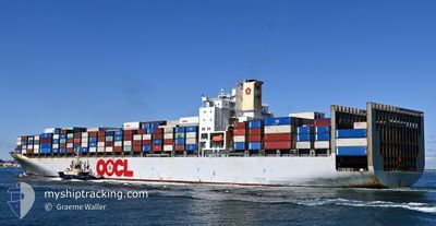
OOCL CHICAGO
Container Ship
Current Trip
| Time Travelled | 5 h, 52 mins |
|---|---|
| Remaining Time | --- |
| Distance Travelled | 57.53 nm |
| Remaining Distance | 135.98 nm |
| AVG Speed | 10.5 Knop |
| MAX Speed | 14.2 Knop |
| AVG Wind | 9.4 knots |
| MAX Wind | 14 knots |
| MIN Temp | 24.7°C / 76.46°F |
| MAX Temp | 25.9°C / 78.62°F |
| Djupgående | 13 m |
| Position mottagen | 4 h, 24 m sen |
Current Position
| Longitud | 103.56192° |
|---|---|
| Latitude | 1.20469° |
| Status | Under way using engine |
| Fart | 9.3 Knop |
| Kurs | 282.6° |
| Område | Singapore Strait |
| Station | T-AIS |
| Position mottagen | 4 h, 24 m sen |
Info
Information
The current position of OOCL CHICAGO is in Singapore Strait with coordinates 1.20469° / 103.56192° as reported on 2026-01-06 20:47 by AIS to our vessel tracker app. The vessel's current speed is 9.3 Knop and is heading at the port of PORT KLANG. The estimated time of arrival as calculated by MyShipTracking vessel tracking app is 2026-01-10 22:00 LT
The vessel OOCL CHICAGO (IMO: 9199270, MMSI: 477825000) is a Container Ship that was built in 2000 ( 26 År gammal ). It's sailing under the flag of [HK] Hong Kong.
In this page you can find informations about the vessels current position, last detected port calls, and current voyage information. If the vessels is not in coverage by AIS you will find the latest position.
The current position of OOCL CHICAGO is detected by our AIS receivers and we are not responsible for the reliability of the data. The last position was recorded while the vessel was in Coverage by the Ais receivers of our vessel tracking app.
The current draught of OOCL CHICAGO as reported by AIS is 13 meters
Weather
| Temperature | 25.6°C / 78.08°F |
|---|---|
| Wind Speed | 12 knots |
| Direction | 23° NNE |
| Pressure | 1012.5 hPa |
| Humidity | 86.2 % |
| Cloud Coverage | 100 % |
Featured Company
Last Port Calls
| Port | Arrival | Departure | Time In Port |
|---|---|---|---|
| 2026-01-05 14:46 | 2026-01-06 19:19 | 1 d | |
| 2025-12-27 06:22 | 2025-12-29 13:02 | 2 d | |
| 2025-12-21 00:06 | 2025-12-22 09:59 | 1 d | |
| 2025-12-17 10:37 | 2025-12-19 15:43 | 2 d | |
| 2025-12-11 14:23 | 2025-12-12 23:30 | 1 d | |
| 2025-12-03 14:05 | 2025-12-04 17:33 | 1 d | |
| 2025-11-26 22:08 | 2025-11-28 03:25 | 1 d | |
| 2025-11-18 16:20 | 2025-11-20 21:48 | 2 d | |
| 2025-11-11 01:43 | 2025-11-12 03:54 | 1 d | |
| 2025-11-06 13:17 | 2025-11-08 11:18 | 1 d |
Most Visited Ports (Last year)
| Port | Arrivals | |
|---|---|---|
| 18 | ||
| 17 | ||
| 9 | ||
| 9 | ||
| 9 | ||
| 7 |
Last Trips
| Origin | Departure | Destination | Arrival | Distance | |
|---|---|---|---|---|---|
| 2025-12-29 21:02 | 2026-01-05 22:46 | 2319.73 nm | |||
| 2025-12-22 20:29 | 2025-12-27 14:22 | 1381.17 nm | |||
| 2025-12-20 02:43 | 2025-12-21 10:36 | 514.91 nm | |||
| 2025-12-13 07:30 | 2025-12-17 21:37 | 1720.49 nm | |||
| 2025-12-05 01:33 | 2025-12-11 22:23 | 2503.67 nm | |||
| 2025-11-28 11:25 | 2025-12-03 22:05 | 224.30 nm | |||
| 2025-11-21 05:48 | 2025-11-27 06:08 | 2300.13 nm | |||
| 2025-11-12 14:24 | 2025-11-19 00:20 | 1389.76 nm | |||
| 2025-11-08 22:18 | 2025-11-11 12:13 | 980.66 nm | |||
| 2025-11-03 03:46 | 2025-11-07 00:17 | 623.33 nm |
Events
| Tid | Event | Detaljer | Position / Dest | Information |
|---|---|---|---|---|
| 2026-01-06 20:52 | Status ändrad | Default Under way using engine |
1.20817 / 103.54722
SGSIN>MYPKG
|
Fart: 9.3 kn Kurs: 282.6° |
| 2026-01-06 20:47 | UTANFÖR täckningsområde |
1.20469 / 103.56192
Singapore Strait
SGSIN>MYPKG
|
Fart: 9.3 kn Kurs: 282.6° |
|
| 2026-01-06 20:35 | Byter havsområde | Malaysian part of the Singapore Strait Indonesian part of the Singapore Strait |
1.19802 / 103.59187
Singapore Strait
SGSIN>MYPKG
|
Fart: 9.2 kn Kurs: 277.5° |
| 2026-01-06 20:13 | Byter havsområde | Indonesian part of the Singapore Strait Singaporean part of the Singapore Strait |
1.19704 / 103.64757
Singapore Strait
SGSIN>MYPKG
|
Fart: 7.7 kn Kurs: 252.7° |
| 2026-01-06 19:24 | STARTAR förflyttning | 1.84 nm, North East of BUKOM ISLAND |
1.25823 / 103.77534
SGSIN>MYPKG
|
Fart: 4.1 kn Kurs: 303° |
| 2026-01-06 19:21 | STOPPAR förflyttning | 1.83 nm, North East of BUKOM ISLAND |
1.25677 / 103.77643
SGSIN>MYPKG
|
Fart: 0.3 kn Kurs: 348° |
| 2026-01-06 19:19 | AVGÅTT HAMN |
|
1.25714 / 103.77648
SGSIN>MYPKG
|
Fart: 2.4 kn Kurs: 7° |
| 2026-01-06 19:15 | STARTAR förflyttning |
1.26139 / 103.77786
[SG] SINGAPORE
|
Fart: 3.1 kn Kurs: 32° |
|
| 2026-01-06 19:00 | Status ändrad | Under way using engine Moored |
1.26283 / 103.78055
[SG] SINGAPORE
|
Fart: Kurs: 32° |
| 2026-01-06 18:29 | Status ändrad | Moored Default |
1.26259 / 103.78070
[SG] SINGAPORE
|
Fart: Kurs: 32° |