

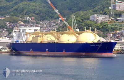
PACIFIC ARCADIA
Tanker

Current Trip
| Time Travelled | 25 days |
|---|---|
| Remaining Time | --- |
| Distance Travelled | 5241.99 nm |
| Remaining Distance | --- |
| AVG Speed | 8.3 Knop |
| MAX Speed | 18.1 Knop |
| AVG Wind | 19.2 knots |
| MAX Wind | 41 knots |
| MIN Temp | 0.5°C / 32.9°F |
| MAX Temp | 19.8°C / 67.64°F |
| Djupgående | 9.5 m |
| Position mottagen | 5 d sen |
Current Position
| Longitud | 139.76986° |
|---|---|
| Latitude | 41.13215° |
| Status | Under way using engine |
| Fart | 8.9 Knop |
| Kurs | 276.6° |
| Område | Japan Sea |
| Station | T-AIS |
| Position mottagen | 5 d sen |
Information
The current position of PACIFIC ARCADIA is in Japan Sea with coordinates 41.13215° / 139.76986° as reported on 2025-04-21 08:26 by AIS to our vessel tracker app. The vessel's current speed is 8.9 Knop and is heading at the port of PRIGORODNOYE. The estimated time of arrival as calculated by MyShipTracking vessel tracking app is 2025-05-03 09:00 LT
The vessel PACIFIC ARCADIA (IMO: 9621077, MMSI: 311072200) is a Tanker It's sailing under the flag of [BS] Bahamas.
In this page you can find informations about the vessels current position, last detected port calls, and current voyage information. If the vessels is not in coverage by AIS you will find the latest position.
The current position of PACIFIC ARCADIA is detected by our AIS receivers and we are not responsible for the reliability of the data. The last position was recorded while the vessel was in Coverage by the Ais receivers of our vessel tracking app.
The current draught of PACIFIC ARCADIA as reported by AIS is 9.5 meters
Weather
| Temperature | 7.8°C / 46.04°F |
|---|---|
| Wind Speed | 3 knots |
| Direction | 36° NE |
| Pressure | 1010.2 hPa |
| Humidity | 78.4 % |
| Cloud Coverage | 100 % |


Featured Company
Last Port Calls
| Port | Arrival | Departure | Time In Port |
|---|---|---|---|
| 2025-03-31 23:52 | 2025-04-02 00:45 | 1 d | |
| 2025-03-17 17:11 | 2025-03-19 13:15 | 1 d | |
| 2025-03-11 10:19 | 2025-03-12 09:29 | 23 h | |
| 2025-03-05 07:45 | 2025-03-06 09:34 | 1 d | |
| 2025-02-03 08:28 | 2025-02-04 08:58 | 1 d |
Last Trips
| Origin | Departure | Destination | Arrival | Distance | |
|---|---|---|---|---|---|
| 2025-03-19 13:15 | 2025-03-31 23:52 | 2362.00 nm | |||
| 2025-03-12 09:29 | 2025-03-17 17:11 | 951.12 nm | |||
| 2025-03-06 09:34 | 2025-03-11 10:19 | 1208.80 nm | |||
| 2025-02-04 08:58 | 2025-03-05 07:45 | 5535.14 nm | |||
| 2025-01-16 09:21 | 2025-02-03 08:28 | 2254.17 nm |
Events
| Tid | Event | Detaljer | Position / Dest | Information |
|---|---|---|---|---|
| 2025-04-21 08:28 | Status ändrad | Default Under way using engine |
41.13374 / 139.76147
RUPGN
|
Fart: 8.9 kn Kurs: 276.6° |
| 2025-04-21 08:26 | Status ändrad | Under way using engine Default |
41.13215 / 139.76986
RUPGN
|
Fart: 9.8 kn Kurs: 274° |
| 2025-04-21 08:26 | UTANFÖR täckningsområde |
41.13215 / 139.76986
Japan Sea
RUPGN
|
Fart: 8.9 kn Kurs: 276.6° |
|
| 2025-04-21 08:12 | Status ändrad | Default Under way using engine |
41.12938 / 139.81648
RUPGN
|
Fart: 9.8 kn Kurs: 265.3° |
| 2025-04-21 07:58 | Status ändrad | Under way using engine Default |
41.14151 / 139.86514
RUPGN
|
Fart: 10 kn Kurs: 232° |
| 2025-04-21 07:58 | I täckningsområde |
41.14151 / 139.86514
Japan Sea
RUPGN
|
Fart: 10.4 kn Kurs: 239.3° |
|
| 2025-04-21 05:03 | Status ändrad | Default Under way using engine |
41.39349 / 140.35428
RUPGN
|
Fart: 9.4 kn Kurs: 222.1° |
| 2025-04-21 05:01 | UTANFÖR täckningsområde |
41.39681 / 140.35831
Japan Sea
RUPGN
|
Fart: 9.4 kn Kurs: 222.1° |
|
| 2025-04-20 23:49 | Byter havsområde | Japanese part of the Japan Sea Japanese part of the North Pacific Ocean |
41.64342 / 141.27871
Japan Sea
RUPGN
|
Fart: 10.9 kn Kurs: 270.5° |
| 2025-04-20 20:49 | Status ändrad | Under way using engine Default |
41.60126 / 141.69661
RUPGN
|
Fart: 7.5 kn Kurs: 320° |