

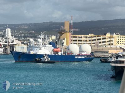
PACIFIC COLLECTOR
Combat Vessel

Current Trip
| Time Travelled | 2 days |
|---|---|
| Remaining Time | 7 days |
| Distance Travelled | 11.06 nm |
| Remaining Distance | 2425.39 nm |
| AVG Speed | 11 Knop |
| MAX Speed | 11.3 Knop |
| AVG Wind | 19 knots |
| MAX Wind | 19 knots |
| MIN Temp | 26.2°C / 79.16°F |
| MAX Temp | 26.5°C / 79.7°F |
| Djupgående | 5.4 m |
| Position mottagen | 2 d sen |
Current Position
| Longitud | -158.05334° |
|---|---|
| Latitude | 21.23201° |
| Status | Under way using engine |
| Fart | 10.8 Knop |
| Kurs | 272.6° |
| Område | North Pacific Ocean |
| Station | T-AIS |
| Position mottagen | 2 d sen |
Information
The current position of PACIFIC COLLECTOR is in North Pacific Ocean with coordinates 21.23201° / -158.05334° as reported on 2025-06-11 03:22 by AIS to our vessel tracker app. The vessel's current speed is 10.8 Knop and is heading at the port of SEATTLE. The estimated time of arrival as calculated by MyShipTracking vessel tracking app is 2025-06-20 00:47 LT
The vessel PACIFIC COLLECTOR (IMO: 7738474, MMSI: 367130000) is a Combat Vessel that was built in 1970 ( 55 År gammal ). It's sailing under the flag of [US] USA.
In this page you can find informations about the vessels current position, last detected port calls, and current voyage information. If the vessels is not in coverage by AIS you will find the latest position.
The current position of PACIFIC COLLECTOR is detected by our AIS receivers and we are not responsible for the reliability of the data. The last position was recorded while the vessel was in Coverage by the Ais receivers of our vessel tracking app.
The current draught of PACIFIC COLLECTOR as reported by AIS is 5.4 meters
Weather
| Temperature | 26.2°C / 79.16°F |
|---|---|
| Wind Speed | 19 knots |
| Direction | 76° ENE |
| Pressure | 1017.4 hPa |
| Humidity | 69.9 % |
| Cloud Coverage | 8 % |


Featured Company
Events
| Tid | Event | Detaljer | Position / Dest | Information |
|---|---|---|---|---|
| 2025-06-11 03:22 | UTANFÖR täckningsområde |
21.23201 / -158.05334
North Pacific Ocean
|
Fart: 10.8 kn Kurs: 272.6° |
|
| 2025-06-11 02:18 | Status ändrad | Under way using engine Moored |
21.28933 / -157.87545
SEA
|
Fart: Kurs: 38° |
| 2025-06-11 02:18 | STARTAR förflyttning | 0.3 nm, South West of HONOLULU |
21.28933 / -157.87545
SEA
|
Fart: 7.9 kn Kurs: 223° |
| 2025-06-11 02:11 | AVGÅTT HAMN |
|
21.28933 / -157.87545
SEA
|
Fart: Kurs: 38° |
| 2025-06-10 21:01 | I täckningsområde |
21.30142 / -157.86575
North Pacific Ocean
[US] HONOLULU
|
Fart: Kurs: 96.2° |
|
| 2025-06-10 19:25 | UTANFÖR täckningsområde |
21.30143 / -157.86575
North Pacific Ocean
[US] HONOLULU
|
Fart: Kurs: 96.2° |
|
| 2025-06-09 18:12 | Destination ändrad | SEA USHNL 32>2B |
21.30139 / -157.86574
[US] HONOLULU
|
Fart: Kurs: 38° |
| 2025-06-08 23:24 | I täckningsområde |
21.30143 / -157.86576
North Pacific Ocean
[US] HONOLULU
|
Fart: Kurs: 96.2° |
|
| 2025-06-08 21:42 | UTANFÖR täckningsområde |
21.30143 / -157.86577
North Pacific Ocean
[US] HONOLULU
|
Fart: Kurs: 96.2° |
|
| 2025-06-08 19:43 | Status ändrad | Moored Under way using engine |
21.30144 / -157.86576
[US] HONOLULU
|
Fart: 0.1 kn Kurs: 39° |