
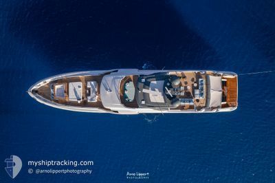
PAPA JOE 1
Pleasure Craft
Current Trip
| Trip Time | 6 h, 41 mins |
|---|---|
| Trip Distance | 80.81 nm |
| AVG Speed | 12.8 Knop |
| MAX Speed | 13.9 Knop |
| Djupgående | 2.3 m |
| AVG Wind | 3.3 knots |
| MAX Wind | 4.8 knots |
| MIN Temp | 10.5°C / 50.9°F |
| MAX Temp | 14.1°C / 57.38°F |
| Position mottagen | 7 d sen |
Current Position
| Longitud | 8.92206° |
|---|---|
| Latitude | 44.40899° |
| Status | Moored |
| Fart | |
| Kurs | 343° |
| Område | Ligurian Sea |
| Station | T-AIS |
| Position mottagen | 7 d sen |
Info
Information
The current position of PAPA JOE 1 is in Ligurian Sea with coordinates 44.40899° / 8.92206° as reported on 2025-03-07 08:26 by AIS to our vessel tracker app. The vessel's current speed is 0 Knop and is currently inside the port of GENOVA.
The vessel PAPA JOE 1 (IMO: 1062914, MMSI: 256922000) is a Pleasure Craft It's sailing under the flag of [MT] Malta.
In this page you can find informations about the vessels current position, last detected port calls, and current voyage information. If the vessels is not in coverage by AIS you will find the latest position.
The current position of PAPA JOE 1 is detected by our AIS receivers and we are not responsible for the reliability of the data. The last position was recorded while the vessel was in Coverage by the Ais receivers of our vessel tracking app.
The current draught of PAPA JOE 1 as reported by AIS is 2.3 meters
Weather
| Temperature | 9°C / 48.2°F |
|---|---|
| Wind Speed | 4 knots |
| Direction | 344° NNW |
| Pressure | 1021.9 hPa |
| Humidity | 68.9 % |
| Cloud Coverage | 32 % |
Featured Company
Events
| Tid | Event | Detaljer | Position / Dest | Information |
|---|---|---|---|---|
| 2025-03-07 08:26 | UTANFÖR täckningsområde |
44.40899 / 8.92206
Ligurian Sea
[IT] GENOVA
|
Fart: Kurs: 146.3° |
|
| 2025-03-06 15:14 | Status ändrad | Moored Under way using engine |
44.40901 / 8.92206
[IT] GENOVA
|
Fart: Kurs: 345° |
| 2025-03-06 14:41 | STOPPAR förflyttning |
44.40945 / 8.92089
[IT] GENOVA
|
Fart: 0.1 kn Kurs: 83° |
|
| 2025-03-06 14:02 | ANLÄNDER HAMN |
|
44.38647 / 8.94635
[IT] GENOVA
|
Fart: 6.4 kn Kurs: 318.4° |
| 2025-03-06 12:39 | Destination ändrad | GENOVA LIVORNO |
44.18363 / 9.26614
GENOVA
|
Fart: 13.6 kn Kurs: 309.2° |
| 2025-03-06 12:19 | Byter havsområde | Italian part of the Ligurian Sea Italian part of the Tyrrhenian Sea |
44.14061 / 9.34185
Ligurian Sea
|
Fart: 13.7 kn Kurs: 309.6° |
| 2025-03-06 12:19 | I täckningsområde |
44.14061 / 9.34185
Ligurian Sea
|
Fart: 13.7 kn Kurs: 309.6° |
|
| 2025-03-06 07:57 | UTANFÖR täckningsområde |
43.53694 / 10.25373
Tyrrhenian Sea
|
Fart: 13.2 kn Kurs: 256.6° |
|
| 2025-03-06 07:21 | AVGÅTT HAMN |
|
43.53774 / 10.28360
LIVORNO
|
Fart: 6 kn Kurs: 261° |
| 2025-03-06 07:19 | I täckningsområde |
43.53972 / 10.28945
Tyrrhenian Sea
[IT] LIVORNO
|
Fart: 6 kn Kurs: 263.5° |