
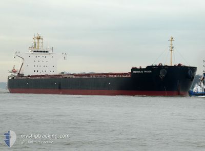
PEDHOULAS TRADER
Cargo
Current Trip
| Time Travelled | 12 days |
|---|---|
| Remaining Time | --- |
| Distance Travelled | 3463.48 nm |
| Remaining Distance | --- |
| AVG Speed | 11.4 Knop |
| MAX Speed | 14.8 Knop |
| AVG Wind | 14.2 knots |
| MAX Wind | 36 knots |
| MIN Temp | 11.4°C / 52.52°F |
| MAX Temp | 24.2°C / 75.56°F |
| Djupgående | 7.6 m |
| Position mottagen | 9 d sen |
Current Position
| Longitud | -25.05574° |
|---|---|
| Latitude | 35.81305° |
| Status | Under way using engine |
| Fart | 13.5 Knop |
| Kurs | 258.2° |
| Område | North Atlantic Ocean |
| Station | T-AIS |
| Position mottagen | 9 d sen |
Info
Information
The current position of PEDHOULAS TRADER is in North Atlantic Ocean with coordinates 35.81305° / -25.05574° as reported on 2025-12-25 18:40 by AIS to our vessel tracker app. The vessel's current speed is 13.5 Knop and is heading at the port of NEW ORLEANS. The estimated time of arrival as calculated by MyShipTracking vessel tracking app is 2026-01-05 09:00 LT
The vessel PEDHOULAS TRADER (IMO: 9980629, MMSI: 210602000) is a Cargo It's sailing under the flag of [CY] Cyprus.
In this page you can find informations about the vessels current position, last detected port calls, and current voyage information. If the vessels is not in coverage by AIS you will find the latest position.
The current position of PEDHOULAS TRADER is detected by our AIS receivers and we are not responsible for the reliability of the data. The last position was recorded while the vessel was in Coverage by the Ais receivers of our vessel tracking app.
The current draught of PEDHOULAS TRADER as reported by AIS is 7.6 meters
Weather
| Temperature | 22.2°C / 71.96°F |
|---|---|
| Wind Speed | 9 knots |
| Direction | 212° SSW |
| Pressure | 1015.5 hPa |
| Humidity | 57.1 % |
| Cloud Coverage | 60 % |
Featured Company
Events
| Tid | Event | Detaljer | Position / Dest | Information |
|---|---|---|---|---|
| 2025-12-25 18:48 | Status ändrad | Default Under way using engine |
35.80668 / -25.09219
US MSY
|
Fart: 13.5 kn Kurs: 258.2° |
| 2025-12-25 18:40 | UTANFÖR täckningsområde |
35.81305 / -25.05574
North Atlantic Ocean
US MSY
|
Fart: 13.5 kn Kurs: 258.2° |
|
| 2025-12-25 18:28 | Status ändrad | Under way using engine Default |
35.82272 / -24.99985
US MSY
|
Fart: 13.2 kn Kurs: 259° |
| 2025-12-25 18:26 | Status ändrad | Default Under way using engine |
35.82375 / -24.99388
US MSY
|
Fart: 13.2 kn Kurs: 258.4° |
| 2025-12-25 18:19 | Status ändrad | Under way using engine Default |
35.82902 / -24.96288
US MSY
|
Fart: 13.1 kn Kurs: 258° |
| 2025-12-25 17:48 | Status ändrad | Default Under way using engine |
35.85302 / -24.82353
US MSY
|
Fart: 13.4 kn Kurs: 257.5° |
| 2025-12-25 17:41 | Upptäckt i hav | Portuguese (Azores) part of the North Atlantic Ocean |
35.85835 / -24.79342
North Atlantic Ocean
US MSY
|
Fart: 13.4 kn Kurs: 257.5° |
| 2025-12-25 17:41 | Status ändrad | Under way using engine Default |
35.85860 / -24.79207
US MSY
|
Fart: 13.4 kn Kurs: 257° |
| 2025-12-25 17:24 | I täckningsområde |
35.85835 / -24.79342
North Atlantic Ocean
US MSY
|
Fart: 13.4 kn Kurs: 257.5° |