
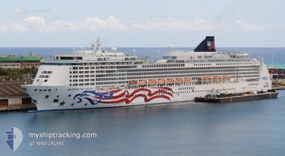
PRIDE OF AMERICA
Passenger
Current Trip
| Time Travelled | 8 h, 55 mins |
|---|---|
| Remaining Time | 3 h, 26 mins |
| Distance Travelled | 81.82 nm |
| Remaining Distance | 34.07 nm |
| AVG Speed | 9.4 Knop |
| MAX Speed | 9.9 Knop |
| AVG Wind | 12.6 knots |
| MAX Wind | 16 knots |
| MIN Temp | 23°C / 73.4°F |
| MAX Temp | 23.8°C / 74.84°F |
| Djupgående | 8.2 m |
| Position mottagen | Nu |
Current Position
| Longitud | -158.37082° |
|---|---|
| Latitude | 21.07568° |
| Status | Under way using engine |
| Fart | 9.3 Knop |
| Kurs | 93.6° |
| Område | North Pacific Ocean |
| Station | T-AIS |
| Position mottagen | Nu |
Info
Information
The current position of PRIDE OF AMERICA is in North Pacific Ocean with coordinates 21.07568° / -158.37082° as reported on 2025-02-01 12:43 by AIS to our vessel tracker app. The vessel's current speed is 9.3 Knop and is heading at the port of HONOLULU . The estimated time of arrival as calculated by MyShipTracking vessel tracking app is 2025-02-01 16:10 LT
The vessel PRIDE OF AMERICA (IMO: 9209221, MMSI: 366994450) is a Passenger It's sailing under the flag of [US] USA.
In this page you can find informations about the vessels current position, last detected port calls, and current voyage information. If the vessels is not in coverage by AIS you will find the latest position.
The current position of PRIDE OF AMERICA is detected by our AIS receivers and we are not responsible for the reliability of the data. The last position was recorded while the vessel was in Coverage by the Ais receivers of our vessel tracking app.
The current draught of PRIDE OF AMERICA as reported by AIS is 8.2 meters
Weather
| Temperature | 23.7°C / 74.66°F |
|---|---|
| Wind Speed | 13 knots |
| Direction | 303° WNW |
| Pressure | 1012 hPa |
| Humidity | 68.6 % |
| Cloud Coverage | 54 % |
Featured Company
Last Port Calls
| Port | Arrival | Departure | Time In Port |
|---|---|---|---|
| 2025-01-31 17:27 | 2025-02-01 03:49 | 10 h | |
| 2025-01-28 17:00 | 2025-01-29 04:35 | 11 h | |
| 2025-01-26 17:18 | 2025-01-28 04:22 | 1 d | |
| 2025-01-25 16:40 | 2025-01-26 05:14 | 12 h | |
| 2025-01-23 17:21 | 2025-01-25 03:54 | 1 d | |
| 2025-01-21 17:02 | 2025-01-22 04:32 | 11 h | |
| 2025-01-19 17:16 | 2025-01-21 04:14 | 1 d | |
| 2025-01-18 16:38 | 2025-01-19 05:20 | 12 h | |
| 2025-01-16 17:22 | 2025-01-18 03:58 | 1 d | |
| 2025-01-14 17:02 | 2025-01-15 04:22 | 11 h |
Most Visited Ports (Last year)
| Port | Arrivals | |
|---|---|---|
| 54 | ||
| 53 | ||
| 52 | ||
| 51 | ||
| 1 |
Last Trips
| Origin | Departure | Destination | Arrival | Distance | |
|---|---|---|---|---|---|
| 2025-01-28 18:35 | 2025-01-31 07:27 | 657.67 nm | |||
| 2025-01-27 18:22 | 2025-01-28 07:00 | 135.72 nm | |||
| 2025-01-25 19:14 | 2025-01-26 07:18 | 120.18 nm | |||
| 2025-01-24 17:54 | 2025-01-25 06:40 | 119.49 nm | |||
| 2025-01-21 18:32 | 2025-01-23 07:21 | 371.12 nm | |||
| 2025-01-20 18:14 | 2025-01-21 07:02 | 135.45 nm | |||
| 2025-01-18 19:20 | 2025-01-19 07:16 | 120.31 nm | |||
| 2025-01-17 17:58 | 2025-01-18 06:38 | 119.45 nm | |||
| 2025-01-14 18:22 | 2025-01-16 07:22 | 381.16 nm | |||
| 2025-01-13 18:25 | 2025-01-14 07:02 | 136.35 nm |
Events
| Tid | Event | Detaljer | Position / Dest | Information |
|---|---|---|---|---|
| 2025-02-01 11:10 | Destination ändrad | USHNL USNIJ |
21.08120 / -158.62840
USHNL
|
Fart: 9.3 kn Kurs: 112.1° |
| 2025-02-01 11:10 | ETA ändrat | 2025/02/01 16:30 2025/01/31 17:05 |
21.08120 / -158.62840
USHNL
|
Fart: 9.3 kn Kurs: 112.1° |
| 2025-02-01 10:37 | Status ändrad | Under way using engine Default |
21.14654 / -158.68431
USNIJ
|
Fart: 9.5 kn Kurs: 152° |
| 2025-02-01 10:19 | Status ändrad | Default Under way using engine |
21.18868 / -158.70808
USNIJ
|
Fart: 9.4 kn Kurs: 151.1° |
| 2025-02-01 10:18 | Status ändrad | Under way using engine Default |
21.19139 / -158.70963
USNIJ
|
Fart: 9.4 kn Kurs: 152° |
| 2025-02-01 10:03 | I täckningsområde |
21.19139 / -158.70963
North Pacific Ocean
|
Fart: 9.4 kn Kurs: 151.1° |
|
| 2025-02-01 03:49 | AVGÅTT HAMN |
|
21.95421 / -159.34563
USNIJ
|
Fart: 4.5 kn Kurs: 48° |
| 2025-02-01 03:46 | STARTAR förflyttning |
21.95402 / -159.34938
[US] NAWILIWILI
|
Fart: 4.5 kn Kurs: 48° |
|
| 2025-01-31 17:38 | STOPPAR förflyttning |
21.95399 / -159.35704
[US] NAWILIWILI
|
Fart: 0.2 kn Kurs: 259° |
|
| 2025-01-31 17:27 | ANLÄNDER HAMN |
|
21.95192 / -159.35465
[US] NAWILIWILI
|
Fart: 5.5 kn Kurs: 285° |