
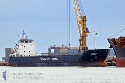
PROUD
General Cargo
Current Trip
| Time Travelled | 2 days |
|---|---|
| Remaining Time | --- |
| Distance Travelled | 546.55 nm |
| Remaining Distance | --- |
| AVG Speed | 10.1 Knop |
| MAX Speed | 11 Knop |
| AVG Wind | 7.2 knots |
| MAX Wind | 15 knots |
| MIN Temp | 16.4°C / 61.52°F |
| MAX Temp | 18.9°C / 66.02°F |
| Djupgående | 6.4 m |
| Position mottagen | 30 m sen |
Current Position
| Longitud | 24.06159° |
|---|---|
| Latitude | 35.74242° |
| Status | Under way using engine |
| Fart | 10 Knop |
| Kurs | 274° |
| Område | Aegean Sea |
| Station | T-AIS |
| Position mottagen | 30 m sen |
Info
Information
The current position of PROUD is in Aegean Sea with coordinates 35.74242° / 24.06159° as reported on 2025-03-14 19:19 by AIS to our vessel tracker app. The vessel's current speed is 10 Knop and is heading at the port of TREPORT. The estimated time of arrival as calculated by MyShipTracking vessel tracking app is 2025-03-27 08:00 LT
The vessel PROUD (IMO: 9386433, MMSI: 246611000) is a General Cargo that was built in 2009 ( 16 År gammal ). It's sailing under the flag of [NL] Netherlands.
In this page you can find informations about the vessels current position, last detected port calls, and current voyage information. If the vessels is not in coverage by AIS you will find the latest position.
The current position of PROUD is detected by our AIS receivers and we are not responsible for the reliability of the data. The last position was recorded while the vessel was in Coverage by the Ais receivers of our vessel tracking app.
The current draught of PROUD as reported by AIS is 6.4 meters
Weather
| Temperature | 18.2°C / 64.76°F |
|---|---|
| Wind Speed | 6 knots |
| Direction | 114° ESE |
| Pressure | 1018.5 hPa |
| Humidity | 68.1 % |
| Cloud Coverage | 72 % |
Featured Company
Last Port Calls
| Port | Arrival | Departure | Time In Port |
|---|---|---|---|
| 2025-03-10 14:51 | 2025-03-12 16:12 | 2 d | |
| 2025-03-01 12:29 | 2025-03-08 12:27 | 6 d | |
| 2025-02-13 10:52 | 2025-02-14 12:57 | 1 d | |
| 2025-02-03 15:19 | 2025-02-04 14:49 | 23 h | |
| 2025-01-29 18:11 | 2025-02-03 14:18 | 4 d | |
| 2025-01-26 03:24 | 2025-01-28 23:39 | 2 d | |
| 2025-01-11 12:00 | 2025-01-13 23:50 | 2 d | |
| 2025-01-02 14:45 |
Last Trips
| Origin | Departure | Destination | Arrival | Distance | |
|---|---|---|---|---|---|
| 2025-03-08 12:27 | 2025-03-10 14:51 | 412.48 nm | |||
| 2025-02-14 12:57 | 2025-03-01 12:29 | 3221.63 nm | |||
| 2025-02-04 14:49 | 2025-02-13 10:52 | 1191.01 nm | |||
| 2025-02-03 14:18 | 2025-02-03 15:19 | 0.40 nm | |||
| 2025-01-28 23:39 | 2025-01-29 18:11 | 195.80 nm | |||
| 2025-01-13 23:50 | 2025-01-26 03:24 | 2896.30 nm | |||
| 2025-01-02 14:45 | 2025-01-11 12:00 | 332.38 nm |
Events
| Tid | Event | Detaljer | Position / Dest | Information |
|---|---|---|---|---|
| 2025-03-14 19:22 | Status ändrad | Default Under way using engine |
35.74298 / 24.05062
FRLTR
|
Fart: 10 kn Kurs: 274° |
| 2025-03-14 15:13 | Status ändrad | Under way using engine Default |
35.62604 / 24.90126
FRLTR
|
Fart: 10.5 kn Kurs: 279° |
| 2025-03-14 15:04 | Status ändrad | Default Under way using engine |
35.62216 / 24.93128
FRLTR
|
Fart: 10.5 kn Kurs: 279.2° |
| 2025-03-14 06:23 | Byter havsområde | Greek part of the Aegean Sea Greek part of the Mediterranean Sea - Eastern Basin |
35.33571 / 26.67227
Aegean Sea
FRLTR
|
Fart: 10.7 kn Kurs: 309.4° |
| 2025-03-14 00:43 | Status ändrad | Under way using engine Default |
35.33567 / 27.84070
FRLTR
|
Fart: 10.5 kn Kurs: 264° |
| 2025-03-13 23:49 | Status ändrad | Default Under way using engine |
35.35146 / 28.03110
FRLTR
|
Fart: 10 kn Kurs: 263.8° |
| 2025-03-13 19:55 | Upptäckt i hav | Greek part of the Mediterranean Sea - Eastern Basin |
35.42571 / 28.84276
Mediterranean Sea - Eastern Basin
FRLTR
|
Fart: 10 kn Kurs: 262.5° |
| 2025-03-13 19:22 | Byter havsområde | Turkish part of the Mediterranean Sea - Eastern Basin Greek part of the Mediterranean Sea - Eastern Basin |
35.43651 / 28.95422
Mediterranean Sea - Eastern Basin
FRLTR
|
Fart: 9.9 kn Kurs: 264.5° |
| 2025-03-13 14:19 | Upptäckt i hav | Greek part of the Mediterranean Sea - Eastern Basin |
35.55641 / 30.00458
Mediterranean Sea - Eastern Basin
FRLTR
|
Fart: 10.2 kn Kurs: 261.2° |
| 2025-03-13 11:20 | Status ändrad | Under way using engine Default |
35.63355 / 30.62981
FRLTR
|
Fart: 10.6 kn Kurs: 265° |