

RANTANPLAN
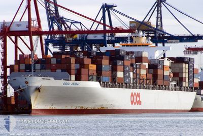
Container Ship

Current Trip
| Time Travelled | 2 days |
|---|---|
| Remaining Time | 3 mins |
| Distance Travelled | 71.56 nm |
| Remaining Distance | 1.52 nm |
| AVG Speed | 6.4 Knop |
| MAX Speed | 15 Knop |
| AVG Wind | 8.8 knots |
| MAX Wind | 14.9 knots |
| MIN Temp | 15.5°C / 59.9°F |
| MAX Temp | 27.5°C / 81.5°F |
| Djupgående | 13.6 m |
| Position mottagen | 1 m sen |
Current Position
| Longitud | 28.67962° |
|---|---|
| Latitude | 40.93771° |
| Status | At anchor |
| Fart | 2.3 Knop |
| Kurs | 358° |
| Område | Sea of Marmara |
| Station | T-AIS |
| Position mottagen | 1 m sen |
Information
The current position of RANTANPLAN is in Sea of Marmara with coordinates 40.93771° / 28.67962° as reported on 2025-06-09 20:18 by AIS to our vessel tracker app. The vessel's current speed is 2.3 Knop and is heading at the port of AMBARLI. The estimated time of arrival as calculated by MyShipTracking vessel tracking app is 2025-06-09 23:23 LT
The vessel RANTANPLAN (IMO: 9307023, MMSI: 636021101) is a Container Ship that was built in 2006 ( 19 År gammal ). It's sailing under the flag of [LR] Liberia.
In this page you can find informations about the vessels current position, last detected port calls, and current voyage information. If the vessels is not in coverage by AIS you will find the latest position.
The current position of RANTANPLAN is detected by our AIS receivers and we are not responsible for the reliability of the data. The last position was recorded while the vessel was in Coverage by the Ais receivers of our vessel tracking app.
The current draught of RANTANPLAN as reported by AIS is 13.6 meters
Weather
| Temperature | 20.7°C / 69.26°F |
|---|---|
| Wind Speed | 9 knots |
| Direction | 39° NE |
| Pressure | 1016.3 hPa |
| Humidity | 75.5 % |
| Cloud Coverage | --- |


Featured Company
Last Port Calls
| Port | Arrival | Departure | Time In Port |
|---|---|---|---|
| 2025-06-06 08:03 | 2025-06-07 01:23 | 17 h | |
| 2025-06-02 19:31 | 2025-06-03 19:56 | 1 d | |
| 2025-06-02 06:15 | 2025-06-02 15:06 | 8 h | |
| 2025-05-18 16:42 | 2025-05-19 10:26 | 17 h | |
| 2025-05-10 23:26 | 2025-05-11 17:12 | 17 h | |
| 2025-05-07 04:50 | 2025-05-07 21:38 | 16 h | |
| 2025-04-29 08:34 | 2025-04-30 07:17 | 22 h | |
| 2025-04-19 07:06 | 2025-04-19 20:40 | 13 h | |
| 2025-04-06 18:18 | 2025-04-07 15:31 | 21 h | |
| 2025-04-04 06:22 | 2025-04-04 15:14 | 8 h |
Most Visited Ports (Last year)
| Port | Arrivals | |
|---|---|---|
| 10 | ||
| 6 | ||
| 5 | ||
| 5 | ||
| 5 | ||
| 5 |
Last Trips
| Origin | Departure | Destination | Arrival | Distance | |
|---|---|---|---|---|---|
| 2025-06-03 19:56 | 2025-06-06 08:03 | 824.77 nm | |||
| 2025-05-19 10:26 | 2025-06-02 19:31 | 5236.61 nm | |||
| 2025-05-19 10:26 | 2025-06-02 06:15 | 5092.35 nm | |||
| 2025-05-11 17:12 | 2025-05-18 16:42 | 1657.83 nm | |||
| 2025-05-07 21:38 | 2025-05-10 23:26 | 860.64 nm | |||
| 2025-04-30 07:17 | 2025-05-07 04:50 | 626.27 nm | |||
| 2025-04-19 20:40 | 2025-04-29 08:34 | 2856.50 nm | |||
| 2025-04-07 15:31 | 2025-04-19 07:06 | 4250.66 nm | |||
| 2025-04-02 06:18 | 2025-04-06 18:18 | 1088.69 nm | |||
| 2025-04-02 06:18 | 2025-04-04 06:22 | 370.89 nm |
Events
| Tid | Event | Detaljer | Position / Dest | Information |
|---|---|---|---|---|
| 2025-06-09 20:12 | STOPPAR förflyttning | 1.43 nm, South of AMBARLI |
40.93627 / 28.68040
TRAMB
|
Fart: 0.3 kn Kurs: 6° |
| 2025-06-09 19:24 | STARTAR förflyttning | 2.01 nm, South West of AMBARLI |
40.93341 / 28.64688
TRAMB
|
Fart: 3.2 kn Kurs: 86° |
| 2025-06-08 04:20 | Status ändrad | At anchor Default |
40.92952 / 28.64343
TRAMB
|
Fart: 0.1 kn Kurs: 8° |
| 2025-06-08 04:17 | Status ändrad | Default At anchor |
40.92960 / 28.64346
TRAMB
|
Fart: Kurs: 9° |
| 2025-06-07 20:19 | Status ändrad | At anchor Default |
40.93041 / 28.64167
TRAMB
|
Fart: Kurs: 57° |
| 2025-06-07 20:17 | Status ändrad | Default At anchor |
40.93043 / 28.64164
TRAMB
|
Fart: Kurs: 58° |
| 2025-06-07 09:35 | Status ändrad | At anchor Under way using engine |
40.93130 / 28.64136
TRAMB
|
Fart: 0.2 kn Kurs: 91° |
| 2025-06-07 07:55 | STOPPAR förflyttning | 2.07 nm, South West of AMBARLI |
40.93383 / 28.64428
TRAMB
|
Fart: 0.3 kn Kurs: 174° |
| 2025-06-06 22:23 | AVGÅTT HAMN |
|
40.74263 / 29.82084
TRAMB
|
Fart: 4.7 kn Kurs: 254° |
| 2025-06-06 22:14 | STARTAR förflyttning |
40.74637 / 29.83382
[TR] DERINCE
|
Fart: 3.1 kn Kurs: 252° |