
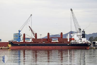
REGIUS
Cargo
Current Trip
| Time Travelled | 1 day |
|---|---|
| Remaining Time | 4 days |
| Distance Travelled | 361.66 nm |
| Remaining Distance | 1297.66 nm |
| AVG Speed | 11.8 Knop |
| MAX Speed | 13.2 Knop |
| AVG Wind | 24.5 knots |
| MAX Wind | 32 knots |
| MIN Temp | 3.5°C / 38.3°F |
| MAX Temp | 12.8°C / 55.04°F |
| Djupgående | 8.7 m |
| Position mottagen | 13 h, 39 m sen |
Current Position
| Longitud | 23.39443° |
|---|---|
| Latitude | 36.63325° |
| Status | Under way using engine |
| Fart | 12.3 Knop |
| Kurs | 207.3° |
| Område | Aegean Sea |
| Station | T-AIS |
| Position mottagen | 13 h, 39 m sen |
Info
Information
The current position of REGIUS is in Aegean Sea with coordinates 36.63325° / 23.39443° as reported on 2025-02-05 16:36 by AIS to our vessel tracker app. The vessel's current speed is 12.3 Knop and is heading at the port of GIBRALTAR. The estimated time of arrival as calculated by MyShipTracking vessel tracking app is 2025-02-10 20:11 LT
The vessel REGIUS (IMO: 9737113, MMSI: 538006871) is a Cargo It's sailing under the flag of [MH] Marshall Is.
In this page you can find informations about the vessels current position, last detected port calls, and current voyage information. If the vessels is not in coverage by AIS you will find the latest position.
The current position of REGIUS is detected by our AIS receivers and we are not responsible for the reliability of the data. The last position was recorded while the vessel was in Coverage by the Ais receivers of our vessel tracking app.
The current draught of REGIUS as reported by AIS is 8.7 meters
Weather
| Temperature | 13°C / 55.4°F |
|---|---|
| Wind Speed | 13 knots |
| Direction | 145° SE |
| Pressure | 1027 hPa |
| Humidity | 75.6 % |
| Cloud Coverage | 86 % |
Featured Company
Last Port Calls
| Port | Arrival | Departure | Time In Port |
|---|---|---|---|
| 2025-01-30 13:42 | 2025-02-04 21:27 | 5 d | |
| 2025-01-20 16:39 | 2025-01-28 18:38 | 8 d | |
| 2025-01-14 06:02 | 2025-01-16 07:01 | 2 d | |
| 2025-01-13 19:49 | 2025-01-14 05:51 | 10 h | |
| 2025-01-12 14:56 | 2025-01-13 19:25 | 1 d | |
| 2024-12-31 05:09 | 2025-01-05 18:07 | 5 d | |
| 2024-12-16 10:21 | 2024-12-22 13:29 | 6 d | |
| 2024-12-10 09:39 |
Last Trips
| Origin | Departure | Destination | Arrival | Distance | |
|---|---|---|---|---|---|
| 2025-01-28 20:38 | 2025-01-30 16:42 | 556.02 nm | |||
| 2025-01-16 09:01 | 2025-01-20 18:39 | 245.85 nm | |||
| 2025-01-14 07:51 | 2025-01-14 08:02 | 3.78 nm | |||
| 2025-01-13 21:25 | 2025-01-13 21:49 | 2.73 nm | |||
| 2025-01-05 21:07 | 2025-01-12 16:56 | 433.51 nm | |||
| 2024-12-22 14:29 | 2024-12-31 08:09 | 1842.12 nm | |||
| 2024-12-10 10:39 | 2024-12-16 11:21 | 307.49 nm |
Events
| Tid | Event | Detaljer | Position / Dest | Information |
|---|---|---|---|---|
| 2025-02-05 16:38 | Status ändrad | Default Under way using engine |
36.62976 / 23.39220
GI GIB
|
Fart: 12.3 kn Kurs: 207.3° |
| 2025-02-05 16:36 | UTANFÖR täckningsområde |
36.63325 / 23.39443
Aegean Sea
GI GIB
|
Fart: 12.3 kn Kurs: 207.3° |
|
| 2025-02-05 16:31 | Status ändrad | Under way using engine Default |
36.64839 / 23.40402
GI GIB
|
Fart: 12.1 kn Kurs: 204° |
| 2025-02-05 15:38 | Status ändrad | Default Under way using engine |
36.80462 / 23.51101
GI GIB
|
Fart: 12.2 kn Kurs: 210.1° |
| 2025-02-05 14:56 | Status ändrad | Under way using engine Default |
36.92668 / 23.60116
GI GIB
|
Fart: 12.2 kn Kurs: 217° |
| 2025-02-05 14:56 | I täckningsområde |
36.92668 / 23.60116
Aegean Sea
GI GIB
|
Fart: 12.1 kn Kurs: 214.3° |
|
| 2025-02-05 14:23 | Status ändrad | Default Under way using engine |
37.01661 / 23.68243
GI GIB
|
Fart: 12.1 kn Kurs: 214.8° |
| 2025-02-05 13:52 | UTANFÖR täckningsområde |
37.09976 / 23.75521
Aegean Sea
GI GIB
|
Fart: 12.1 kn Kurs: 214.8° |
|
| 2025-02-04 23:28 | Upptäckt i hav | Greek part of the Aegean Sea |
38.76727 / 26.40246
Aegean Sea
GI GIB
|
Fart: 11.7 kn Kurs: 266.3° |
| 2025-02-04 21:27 | AVGÅTT HAMN |
|
38.77287 / 26.91009
GI GIB
|
Fart: 8 kn Kurs: 291° |