
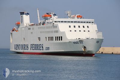
RIGEL VII
Passenger
Current Trip
| Trip Time | 8 h, 28 mins |
|---|---|
| Trip Distance | 123.68 nm |
| AVG Speed | 14.7 Knop |
| MAX Speed | 16.1 Knop |
| Djupgående | 5.5 m |
| AVG Wind | 7.4 knots |
| MAX Wind | 22 knots |
| MIN Temp | 10.1°C / 50.18°F |
| MAX Temp | 13.1°C / 55.58°F |
| Position mottagen | 11 h, 42 m sen |
Current Position
| Longitud | 17.08242° |
|---|---|
| Latitude | 41.16265° |
| Status | Under way using engine |
| Fart | 16 Knop |
| Kurs | 277.9° |
| Område | Adriatic Sea |
| Station | T-AIS |
| Position mottagen | 11 h, 42 m sen |
Info
Information
The current position of RIGEL VII is in Adriatic Sea with coordinates 41.16265° / 17.08242° as reported on 2025-02-13 06:58 by AIS to our vessel tracker app. The vessel's current speed is 16 Knop and is currently inside the port of BARI.
The vessel RIGEL VII (IMO: 9087726, MMSI: 209481000) is a Passenger It's sailing under the flag of [CY] Cyprus.
In this page you can find informations about the vessels current position, last detected port calls, and current voyage information. If the vessels is not in coverage by AIS you will find the latest position.
The current position of RIGEL VII is detected by our AIS receivers and we are not responsible for the reliability of the data. The last position was recorded while the vessel was in Coverage by the Ais receivers of our vessel tracking app.
The current draught of RIGEL VII as reported by AIS is 5.5 meters
Weather
| Temperature | 14.1°C / 57.38°F |
|---|---|
| Wind Speed | 6 knots |
| Direction | 166° SSE |
| Pressure | 1016.6 hPa |
| Humidity | 69.7 % |
| Cloud Coverage | 50 % |
Featured Company
Last Port Calls
| Port | Arrival | Departure | Time In Port |
|---|---|---|---|
| 2025-02-13 09:08 | |||
| 2025-02-12 07:12 | 2025-02-13 00:40 | 17 h | |
| 2025-02-11 07:37 | 2025-02-11 23:00 | 15 h | |
| 2025-02-10 07:09 | 2025-02-10 23:38 | 16 h | |
| 2025-02-09 07:32 | 2025-02-09 23:16 | 15 h | |
| 2025-02-08 07:11 | 2025-02-08 23:03 | 15 h | |
| 2025-02-07 08:04 | 2025-02-07 23:09 | 15 h | |
| 2025-02-06 07:07 | 2025-02-06 23:07 | 15 h | |
| 2025-02-05 07:46 | 2025-02-05 23:13 | 15 h | |
| 2025-02-04 07:10 | 2025-02-04 23:43 | 16 h |
Most Visited Ports (Last year)
| Port | Arrivals | |
|---|---|---|
| 192 | ||
| 137 | ||
| 54 | ||
| 16 |
Last Trips
| Origin | Departure | Destination | Arrival | Distance | |
|---|---|---|---|---|---|
| 2025-02-13 00:40 | 2025-02-13 09:08 | 123.68 nm | |||
| 2025-02-11 23:00 | 2025-02-12 07:12 | 120.89 nm | |||
| 2025-02-10 23:38 | 2025-02-11 07:37 | 122.27 nm | |||
| 2025-02-09 23:16 | 2025-02-10 07:09 | 120.01 nm | |||
| 2025-02-08 23:03 | 2025-02-09 07:32 | 122.42 nm | |||
| 2025-02-07 23:09 | 2025-02-08 07:11 | 121.01 nm | |||
| 2025-02-06 23:07 | 2025-02-07 08:04 | 123.24 nm | |||
| 2025-02-05 23:13 | 2025-02-06 07:07 | 120.51 nm | |||
| 2025-02-04 23:43 | 2025-02-05 07:46 | 121.84 nm | |||
| 2025-02-03 23:13 | 2025-02-04 07:10 | 120.71 nm |
Events
| Tid | Event | Detaljer | Position / Dest | Information |
|---|---|---|---|---|
| 2025-02-13 08:24 | STOPPAR förflyttning |
41.13388 / 16.86453
[IT] BARI
|
Fart: Kurs: 312° |
|
| 2025-02-13 08:08 | ANLÄNDER HAMN |
|
41.14306 / 16.85338
[IT] BARI
|
Fart: 5.9 kn Kurs: 122° |
| 2025-02-13 07:05 | Status ändrad | Default Under way using engine |
41.16661 / 17.04806
BARI-DURRES-BARI
|
Fart: 16 kn Kurs: 277.9° |
| 2025-02-13 06:58 | UTANFÖR täckningsområde |
41.16265 / 17.08242
Adriatic Sea
BARI-DURRES-BARI
|
Fart: 16 kn Kurs: 277.9° |
|
| 2025-02-13 05:22 | ETA ändrat | 2025/02/13 08:35 2025/02/13 07:15 |
41.10731 / 17.62646
BARI-DURRES-BARI
|
Fart: 15.3 kn Kurs: 285.6° |
| 2025-02-13 05:04 | Byter havsområde | Italian part of the Adriatic Sea Albanian part of the Adriatic Sea |
41.09369 / 17.72396
Adriatic Sea
BARI-DURRES-BARI
|
Fart: 15.1 kn Kurs: 271.6° |
| 2025-02-13 05:03 | Status ändrad | Under way using engine Default |
41.09343 / 17.73337
BARI-DURRES-BARI
|
Fart: 15.1 kn Kurs: 260° |
| 2025-02-13 05:03 | I täckningsområde |
41.09369 / 17.72396
Adriatic Sea
BARI-DURRES-BARI
|
Fart: 15.1 kn Kurs: 271.6° |
|
| 2025-02-13 00:20 | UTANFÖR täckningsområde |
41.26465 / 19.27189
Adriatic Sea
BARI-DURRES-BARI
|
Fart: 15.4 kn Kurs: 268.7° |
|
| 2025-02-12 23:40 | AVGÅTT HAMN |
|
41.30138 / 19.45765
BARI-DURRES-BARI
|
Fart: 10.5 kn Kurs: 150° |