
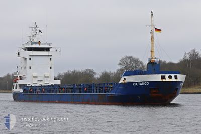
RIX TANGO
General Cargo
Current Trip
| Time Travelled | 1 day |
|---|---|
| Remaining Time | 17 h, 57 mins |
| Distance Travelled | 450.01 nm |
| Remaining Distance | 153.27 nm |
| AVG Speed | 10.3 Knop |
| MAX Speed | 13.6 Knop |
| AVG Wind | 21.9 knots |
| MAX Wind | 28.8 knots |
| MIN Temp | 3.2°C / 37.76°F |
| MAX Temp | 8°C / 46.4°F |
| Djupgående | 3.8 m |
| Position mottagen | 1 m sen |
Current Position
| Longitud | -4.85217° |
|---|---|
| Latitude | 47.82356° |
| Status | Under way using engine |
| Fart | 9.1 Knop |
| Kurs | 123.5° |
| Område | Celtic Sea |
| Station | T-AIS |
| Position mottagen | 1 m sen |
Info
Information
The current position of RIX TANGO is in Celtic Sea with coordinates 47.82356° / -4.85217° as reported on 2026-01-04 11:11 by AIS to our vessel tracker app. The vessel's current speed is 9.1 Knop and is heading at the port of LES SABLES D OLONNE. The estimated time of arrival as calculated by MyShipTracking vessel tracking app is 2026-01-05 06:10 LT
The vessel RIX TANGO (IMO: 9156113, MMSI: 212797000) is a General Cargo that was built in 2002 ( 24 År gammal ). It's sailing under the flag of [CY] Cyprus.
In this page you can find informations about the vessels current position, last detected port calls, and current voyage information. If the vessels is not in coverage by AIS you will find the latest position.
The current position of RIX TANGO is detected by our AIS receivers and we are not responsible for the reliability of the data. The last position was recorded while the vessel was in Coverage by the Ais receivers of our vessel tracking app.
The current draught of RIX TANGO as reported by AIS is 3.8 meters
Weather
| Temperature | 6.3°C / 43.34°F |
|---|---|
| Wind Speed | 5 knots |
| Direction | 66° ENE |
| Pressure | 1018.5 hPa |
| Humidity | 54.3 % |
| Cloud Coverage | 21 % |
Featured Company
Last Port Calls
| Port | Arrival | Departure | Time In Port |
|---|---|---|---|
| 2025-12-30 21:02 | 2026-01-02 13:32 | 2 d | |
| 2025-12-18 14:14 | 2025-12-19 21:24 | 1 d | |
| 2025-12-15 02:38 | 2025-12-16 11:27 | 1 d | |
| 2025-12-10 03:49 | 2025-12-11 14:17 | 1 d | |
| 2025-12-05 10:33 | 2025-12-08 22:42 | 3 d | |
| 2025-11-26 20:05 | 2025-12-02 15:57 | 5 d | |
| 2025-11-23 23:05 | 2025-11-25 18:04 | 1 d | |
| 2025-11-22 06:58 | 2025-11-22 22:30 | 15 h | |
| 2025-11-21 08:32 | 2025-11-21 18:40 | 10 h | |
| 2025-11-20 06:49 | 2025-11-20 19:08 | 12 h |
Last Trips
| Origin | Departure | Destination | Arrival | Distance | |
|---|---|---|---|---|---|
| 2025-12-19 21:24 | 2025-12-30 21:02 | 1112.73 nm | |||
| 2025-12-16 11:27 | 2025-12-18 14:14 | 366.72 nm | |||
| 2025-12-11 14:17 | 2025-12-15 02:38 | 476.18 nm | |||
| 2025-12-08 22:42 | 2025-12-10 03:49 | 281.35 nm | |||
| 2025-12-02 15:57 | 2025-12-05 10:33 | 577.11 nm | |||
| 2025-11-25 18:04 | 2025-11-26 20:05 | 129.29 nm | |||
| 2025-11-22 22:30 | 2025-11-23 23:05 | 262.28 nm | |||
| 2025-11-21 18:40 | 2025-11-22 06:58 | 112.95 nm | |||
| 2025-11-20 19:08 | 2025-11-21 08:32 | 116.39 nm | |||
| 2025-11-19 20:17 | 2025-11-20 06:49 | 106.21 nm |
Events
| Tid | Event | Detaljer | Position / Dest | Information |
|---|---|---|---|---|
| 2026-01-04 10:46 | Status ändrad | Under way using engine Default |
47.85649 / -4.92957
FRLSO
|
Fart: 7.4 kn Kurs: 124° |
| 2026-01-04 10:34 | Status ändrad | Default Under way using engine |
47.86996 / -4.96045
FRLSO
|
Fart: 7.7 kn Kurs: 117° |
| 2026-01-04 10:08 | Status ändrad | Under way using engine Default |
47.89736 / -5.03633
FRLSO
|
Fart: 8 kn Kurs: 120° |
| 2026-01-04 09:52 | Status ändrad | Default Under way using engine |
47.91500 / -5.08500
FRLSO
|
Fart: 8.7 kn Kurs: 121.9° |
| 2026-01-04 09:11 | Byter havsområde | French part of the Celtic Sea Irish part of the Irish Sea and St. George's Channel |
47.98217 / -5.20280
Celtic Sea
FRLSO
|
Fart: 8.8 kn Kurs: 127.4° |
| 2026-01-04 09:10 | Status ändrad | Under way using engine Default |
47.98290 / -5.20420
FRLSO
|
Fart: 8 kn Kurs: 131° |
| 2026-01-04 08:55 | I täckningsområde |
47.98217 / -5.20280
Celtic Sea
FRLSO
|
Fart: 8.8 kn Kurs: 127.4° |
|
| 2026-01-03 04:34 | Status ändrad | Default Under way using engine |
52.21067 / -5.84069
FRLSO
|
Fart: 9.3 kn Kurs: 186.8° |
| 2026-01-03 04:28 | UTANFÖR täckningsområde |
52.22562 / -5.83739
Irish Sea and St. George's Channel
FRLSO
|
Fart: 9.3 kn Kurs: 186.8° |
|
| 2026-01-03 04:23 | Status ändrad | Under way using engine Default |
52.23868 / -5.83480
FRLSO
|
Fart: 9.5 kn Kurs: 187° |