
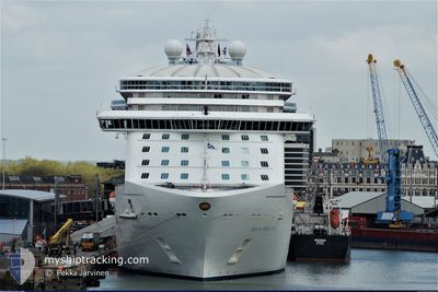
ROYAL PRINCESS
Passengers Ship
Current Trip
| Time Travelled | 13 h, 59 mins |
|---|---|
| Remaining Time | 17 h, 58 mins |
| Distance Travelled | 191.95 nm |
| Remaining Distance | 285.40 nm |
| AVG Speed | 13.8 Knop |
| MAX Speed | 17.1 Knop |
| AVG Wind | 7.5 knots |
| MAX Wind | 10.8 knots |
| MIN Temp | 16.5°C / 61.7°F |
| MAX Temp | 20°C / 68°F |
| Djupgående | 8.6 m |
| Position mottagen | 12 h, 15 m sen |
Current Position
| Longitud | 176.53534° |
|---|---|
| Latitude | -37.42417° |
| Status | Under way using engine |
| Fart | 14.3 Knop |
| Kurs | 66.6° |
| Område | South Pacific Ocean |
| Station | T-AIS |
| Position mottagen | 12 h, 15 m sen |
Info
Information
The current position of ROYAL PRINCESS is in South Pacific Ocean with coordinates -37.42417° / 176.53534° as reported on 2025-02-07 10:04 by AIS to our vessel tracker app. The vessel's current speed is 14.3 Knop and is heading at the port of WELLINGTON. The estimated time of arrival as calculated by MyShipTracking vessel tracking app is 2025-02-09 05:18 LT
The vessel ROYAL PRINCESS (IMO: 9584712, MMSI: 310661000) is a Passengers Ship that was built in 2013 ( 12 År gammal ). It's sailing under the flag of [BM] Bermuda.
In this page you can find informations about the vessels current position, last detected port calls, and current voyage information. If the vessels is not in coverage by AIS you will find the latest position.
The current position of ROYAL PRINCESS is detected by our AIS receivers and we are not responsible for the reliability of the data. The last position was recorded while the vessel was in Coverage by the Ais receivers of our vessel tracking app.
The current draught of ROYAL PRINCESS as reported by AIS is 8.6 meters
Weather
| Temperature | 17.4°C / 63.32°F |
|---|---|
| Wind Speed | 5 knots |
| Direction | 159° SSE |
| Pressure | 1017.3 hPa |
| Humidity | 69.8 % |
| Cloud Coverage | 63 % |
Featured Company
Last Port Calls
| Port | Arrival | Departure | Time In Port |
|---|---|---|---|
| 2025-02-07 08:58 | 2025-02-07 21:21 | 12 h | |
| 2025-02-06 05:27 | 2025-02-06 19:25 | 13 h | |
| 2025-02-01 10:40 | 2025-02-01 18:50 | 8 h | |
| 2025-02-01 06:24 | 2025-02-01 10:32 | 4 h | |
| 2025-01-28 06:44 | 2025-01-28 16:54 | 10 h | |
| 2025-01-27 06:35 | 2025-01-27 17:25 | 10 h | |
| 2025-01-26 07:14 | 2025-01-26 18:19 | 11 h | |
| 2025-01-24 09:12 | 2025-01-24 21:32 | 12 h | |
| 2025-01-23 05:26 | 2025-01-23 19:39 | 14 h | |
| 2025-01-18 05:04 | 2025-01-19 04:15 | 23 h |
Last Trips
| Origin | Departure | Destination | Arrival | Distance | |
|---|---|---|---|---|---|
| 2025-02-06 19:25 | 2025-02-07 08:58 | 174.41 nm | |||
| 2025-02-01 18:50 | 2025-02-06 05:27 | 1351.34 nm | |||
| 2025-02-01 10:32 | 2025-02-01 10:40 | 1.46 nm | |||
| 2025-01-28 16:54 | 2025-02-01 06:24 | 1382.33 nm | |||
| 2025-01-27 17:25 | 2025-01-28 06:44 | 195.13 nm | |||
| 2025-01-26 18:19 | 2025-01-27 06:35 | 172.70 nm | |||
| 2025-01-24 21:32 | 2025-01-26 07:14 | 506.21 nm | |||
| 2025-01-23 19:39 | 2025-01-24 09:12 | 142.44 nm | |||
| 2025-01-19 04:15 | 2025-01-23 05:26 | 1327.90 nm | |||
| 2025-01-14 18:02 | 2025-01-18 05:04 | 1510.26 nm |
Events
| Tid | Event | Detaljer | Position / Dest | Information |
|---|---|---|---|---|
| 2025-02-07 10:11 | Status ändrad | Default Under way using engine |
-37.41212 / 176.56804
NZ WLG
|
Fart: 14.3 kn Kurs: 66.6° |
| 2025-02-07 10:04 | UTANFÖR täckningsområde |
-37.42417 / 176.53534
South Pacific Ocean
NZ WLG
|
Fart: 14.3 kn Kurs: 66.6° |
|
| 2025-02-07 10:01 | Status ändrad | Under way using engine Default |
-37.42933 / 176.52070
NZ WLG
|
Fart: 14.4 kn Kurs: 66° |
| 2025-02-07 09:58 | Status ändrad | Default Under way using engine |
-37.43420 / 176.50696
NZ WLG
|
Fart: 14.5 kn Kurs: 66.5° |
| 2025-02-07 08:21 | AVGÅTT HAMN |
|
-37.63935 / 176.16915
NZ WLG
|
Fart: 8 kn Kurs: 297° |
| 2025-02-07 08:16 | STARTAR förflyttning |
-37.64402 / 176.17779
[NZ] TAURANGA
|
Fart: 3.4 kn Kurs: 325° |
|
| 2025-02-07 08:01 | Status ändrad | Under way using engine Moored |
-37.64203 / 176.18119
[NZ] TAURANGA
|
Fart: Kurs: 351° |
| 2025-02-07 07:09 | Status ändrad | Moored Default |
-37.64204 / 176.18123
[NZ] TAURANGA
|
Fart: Kurs: 351° |
| 2025-02-07 07:06 | Status ändrad | Default Moored |
-37.64203 / 176.18120
[NZ] TAURANGA
|
Fart: Kurs: 351° |
| 2025-02-07 06:12 | Status ändrad | Moored Default |
-37.64205 / 176.18123
[NZ] TAURANGA
|
Fart: Kurs: 351° |