
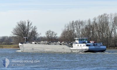
SAFFIRA
Tanker
Current Trip
MOERDIJK
| Time Travelled | 12 h, 56 mins |
|---|---|
| Remaining Time | --- |
| Distance Travelled | 19.72 nm |
| Remaining Distance | --- |
| AVG Speed | 4.7 Knop |
| MAX Speed | 5.2 Knop |
| AVG Wind | 19 knots |
| MAX Wind | 20.8 knots |
| MIN Temp | -0.3°C / 31.46°F |
| MAX Temp | 0.5°C / 32.9°F |
| Djupgående | 0.2 m |
| Position mottagen | 7 h, 44 m sen |
Current Position
| Longitud | 3.31647° |
|---|---|
| Latitude | 50.86841° |
| Status | Under way using engine |
| Fart | 4.6 Knop |
| Kurs | 213.4° |
| Område | North Sea |
| Station | T-AIS |
| Position mottagen | 7 h, 44 m sen |
Info
Information
The current position of SAFFIRA is in North Sea with coordinates 50.86841° / 3.31647° as reported on 2026-01-07 11:20 by AIS to our vessel tracker app. The vessel's current speed is 4.6 Knop
The vessel SAFFIRA (MMSI: 244710843) is a Tanker It's sailing under the flag of [NL] Netherlands.
In this page you can find informations about the vessels current position, last detected port calls, and current voyage information. If the vessels is not in coverage by AIS you will find the latest position.
The current position of SAFFIRA is detected by our AIS receivers and we are not responsible for the reliability of the data. The last position was recorded while the vessel was in Coverage by the Ais receivers of our vessel tracking app.
The current draught of SAFFIRA as reported by AIS is 0.2 meters
Weather
| Temperature | 0.5°C / 32.9°F |
|---|---|
| Wind Speed | 12 knots |
| Direction | 200° SSW |
| Pressure | 1005.8 hPa |
| Humidity | 94.4 % |
| Cloud Coverage | 100 % |
Featured Company
Last Port Calls
| Port | Arrival | Departure | Time In Port |
|---|---|---|---|
| 2026-01-06 18:04 | 2026-01-07 07:09 | 13 h | |
| 2026-01-06 13:42 | 2026-01-06 14:08 | 25 m | |
| 2026-01-05 21:41 | 2026-01-06 06:07 | 8 h | |
| 2026-01-03 14:27 | 2026-01-05 21:19 | 2 d | |
| 2026-01-02 13:34 | 2026-01-03 09:09 | 19 h | |
| 2026-01-02 09:57 | 2026-01-02 11:24 | 1 h | |
| 2026-01-01 22:32 | 2026-01-02 08:22 | 9 h | |
| 2025-12-30 08:48 | 2026-01-01 12:47 | 2 d | |
| 2025-12-20 13:34 | 2025-12-29 12:10 | 8 d | |
| 2025-12-12 15:53 | 2025-12-15 12:50 | 2 d |
Last Trips
| Origin | Departure | Destination | Arrival | Distance | |
|---|---|---|---|---|---|
| 2026-01-06 14:08 | 2026-01-06 18:04 | 21.32 nm | |||
| 2026-01-06 06:07 | 2026-01-06 13:42 | 54.35 nm | |||
| 2026-01-05 21:19 | 2026-01-05 21:41 | 2.81 nm | |||
| 2026-01-03 09:09 | 2026-01-03 14:27 | 42.13 nm | |||
| 2026-01-02 11:24 | 2026-01-02 13:34 | 8.52 nm | |||
| 2026-01-02 08:22 | 2026-01-02 09:57 | 11.97 nm | |||
| 2026-01-01 12:47 | 2026-01-01 22:32 | 1.75 nm | |||
| 2025-12-29 12:10 | 2025-12-30 08:48 | 37.80 nm | |||
| 2025-12-15 12:50 | 2025-12-20 13:34 | 37.09 nm | |||
| 2025-12-12 10:37 | 2025-12-12 15:53 | 31.11 nm |
Events
| Tid | Event | Detaljer | Position / Dest | Information |
|---|---|---|---|---|
| 2026-01-07 11:20 | UTANFÖR täckningsområde |
50.86841 / 3.31647
North Sea
|
Fart: 4.6 kn Kurs: 213.4° |
|
| 2026-01-07 11:20 | I täckningsområde |
50.86841 / 3.31647
North Sea
|
Fart: 4.6 kn Kurs: 213.4° |
|
| 2026-01-07 08:33 | Status ändrad | Default Under way using engine |
50.96870 / 3.48597
MOERDIJK
|
Fart: 3.9 kn Kurs: 234.3° |
| 2026-01-07 08:23 | Status ändrad | Under way using engine Default |
50.97497 / 3.50016
MOERDIJK
|
Fart: 4.3 kn Kurs: -1° |
| 2026-01-07 08:23 | UTANFÖR täckningsområde |
50.97497 / 3.50016
North Sea
|
Fart: 3.9 kn Kurs: 234.3° |
|
| 2026-01-07 08:15 | Status ändrad | Default Under way using engine |
50.98036 / 3.51235
MOERDIJK
|
Fart: 4.8 kn Kurs: 178.1° |
| 2026-01-07 07:07 | Status ändrad | Under way using engine Default |
51.06238 / 3.57012
MOERDIJK
|
Fart: 5.1 kn Kurs: 152° |
| 2026-01-07 06:56 | Status ändrad | Default Under way using engine |
51.07598 / 3.56738
MOERDIJK
|
Fart: 5 kn Kurs: 179.6° |
| 2026-01-07 06:09 | AVGÅTT HAMN |
|
51.09204 / 3.63443
MOERDIJK
|
Fart: 4.6 kn Kurs: 264.5° |
| 2026-01-07 05:51 | STARTAR förflyttning |
51.08916 / 3.66688
[BE] GENT
|
Fart: 3.1 kn Kurs: 250.5° |