
SAHARA GAS
Tanker
Current Trip
| Time Travelled | 1 day |
|---|---|
| Remaining Time | --- |
| Distance Travelled | 515.78 nm |
| Remaining Distance | --- |
| AVG Speed | 10.9 Knop |
| MAX Speed | 16.8 Knop |
| AVG Wind | 7.3 knots |
| MAX Wind | 21 knots |
| MIN Temp | 10.2°C / 50.36°F |
| MAX Temp | 16.6°C / 61.88°F |
| Djupgående | 7.5 m |
| Position mottagen | 3 m sen |
Current Position
| Longitud | -5.37656° |
|---|---|
| Latitude | 36.13907° |
| Status | At anchor |
| Fart | 0.2 Knop |
| Kurs | 186° |
| Område | Strait of Gibraltar |
| Station | T-AIS |
| Position mottagen | 3 m sen |
Info
Information
The current position of SAHARA GAS is in Strait of Gibraltar with coordinates 36.13907° / -5.37656° as reported on 2025-02-19 03:49 by AIS to our vessel tracker app. The vessel's current speed is 0.2 Knop
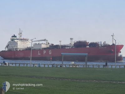
The vessel SAHARA GAS (IMO: 9748215, MMSI: 538007233) is a Tanker It's sailing under the flag of [MH] Marshall Is.
In this page you can find informations about the vessels current position, last detected port calls, and current voyage information. If the vessels is not in coverage by AIS you will find the latest position.
The current position of SAHARA GAS is detected by our AIS receivers and we are not responsible for the reliability of the data. The last position was recorded while the vessel was in Coverage by the Ais receivers of our vessel tracking app.
The current draught of SAHARA GAS as reported by AIS is 7.5 meters
Weather
| Temperature | 10.4°C / 50.72°F |
|---|---|
| Wind Speed | 1 knots |
| Direction | 346° NNW |
| Pressure | 1015.2 hPa |
| Humidity | 95.2 % |
| Cloud Coverage | 100 % |
Featured Company
Last Port Calls
| Port | Arrival | Departure | Time In Port |
|---|---|---|---|
| 2025-02-12 08:30 | 2025-02-17 11:21 | 5 d | |
| 2025-02-10 09:51 | 2025-02-11 12:39 | 1 d | |
| 2025-01-24 15:14 | 2025-01-25 21:54 | 1 d | |
| 2024-12-27 06:15 | 2024-12-30 21:37 | 3 d | |
| 2024-12-20 03:34 | 2024-12-24 00:27 | 3 d | |
| 2024-11-30 18:01 | 2024-12-01 19:01 | 1 d |
Most Visited Ports (Last year)
| Port | Arrivals | |
|---|---|---|
| 10 | ||
| 7 | ||
| 1 | ||
| 1 | ||
| 1 | ||
| 1 |
Last Trips
| Origin | Departure | Destination | Arrival | Distance | |
|---|---|---|---|---|---|
| 2025-02-11 12:39 | 2025-02-12 08:30 | 273.37 nm | |||
| 2025-01-25 21:54 | 2025-02-10 09:51 | 5256.93 nm | |||
| 2024-12-30 21:37 | 2025-01-24 15:14 | 6370.72 nm | |||
| 2024-12-24 00:27 | 2024-12-27 06:15 | 736.70 nm | |||
| 2024-12-01 19:01 | 2024-12-20 03:34 | 5574.36 nm | |||
| 2024-10-25 13:28 | 2024-11-30 18:01 | 9159.14 nm |
Events
| Tid | Event | Detaljer | Position / Dest | Information |
|---|---|---|---|---|
| 2025-02-18 23:13 | Status ändrad | At anchor Under way using engine |
36.13640 / -5.37796
GI GIB
|
Fart: 0.3 kn Kurs: 12° |
| 2025-02-18 23:12 | STOPPAR förflyttning | 0.99 nm, South West of GIBRALTAR |
36.13641 / -5.37793
GI GIB
|
Fart: 0.3 kn Kurs: 10° |
| 2025-02-18 21:30 | Byter havsområde | Gibraltarian part of the Strait of Gibraltar Gibraltarian part of the Alboran Sea |
36.06876 / -5.33315
Strait of Gibraltar
GI GIB
|
Fart: 7.6 kn Kurs: 300.7° |
| 2025-02-18 19:49 | Upptäckt i hav | Gibraltarian part of the Alboran Sea |
36.08701 / -4.91004
Alboran Sea
GI GIB
|
Fart: 13.8 kn Kurs: 268.4° |
| 2025-02-18 19:31 | Djupgående ändrat | 7.5 7.3 |
36.08973 / -4.82714
GI GIB
|
Fart: 13.8 kn Kurs: 266.2° |
| 2025-02-18 19:31 | Destination ändrad | GI GIB ES ALG |
36.08973 / -4.82714
GI GIB
|
Fart: 13.8 kn Kurs: 266.2° |
| 2025-02-18 19:31 | ETA ändrat | 2025/02/18 21:00 2025/02/18 23:00 |
36.08973 / -4.82714
GI GIB
|
Fart: 13.8 kn Kurs: 266.2° |
| 2025-02-18 18:48 | Status ändrad | Under way using engine Default |
36.13059 / -4.63430
ES ALG
|
Fart: 13.9 kn Kurs: 254° |
| 2025-02-18 18:32 | I täckningsområde |
36.13059 / -4.63430
Alboran Sea
ES ALG
|
Fart: 13.3 kn Kurs: 256.7° |
|
| 2025-02-18 15:47 | UTANFÖR täckningsområde |
36.24129 / -3.76520
Alboran Sea
ES ALG
|
Fart: 12.9 kn Kurs: 260.4° |