
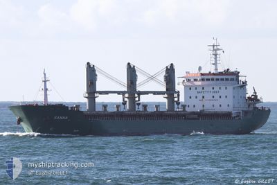
SANNA
General Cargo
Current Trip
| Trip Time | 6 days |
|---|---|
| Trip Distance | 211.48 nm |
| AVG Speed | 8 Knop |
| MAX Speed | 9.9 Knop |
| Djupgående | 8.5 m |
| AVG Wind | 13.4 knots |
| MAX Wind | 19 knots |
| MIN Temp | 19.2°C / 66.56°F |
| MAX Temp | 30°C / 86°F |
| Position mottagen | 2025-01-22 14:28 |
Current Position
| Longitud | -16.82317° |
|---|---|
| Latitude | 13.53501° |
| Status | Under way using engine |
| Fart | 9.9 Knop |
| Kurs | 93.9° |
| Område | North Atlantic Ocean |
| Station | T-AIS |
| Position mottagen | 2025-01-22 14:28 |
Info
Information
The current position of SANNA is in North Atlantic Ocean with coordinates 13.53501° / -16.82317° as reported on 2025-01-22 14:28 by AIS to our vessel tracker app. The vessel's current speed is 9.9 Knop and is currently inside the port of DAKAR.
The vessel SANNA (IMO: 9537472, MMSI: 249384000) is a General Cargo that was built in 2009 ( 16 År gammal ). It's sailing under the flag of [MT] Malta.
In this page you can find informations about the vessels current position, last detected port calls, and current voyage information. If the vessels is not in coverage by AIS you will find the latest position.
The current position of SANNA is detected by our AIS receivers and we are not responsible for the reliability of the data. The last position was recorded while the vessel was in Coverage by the Ais receivers of our vessel tracking app.
The current draught of SANNA as reported by AIS is 8.5 meters
Weather
| Temperature | 19.4°C / 66.92°F |
|---|---|
| Wind Speed | 12 knots |
| Direction | 13° NNE |
| Pressure | 1013.7 hPa |
| Humidity | 79.8 % |
| Cloud Coverage | 91 % |
Featured Company
Last Port Calls
| Port | Arrival | Departure | Time In Port |
|---|---|---|---|
| 2025-02-27 09:27 | |||
| 2025-02-17 11:03 | 2025-02-20 15:59 | 3 d | |
| 2025-02-11 11:15 | 2025-02-14 16:47 | 3 d | |
| 2025-02-01 12:27 | 2025-02-05 07:47 | 3 d | |
| 2025-01-24 09:03 | 2025-01-26 15:11 | 2 d | |
| 2025-01-15 08:29 | 2025-01-16 18:16 | 1 d | |
| 2025-01-06 10:11 | 2025-01-10 17:11 | 4 d | |
| 2024-12-29 10:07 | 2025-01-02 09:31 | 3 d | |
| 2024-12-25 08:39 |
Last Trips
| Origin | Departure | Destination | Arrival | Distance | |
|---|---|---|---|---|---|
| 2025-02-20 15:59 | 2025-02-27 09:27 | 211.48 nm | |||
| 2025-02-14 16:47 | 2025-02-17 11:03 | 19.03 nm | |||
| 2025-02-05 07:47 | 2025-02-11 11:15 | 28.86 nm | |||
| 2025-01-26 15:11 | 2025-02-01 12:27 | 20.32 nm | |||
| 2025-01-16 18:16 | 2025-01-24 09:03 | 719.87 nm | |||
| 2025-01-10 17:11 | 2025-01-15 08:29 | 565.83 nm | |||
| 2025-01-02 09:31 | 2025-01-06 10:11 | 210.55 nm | |||
| 2024-12-25 08:39 | 2024-12-29 10:07 | 208.55 nm |
Events
| Tid | Event | Detaljer | Position / Dest | Information |
|---|---|---|---|---|
| 2025-02-27 09:44 | STOPPAR förflyttning |
14.68806 / -17.43174
[SN] DAKAR
|
Fart: 0.3 kn Kurs: -1° |
|
| 2025-02-27 09:27 | ANLÄNDER HAMN |
|
14.67911 / -17.42261
[SN] DAKAR
|
Fart: 5.5 kn Kurs: 276° |
| 2025-02-27 08:20 | STARTAR förflyttning | 3.93 nm, South West of RUFISQUE |
14.66252 / -17.32441
ITRAN
|
Fart: 3.1 kn Kurs: 67° |
| 2025-02-25 03:55 | STOPPAR förflyttning | 4.05 nm, South West of RUFISQUE |
14.65991 / -17.32448
ITRAN
|
Fart: 0.2 kn Kurs: 12° |
| 2025-02-25 03:23 | STARTAR förflyttning | 5.11 nm, South West of RUFISQUE |
14.63317 / -17.31406
ITRAN
|
Fart: 5.1 kn Kurs: 358° |
| 2025-02-24 16:02 | STOPPAR förflyttning | 5.37 nm, South of RUFISQUE |
14.62852 / -17.31432
ITRAN
|
Fart: 0.3 kn Kurs: 327° |
| 2025-02-24 14:11 | STARTAR förflyttning | 4.29 nm, South West of RUFISQUE |
14.65491 / -17.32461
ITRAN
|
Fart: 3.1 kn Kurs: 174° |
| 2025-02-23 07:29 | STOPPAR förflyttning | 4.17 nm, South West of RUFISQUE |
14.65892 / -17.32640
ITRAN
|
Fart: 0.2 kn Kurs: 40° |
| 2025-02-22 20:13 | STARTAR förflyttning | 0.86 nm, North of BANJUL |
13.46017 / -16.56737
ITRAN
|
Fart: 5.5 kn Kurs: 352° |
| 2025-02-21 16:30 | STOPPAR förflyttning | 0.48 nm, North East of BANJUL |
13.45377 / -16.56806
ITRAN
|
Fart: 0.3 kn Kurs: 341° |