
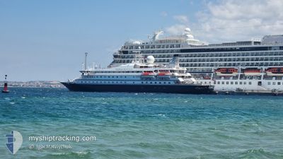
SEADREAM 1
Passengers Ship
Current Trip
| Time Travelled | 22 h, 7 mins |
|---|---|
| Remaining Time | --- |
| Distance Travelled | 114.64 nm |
| Remaining Distance | --- |
| AVG Speed | 8 Knop |
| MAX Speed | 9.7 Knop |
| AVG Wind | 13.8 knots |
| MAX Wind | 18 knots |
| MIN Temp | 24.7°C / 76.46°F |
| MAX Temp | 27.1°C / 80.78°F |
| Djupgående | 4.3 m |
| Position mottagen | 2 m sen |
Current Position
| Longitud | -60.88096° |
|---|---|
| Latitude | 14.45695° |
| Status | At anchor |
| Fart | 0.3 Knop |
| Kurs | 102° |
| Område | Caribbean Sea |
| Station | T-AIS |
| Position mottagen | 2 m sen |
Info
Information
The current position of SEADREAM 1 is in Caribbean Sea with coordinates 14.45695° / -60.88096° as reported on 2025-03-02 20:57 by AIS to our vessel tracker app. The vessel's current speed is 0.3 Knop
The vessel SEADREAM 1 (IMO: 8203438, MMSI: 308908000) is a Passengers Ship that was built in 1984 ( 41 År gammal ). It's sailing under the flag of [BS] Bahamas.
In this page you can find informations about the vessels current position, last detected port calls, and current voyage information. If the vessels is not in coverage by AIS you will find the latest position.
The current position of SEADREAM 1 is detected by our AIS receivers and we are not responsible for the reliability of the data. The last position was recorded while the vessel was in Coverage by the Ais receivers of our vessel tracking app.
The current draught of SEADREAM 1 as reported by AIS is 4.3 meters
Weather
| Temperature | 26.7°C / 80.06°F |
|---|---|
| Wind Speed | 13 knots |
| Direction | 92° E |
| Pressure | 1012.4 hPa |
| Humidity | 69.3 % |
| Cloud Coverage | 32 % |
Featured Company
Last Port Calls
| Port | Arrival | Departure | Time In Port |
|---|---|---|---|
| 2025-03-01 09:08 | 2025-03-01 22:52 | 13 h | |
| 2025-02-22 11:26 | 2025-02-22 22:10 | 10 h | |
| 2025-02-20 10:38 | 2025-02-20 19:54 | 9 h | |
| 2025-02-18 15:45 | 2025-02-18 22:46 | 7 h | |
| 2025-02-17 11:31 | 2025-02-17 22:23 | 10 h | |
| 2025-02-15 11:07 | 2025-02-16 23:46 | 1 d | |
| 2025-02-13 11:29 | 2025-02-13 18:55 | 7 h | |
| 2025-02-08 10:40 | 2025-02-08 22:08 | 11 h | |
| 2025-02-07 11:51 | 2025-02-07 22:03 | 10 h | |
| 2025-02-01 13:01 | 2025-02-01 22:03 | 9 h |
Most Visited Ports (Last year)
| Port | Arrivals | |
|---|---|---|
| 13 | ||
| 10 | ||
| 6 | ||
| 6 | ||
| 6 | ||
| 6 |
Last Trips
| Origin | Departure | Destination | Arrival | Distance | |
|---|---|---|---|---|---|
| 2025-02-22 18:10 | 2025-03-01 05:08 | 679.22 nm | |||
| 2025-02-20 15:54 | 2025-02-22 07:26 | 92.01 nm | |||
| 2025-02-18 18:46 | 2025-02-20 06:38 | 133.84 nm | |||
| 2025-02-17 18:23 | 2025-02-18 11:45 | 202.06 nm | |||
| 2025-02-16 19:46 | 2025-02-17 07:31 | 119.54 nm | |||
| 2025-02-13 14:55 | 2025-02-15 07:07 | 211.55 nm | |||
| 2025-02-08 18:08 | 2025-02-13 07:29 | 367.14 nm | |||
| 2025-02-07 18:03 | 2025-02-08 06:40 | 90.18 nm | |||
| 2025-02-01 18:03 | 2025-02-07 07:51 | 532.51 nm | |||
| 2025-02-01 08:51 | 2025-02-01 09:01 | 1.30 nm |
Events
| Tid | Event | Detaljer | Position / Dest | Information |
|---|---|---|---|---|
| 2025-03-02 11:54 | STOPPAR förflyttning | 0.86 nm, South West of LE MARIN |
14.45688 / -60.88077
BB BGI > MQ QMR
|
Fart: 0.3 kn Kurs: 85° |
| 2025-03-02 11:52 | Status ändrad | At anchor Under way using engine |
14.45687 / -60.88032
BB BGI > MQ QMR
|
Fart: 1.1 kn Kurs: 80° |
| 2025-03-02 10:45 | Destination ändrad | BB BGI > MQ QMR VC BQU > BB BGI |
14.36150 / -60.89323
BB BGI > MQ QMR
|
Fart: 8.9 kn Kurs: 316.2° |
| 2025-03-02 10:45 | ETA ändrat | 2025/03/02 11:30 2025/03/01 01:00 |
14.36150 / -60.89323
BB BGI > MQ QMR
|
Fart: 8.9 kn Kurs: 316.2° |
| 2025-03-02 09:15 | Byter havsområde | Guadeloupe and Martinique part of the Caribbean Sea Saint Lucia part of the Caribbean Sea |
14.21899 / -60.72308
Caribbean Sea
|
Fart: 9.1 kn Kurs: 304.3° |
| 2025-03-02 09:01 | Byter havsområde | Saint Lucia part of the Caribbean Sea Barbados part of the Caribbean Sea |
14.19592 / -60.69644
Caribbean Sea
|
Fart: 8.8 kn Kurs: 309.2° |
| 2025-03-02 09:01 | Status ändrad | Under way using engine Default |
14.19592 / -60.69644
VC BQU > BB BGI
|
Fart: 9.2 kn Kurs: 317° |
| 2025-03-02 08:55 | I täckningsområde |
14.19592 / -60.69644
Caribbean Sea
|
Fart: 8.8 kn Kurs: 309.2° |
|
| 2025-03-01 23:59 | Status ändrad | Default Under way using engine |
13.20067 / -59.77583
VC BQU > BB BGI
|
Fart: 8.6 kn Kurs: 313.9° |
| 2025-03-01 23:48 | UTANFÖR täckningsområde |
13.18074 / -59.75623
Caribbean Sea
|
Fart: 8.6 kn Kurs: 313.9° |