

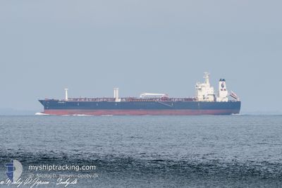
SEALION I
Tanker

Current Trip
| Time Travelled | 49 days |
|---|---|
| Remaining Time | --- |
| Distance Travelled | 1033.87 nm |
| Remaining Distance | --- |
| AVG Speed | 6.6 Knop |
| MAX Speed | 6.6 Knop |
| AVG Wind | 9.6 knots |
| MAX Wind | 25.1 knots |
| MIN Temp | 17.4°C / 63.32°F |
| MAX Temp | 25.5°C / 77.9°F |
| Djupgående | 8 m |
| Position mottagen | 2 d sen |
Current Position
| Longitud | 32.28268° |
|---|---|
| Latitude | 31.59516° |
| Status | At anchor |
| Fart | 0.1 Knop |
| Kurs | 345° |
| Område | Mediterranean Sea - Eastern Basin |
| Station | T-AIS |
| Position mottagen | 2 d sen |
Information
The current position of SEALION I is in Mediterranean Sea - Eastern Basin with coordinates 31.59516° / 32.28268° as reported on 2025-05-31 04:25 by AIS to our vessel tracker app. The vessel's current speed is 0.1 Knop
The vessel SEALION I (IMO: 9234501, MMSI: 374024000) is a Tanker It's sailing under the flag of [PA] Panama.
In this page you can find informations about the vessels current position, last detected port calls, and current voyage information. If the vessels is not in coverage by AIS you will find the latest position.
The current position of SEALION I is detected by our AIS receivers and we are not responsible for the reliability of the data. The last position was recorded while the vessel was in Coverage by the Ais receivers of our vessel tracking app.
The current draught of SEALION I as reported by AIS is 8 meters
Weather
| Temperature | 21.8°C / 71.24°F |
|---|---|
| Wind Speed | 16 knots |
| Direction | 319° NW |
| Pressure | 1018 hPa |
| Humidity | 71.9 % |
| Cloud Coverage | --- |


Featured Company
Last Port Calls
| Port | Arrival | Departure | Time In Port |
|---|---|---|---|
| 2025-04-12 13:35 | 2025-04-14 07:14 | 1 d |
Most Visited Ports (Last year)
| Port | Arrivals | |
|---|---|---|
| 16 | ||
| 12 | ||
| 2 | ||
| 2 | ||
| 1 | ||
| 1 |
Last Trips
| Origin | Departure | Destination | Arrival | Distance | |
|---|---|---|---|---|---|
| 2025-02-23 13:14 | 2025-04-12 16:35 | 576.85 nm |
Events
| Tid | Event | Detaljer | Position / Dest | Information |
|---|---|---|---|---|
| 2025-05-31 04:27 | Status ändrad | Default At anchor |
31.59516 / 32.28253
EG PSD
|
Fart: 0.1 kn Kurs: 345° |
| 2025-05-31 04:25 | Status ändrad | At anchor Default |
31.59516 / 32.28268
EG PSD
|
Fart: 0.1 kn Kurs: 16° |
| 2025-05-31 04:25 | I täckningsområde |
31.59516 / 32.28268
Mediterranean Sea - Eastern Basin
|
Fart: 0.1 kn Kurs: 90.8° |
|
| 2025-05-31 04:25 | UTANFÖR täckningsområde |
31.59516 / 32.28268
Mediterranean Sea - Eastern Basin
|
Fart: 0.1 kn Kurs: 90.8° |
|
| 2025-05-31 03:15 | Status ändrad | Default At anchor |
31.59643 / 32.28060
EG PSD
|
Fart: 0.1 kn Kurs: 72° |
| 2025-05-31 03:10 | Status ändrad | At anchor Default |
31.59628 / 32.28065
EG PSD
|
Fart: 0.3 kn Kurs: 56° |
| 2025-05-31 03:10 | I täckningsområde |
31.59628 / 32.28065
Mediterranean Sea - Eastern Basin
|
Fart: 0.1 kn Kurs: 305.4° |
|
| 2025-05-31 03:10 | UTANFÖR täckningsområde |
31.59628 / 32.28065
Mediterranean Sea - Eastern Basin
|
Fart: 0.1 kn Kurs: 305.4° |
|
| 2025-05-31 01:57 | Status ändrad | Default At anchor |
31.59640 / 32.28071
EG PSD
|
Fart: 0.1 kn Kurs: 58° |
| 2025-05-31 01:53 | UTANFÖR täckningsområde |
31.59620 / 32.28057
Mediterranean Sea - Eastern Basin
|
Fart: 0.1 kn Kurs: 105.1° |