
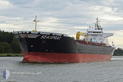
SEASPRAT
Oil Products Tanker
Current Trip
| Time Travelled | 2 days |
|---|---|
| Remaining Time | 4 h, 33 mins |
| Distance Travelled | 550.95 nm |
| Remaining Distance | 53.00 nm |
| AVG Speed | 11.7 Knop |
| MAX Speed | 16.2 Knop |
| AVG Wind | 7.3 knots |
| MAX Wind | 16 knots |
| MIN Temp | 3.5°C / 38.3°F |
| MAX Temp | 6.1°C / 42.98°F |
| Djupgående | 6.5 m |
| Position mottagen | Nu |
Current Position
| Longitud | 10.03954° |
|---|---|
| Latitude | 57.97349° |
| Status | Under way using engine |
| Fart | 9.9 Knop |
| Kurs | 67.4° |
| Område | Skaggerak |
| Station | T-AIS |
| Position mottagen | Nu |
Info
Information
The current position of SEASPRAT is in Skaggerak with coordinates 57.97349° / 10.03954° as reported on 2025-02-03 03:08 by AIS to our vessel tracker app. The vessel's current speed is 9.9 Knop and is heading at the port of BROFJORDEN. The estimated time of arrival as calculated by MyShipTracking vessel tracking app is 2025-02-03 07:42 LT
The vessel SEASPRAT (IMO: 9380477, MMSI: 218057000) is a Oil Products Tanker that was built in 2007 ( 18 År gammal ). It's sailing under the flag of [DE] Germany.
In this page you can find informations about the vessels current position, last detected port calls, and current voyage information. If the vessels is not in coverage by AIS you will find the latest position.
The current position of SEASPRAT is detected by our AIS receivers and we are not responsible for the reliability of the data. The last position was recorded while the vessel was in Coverage by the Ais receivers of our vessel tracking app.
The current draught of SEASPRAT as reported by AIS is 6.5 meters
Weather
| Temperature | 4.2°C / 39.56°F |
|---|---|
| Wind Speed | 6 knots |
| Direction | 188° S |
| Pressure | 1023.4 hPa |
| Humidity | 86 % |
| Cloud Coverage | 100 % |
Featured Company
Last Port Calls
| Port | Arrival | Departure | Time In Port |
|---|---|---|---|
| 2025-01-30 00:16 | 2025-02-01 00:21 | 2 d | |
| 2025-01-25 20:44 | 2025-01-27 06:34 | 1 d | |
| 2025-01-22 16:27 | 2025-01-24 00:04 | 1 d | |
| 2025-01-18 00:27 | 2025-01-20 06:25 | 2 d | |
| 2025-01-11 09:23 | 2025-01-12 07:10 | 21 h | |
| 2025-01-10 23:45 | 2025-01-11 00:34 | 49 m | |
| 2025-01-09 10:57 | 2025-01-10 22:51 | 1 d | |
| 2025-01-03 02:00 | 2025-01-04 18:52 | 1 d | |
| 2024-12-31 15:16 | 2025-01-01 09:43 | 18 h | |
| 2024-12-27 08:14 | 2024-12-28 18:20 | 1 d |
Most Visited Ports (Last year)
| Port | Arrivals | |
|---|---|---|
| 10 | ||
| 5 | ||
| 4 | ||
| 4 | ||
| 4 | ||
| 3 |
Last Trips
| Origin | Departure | Destination | Arrival | Distance | |
|---|---|---|---|---|---|
| 2025-01-27 07:34 | 2025-01-30 00:16 | 617.05 nm | |||
| 2025-01-24 01:04 | 2025-01-25 21:44 | 481.00 nm | |||
| 2025-01-20 07:25 | 2025-01-22 17:27 | 602.70 nm | |||
| 2025-01-12 08:10 | 2025-01-18 01:27 | 545.64 nm | |||
| 2025-01-11 01:34 | 2025-01-11 10:23 | 99.77 nm | |||
| 2025-01-10 23:51 | 2025-01-11 00:45 | 5.12 nm | |||
| 2025-01-04 18:52 | 2025-01-09 11:57 | 1199.90 nm | |||
| 2025-01-01 09:43 | 2025-01-03 02:00 | 9.05 nm | |||
| 2024-12-28 19:20 | 2024-12-31 15:16 | 798.42 nm | |||
| 2024-12-25 09:04 | 2024-12-27 09:14 | 532.96 nm |
Events
| Tid | Event | Detaljer | Position / Dest | Information |
|---|---|---|---|---|
| 2025-02-03 00:53 | Byter havsområde | Danish part of the Skaggerak United Kingdom part of the North Sea |
57.81428 / 9.32172
Skaggerak
BROFJORDEN
|
Fart: 11.1 kn Kurs: 70° |
| 2025-02-03 00:51 | I täckningsområde |
57.81428 / 9.32172
Skaggerak
BROFJORDEN
|
Fart: 11.1 kn Kurs: 70° |
|
| 2025-02-01 11:50 | Status ändrad | Default Under way using engine |
52.46142 / 2.96039
BROFJORDEN
|
Fart: 11.2 kn Kurs: 39.9° |
| 2025-02-01 11:46 | Status ändrad | Under way using engine Default |
52.45256 / 2.94822
BROFJORDEN
|
Fart: 11.2 kn Kurs: 41° |
| 2025-02-01 11:46 | UTANFÖR täckningsområde |
52.45256 / 2.94822
North Sea
BROFJORDEN
|
Fart: 11.2 kn Kurs: 39.9° |
|
| 2025-02-01 11:27 | I täckningsområde |
52.45256 / 2.94822
North Sea
BROFJORDEN
|
Fart: 11.2 kn Kurs: 39.9° |
|
| 2025-02-01 10:09 | Status ändrad | Default Under way using engine |
52.19333 / 2.71666
BROFJORDEN
|
Fart: 11 kn Kurs: 38.5° |
| 2025-02-01 09:31 | Status ändrad | Under way using engine Default |
52.09966 / 2.60167
BROFJORDEN
|
Fart: 10.9 kn Kurs: 38° |
| 2025-02-01 09:31 | UTANFÖR täckningsområde |
52.09966 / 2.60167
North Sea
BROFJORDEN
|
Fart: 11 kn Kurs: 38.5° |
|
| 2025-02-01 09:19 | Status ändrad | Default Under way using engine |
52.07214 / 2.56662
BROFJORDEN
|
Fart: 10.7 kn Kurs: 37.4° |