
SEGULA
General Cargo
Current Trip
| Time Travelled | 1 day |
|---|---|
| Remaining Time | 12 days |
| Distance Travelled | 423.36 nm |
| Remaining Distance | 3653.83 nm |
| AVG Speed | 12.8 Knop |
| MAX Speed | 15.9 Knop |
| AVG Wind | 4.5 knots |
| MAX Wind | 13 knots |
| MIN Temp | 4.8°C / 40.64°F |
| MAX Temp | 11.3°C / 52.34°F |
| Djupgående | 6.1 m |
| Position mottagen | 6 h, 56 m sen |
Current Position
| Longitud | -5.52226° |
|---|---|
| Latitude | 49.00634° |
| Status | Under way using engine |
| Fart | 11.4 Knop |
| Kurs | 240.4° |
| Område | Celtic Sea |
| Station | T-AIS |
| Position mottagen | 6 h, 56 m sen |
Info
Information
The current position of SEGULA is in Celtic Sea with coordinates 49.00634° / -5.52226° as reported on 2025-03-05 19:08 by AIS to our vessel tracker app. The vessel's current speed is 11.4 Knop and is heading at the port of JEDDAH. The estimated time of arrival as calculated by MyShipTracking vessel tracking app is 2025-03-18 10:58 LT
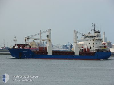
The vessel SEGULA (IMO: 9210323, MMSI: 636024210) is a General Cargo that was built in 2001 ( 24 År gammal ). It's sailing under the flag of [LR] Liberia.
In this page you can find informations about the vessels current position, last detected port calls, and current voyage information. If the vessels is not in coverage by AIS you will find the latest position.
The current position of SEGULA is detected by our AIS receivers and we are not responsible for the reliability of the data. The last position was recorded while the vessel was in Coverage by the Ais receivers of our vessel tracking app.
The current draught of SEGULA as reported by AIS is 6.1 meters
Weather
| Temperature | 11°C / 51.8°F |
|---|---|
| Wind Speed | 9 knots |
| Direction | 139° SE |
| Pressure | 1017.9 hPa |
| Humidity | 85 % |
| Cloud Coverage | 4 % |
Featured Company
Most Visited Ports (Last year)
| Port | Arrivals | |
|---|---|---|
| 1 | ||
| 1 | ||
| 1 | ||
| 1 | ||
| 1 | ||
| 1 |
Events
| Tid | Event | Detaljer | Position / Dest | Information |
|---|---|---|---|---|
| 2025-03-05 19:08 | UTANFÖR täckningsområde |
49.00634 / -5.52226
Celtic Sea
SAJED
|
Fart: 11.4 kn Kurs: 240.4° |
|
| 2025-03-05 17:13 | Byter havsområde | French part of the Celtic Sea French part of the English Channel |
49.19274 / -5.03252
Celtic Sea
SAJED
|
Fart: 12.3 kn Kurs: 236.9° |
| 2025-03-05 14:16 | Byter havsområde | French part of the English Channel United Kingdom part of the English Channel |
49.52225 / -4.16171
English Channel
SAJED
|
Fart: 13.9 kn Kurs: 240.3° |
| 2025-03-05 10:12 | Upptäckt i hav | United Kingdom part of the English Channel |
49.91579 / -3.06926
English Channel
SAJED
|
Fart: 10.6 kn Kurs: 244.7° |
| 2025-03-05 06:43 | Byter havsområde | Guernsey part of the English Channel United Kingdom part of the English Channel |
50.15010 / -2.03457
English Channel
SAJED
|
Fart: 14.9 kn Kurs: 253.5° |
| 2025-03-04 19:23 | Byter havsområde | United Kingdom part of the English Channel United Kingdom part of the North Sea |
51.06834 / 1.46861
English Channel
SAJED
|
Fart: 12.7 kn Kurs: 230.2° |
| 2025-03-04 16:23 | Byter havsområde | United Kingdom part of the North Sea French part of the North Sea |
51.40823 / 2.07088
North Sea
SAJED
|
Fart: 11.7 kn Kurs: 294.3° |
| 2025-03-04 15:22 | Byter havsområde | French part of the North Sea Belgian part of the North Sea |
51.35322 / 2.34287
North Sea
SAJED
|
Fart: 10.2 kn Kurs: 250.8° |
| 2025-03-04 13:08 | Djupgående ändrat | 6.1 5 |
51.38600 / 2.98914
SAJED
|
Fart: 12.3 kn Kurs: 253.1° |
| 2025-03-04 12:04 | Byter havsområde | Belgian part of the North Sea Dutch part of the North Sea |
51.40788 / 3.32166
North Sea
SAJED
|
Fart: 11.8 kn Kurs: 274.4° |