
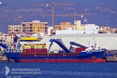
SEHER S
Cargo
Current Trip
| Time Travelled | 1 day |
|---|---|
| Remaining Time | --- |
| Distance Travelled | 21.87 nm |
| Remaining Distance | --- |
| AVG Speed | 7.7 Knop |
| MAX Speed | 8.9 Knop |
| AVG Wind | 8.3 knots |
| MAX Wind | 17 knots |
| MIN Temp | -1.7°C / 28.94°F |
| MAX Temp | 5.5°C / 41.9°F |
| Djupgående | 4.2 m |
| Position mottagen | 2 m sen |
Current Position
| Longitud | 13.28241° |
|---|---|
| Latitude | 45.65337° |
| Status | At anchor |
| Fart | |
| Kurs | 93° |
| Område | Adriatic Sea |
| Station | T-AIS |
| Position mottagen | 2 m sen |
Info
Information
The current position of SEHER S is in Adriatic Sea with coordinates 45.65337° / 13.28241° as reported on 2025-02-19 03:18 by AIS to our vessel tracker app. The vessel's current speed is 0 Knop
The vessel SEHER S (IMO: 9198604, MMSI: 375115000) is a Cargo It's sailing under the flag of [VC] St Vincent Grenadines.
In this page you can find informations about the vessels current position, last detected port calls, and current voyage information. If the vessels is not in coverage by AIS you will find the latest position.
The current position of SEHER S is detected by our AIS receivers and we are not responsible for the reliability of the data. The last position was recorded while the vessel was in Coverage by the Ais receivers of our vessel tracking app.
The current draught of SEHER S as reported by AIS is 4.2 meters
Weather
| Temperature | 0.9°C / 33.62°F |
|---|---|
| Wind Speed | 7 knots |
| Direction | 57° ENE |
| Pressure | 1028 hPa |
| Humidity | 54.4 % |
| Cloud Coverage | --- |
Featured Company
Last Port Calls
| Port | Arrival | Departure | Time In Port |
|---|---|---|---|
| 2025-02-17 03:48 | 2025-02-17 12:37 | 8 h | |
| 2025-02-08 22:14 | 2025-02-09 11:47 | 13 h | |
| 2025-02-04 07:54 | 2025-02-07 16:24 | 3 d | |
| 2025-01-31 10:29 | 2025-02-01 15:41 | 1 d | |
| 2025-01-20 14:35 | 2025-01-22 19:28 | 2 d | |
| 2025-01-19 02:42 | 2025-01-19 13:18 | 10 h | |
| 2025-01-06 20:24 | 2025-01-08 12:05 | 1 d | |
| 2024-12-28 06:43 | 2024-12-31 13:00 | 3 d | |
| 2024-12-19 14:20 | 2024-12-22 14:04 | 2 d | |
| 2024-12-17 10:26 | 2024-12-18 11:44 | 1 d |
Last Trips
| Origin | Departure | Destination | Arrival | Distance | |
|---|---|---|---|---|---|
| 2025-02-09 14:47 | 2025-02-17 04:48 | 1217.19 nm | |||
| 2025-02-07 19:24 | 2025-02-09 01:14 | 43.01 nm | |||
| 2025-02-01 18:41 | 2025-02-04 10:54 | 592.50 nm | |||
| 2025-01-22 20:28 | 2025-01-31 13:29 | 1900.80 nm | |||
| 2025-01-19 14:18 | 2025-01-20 15:35 | 211.74 nm | |||
| 2025-01-08 14:05 | 2025-01-19 03:42 | 2038.32 nm | |||
| 2024-12-31 15:00 | 2025-01-06 22:24 | 707.15 nm | |||
| 2024-12-22 17:04 | 2024-12-28 08:43 | 481.55 nm | |||
| 2024-12-18 14:44 | 2024-12-19 17:20 | 193.28 nm | |||
| 2024-12-11 19:37 | 2024-12-17 13:26 | 376.03 nm |
Events
| Tid | Event | Detaljer | Position / Dest | Information |
|---|---|---|---|---|
| 2025-02-19 03:03 | Djupgående ändrat | 4.2 4 |
45.65304 / 13.28266
ITPNG
|
Fart: Kurs: 63° |
| 2025-02-19 03:03 | ETA ändrat | 2025/02/18 23:00 |
45.65304 / 13.28266
ITPNG
|
Fart: Kurs: 63° |
| 2025-02-19 02:57 | Djupgående ändrat | 4 4.2 |
45.65333 / 13.28251
ITPNG
|
Fart: Kurs: 54° |
| 2025-02-19 02:45 | Djupgående ändrat | 4.2 4 |
45.65302 / 13.28269
ITPNG
|
Fart: Kurs: 57° |
| 2025-02-19 02:45 | ETA ändrat | 2025/02/18 23:00 |
45.65302 / 13.28269
ITPNG
|
Fart: Kurs: 57° |
| 2025-02-19 02:27 | Djupgående ändrat | 4 4.2 |
45.65328 / 13.28247
ITPNG
|
Fart: Kurs: 89° |
| 2025-02-19 02:21 | Djupgående ändrat | 4.2 4 |
45.65303 / 13.28266
ITPNG
|
Fart: Kurs: 67° |
| 2025-02-19 02:21 | ETA ändrat | 2025/02/18 23:00 |
45.65303 / 13.28266
ITPNG
|
Fart: Kurs: 67° |
| 2025-02-19 02:15 | Djupgående ändrat | 4 4.2 |
45.65342 / 13.28244
ITPNG
|
Fart: 0.4 kn Kurs: 77° |
| 2025-02-19 01:57 | Status ändrad | At anchor Default |
45.65311 / 13.28263
ITPNG
|
Fart: 0.3 kn Kurs: 83° |