
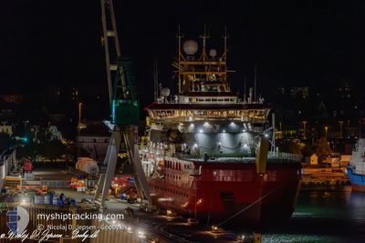
SIR D. ATTENBOROUGH
Other Type
Current Trip
| Time Travelled | 7 days |
|---|---|
| Remaining Time | --- |
| Distance Travelled | 1347.88 nm |
| Remaining Distance | --- |
| AVG Speed | 12.6 Knop |
| MAX Speed | 17.2 Knop |
| AVG Wind | 13.5 knots |
| MAX Wind | 28 knots |
| MIN Temp | -0.9°C / 30.38°F |
| MAX Temp | 15.7°C / 60.26°F |
| Djupgående | 7.3 m |
| Position mottagen | 2 d sen |
Current Position
| Longitud | -37.04605° |
|---|---|
| Latitude | -53.57277° |
| Status | Under way using engine |
| Fart | 0.3 Knop |
| Kurs | 245° |
| Område | South Atlantic Ocean |
| Station | T-AIS |
| Position mottagen | 2 d sen |
Info
Information
The current position of SIR D. ATTENBOROUGH is in South Atlantic Ocean with coordinates -53.57277° / -37.04605° as reported on 2025-02-10 23:29 by AIS to our vessel tracker app. The vessel's current speed is 0.3 Knop
The vessel SIR D. ATTENBOROUGH (IMO: 9798222, MMSI: 740405000) is a Other Type It's sailing under the flag of [UK] UK.
In this page you can find informations about the vessels current position, last detected port calls, and current voyage information. If the vessels is not in coverage by AIS you will find the latest position.
The current position of SIR D. ATTENBOROUGH is detected by our AIS receivers and we are not responsible for the reliability of the data. The last position was recorded while the vessel was in Coverage by the Ais receivers of our vessel tracking app.
The current draught of SIR D. ATTENBOROUGH as reported by AIS is 7.3 meters
Weather
| Temperature | -0.1°C / 31.82°F |
|---|---|
| Wind Speed | 8 knots |
| Direction | 242° WSW |
| Pressure | 960.1 hPa |
| Humidity | 93.3 % |
| Cloud Coverage | 100 % |
Featured Company
Last Port Calls
| Port | Arrival | Departure | Time In Port |
|---|---|---|---|
| 2025-01-31 22:29 | 2025-02-05 15:17 | 4 d | |
| 2025-01-30 17:17 | 2025-01-31 21:40 | 1 d |
Most Visited Ports (Last year)
| Port | Arrivals | |
|---|---|---|
| 4 | ||
| 2 | ||
| 2 | ||
| 1 | ||
| 1 |
Last Trips
| Origin | Departure | Destination | Arrival | Distance | |
|---|---|---|---|---|---|
| 2025-01-31 18:40 | 2025-01-31 19:29 | 5.56 nm | |||
| 2024-11-09 10:29 | 2025-01-30 14:17 | 6427.69 nm |
Events
| Tid | Event | Detaljer | Position / Dest | Information |
|---|---|---|---|---|
| 2025-02-11 13:32 | STOPPAR förflyttning |
-54.18030 / -36.68195
PUNTA ARENAS
|
Fart: 0.2 kn Kurs: 68° |
|
| 2025-02-11 03:36 | STARTAR förflyttning |
-53.57958 / -37.06765
PUNTA ARENAS
|
Fart: 6 kn Kurs: 209° |
|
| 2025-02-10 23:34 | Status ändrad | Default Under way using engine |
-53.57293 / -37.04665
PUNTA ARENAS
|
Fart: 0.3 kn Kurs: 245° |
| 2025-02-10 23:29 | UTANFÖR täckningsområde |
-53.57277 / -37.04605
South Atlantic Ocean
|
Fart: 0.3 kn Kurs: 252.7° |
|
| 2025-02-10 23:23 | Byter havsområde | South Georgian part of the South Atlantic Ocean Chilean (disputed - Chilean point of view) part of the South Pacific Ocean |
-53.57275 / -37.04597
South Atlantic Ocean
|
Fart: 0.2 kn Kurs: 299.6° |
| 2025-02-10 23:23 | Status ändrad | Under way using engine Default |
-53.57275 / -37.04597
PUNTA ARENAS
|
Fart: 0.3 kn Kurs: 244° |
| 2025-02-10 23:22 | STOPPAR förflyttning |
-53.57275 / -37.04597
PUNTA ARENAS
|
Fart: 0.3 kn Kurs: 244° |
|
| 2025-02-10 23:04 | I täckningsområde |
-53.57275 / -37.04597
South Atlantic Ocean
|
Fart: 0.2 kn Kurs: 299.6° |
|
| 2025-02-10 19:31 | STARTAR förflyttning |
-53.79977 / -37.92830
PUNTA ARENAS
|
Fart: 9.7 kn Kurs: 77° |
|
| 2025-02-10 17:53 | STOPPAR förflyttning |
-53.79887 / -37.93279
PUNTA ARENAS
|
Fart: 0.2 kn Kurs: 283° |