
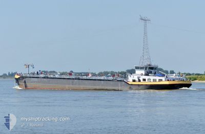
SOMTRANS V
Tanker
Current Trip
| Time Travelled | 17 h, 9 mins |
|---|---|
| Remaining Time | --- |
| Distance Travelled | 113.19 nm |
| Remaining Distance | --- |
| AVG Speed | 11 Knop |
| MAX Speed | 12 Knop |
| AVG Wind | 8.3 knots |
| MAX Wind | 10 knots |
| MIN Temp | -0.5°C / 31.1°F |
| MAX Temp | 8°C / 46.4°F |
| Djupgående | 2.8 m |
| Position mottagen | 2 h, 47 m sen |
Current Position
| Longitud | 4.70404° |
|---|---|
| Latitude | 51.82245° |
| Status | Under way using engine |
| Fart | 6.6 Knop |
| Kurs | 267.7° |
| Område | North Sea |
| Station | T-AIS |
| Position mottagen | 2 h, 47 m sen |
Info
Information
The current position of SOMTRANS V is in North Sea with coordinates 51.82245° / 4.70404° as reported on 2025-03-18 06:43 by AIS to our vessel tracker app. The vessel's current speed is 6.6 Knop
The vessel SOMTRANS V (MMSI: 205238190) is a Tanker It's sailing under the flag of [BE] Belgium.
In this page you can find informations about the vessels current position, last detected port calls, and current voyage information. If the vessels is not in coverage by AIS you will find the latest position.
The current position of SOMTRANS V is detected by our AIS receivers and we are not responsible for the reliability of the data. The last position was recorded while the vessel was in Coverage by the Ais receivers of our vessel tracking app.
The current draught of SOMTRANS V as reported by AIS is 2.8 meters
Weather
| Temperature | -0.5°C / 31.1°F |
|---|---|
| Wind Speed | 7 knots |
| Direction | 88° E |
| Pressure | 1029.2 hPa |
| Humidity | 66 % |
| Cloud Coverage | --- |
Featured Company
Last Port Calls
| Port | Arrival | Departure | Time In Port |
|---|---|---|---|
| 2025-03-17 17:01 | 2025-03-17 17:21 | 20 m | |
| 2025-03-17 11:24 | 2025-03-17 13:07 | 1 h | |
| 2025-03-16 13:37 | 2025-03-17 10:07 | 20 h | |
| 2025-03-14 09:51 | 2025-03-15 05:14 | 19 h | |
| 2025-03-13 21:53 | 2025-03-13 22:15 | 22 m | |
| 2025-03-12 21:34 | 2025-03-13 16:38 | 19 h | |
| 2025-03-12 08:17 | 2025-03-12 09:23 | 1 h | |
| 2025-03-10 10:46 | 2025-03-11 14:22 | 1 d | |
| 2025-03-09 22:33 | 2025-03-09 23:00 | 27 m | |
| 2025-03-09 04:45 | 2025-03-09 17:10 | 12 h |
Last Trips
| Origin | Departure | Destination | Arrival | Distance | |
|---|---|---|---|---|---|
| 2025-03-17 13:07 | 2025-03-17 17:01 | 44.64 nm | |||
| 2025-03-17 10:07 | 2025-03-17 11:24 | 13.55 nm | |||
| 2025-03-15 05:14 | 2025-03-16 13:37 | 170.65 nm | |||
| 2025-03-13 22:15 | 2025-03-14 09:51 | 109.58 nm | |||
| 2025-03-13 16:38 | 2025-03-13 21:53 | 58.16 nm | |||
| 2025-03-12 09:23 | 2025-03-12 21:34 | 55.45 nm | |||
| 2025-03-11 14:22 | 2025-03-12 08:17 | 110.12 nm | |||
| 2025-03-09 23:00 | 2025-03-10 10:46 | 112.96 nm | |||
| 2025-03-09 17:10 | 2025-03-09 22:33 | 58.88 nm | |||
| 2025-03-08 16:42 | 2025-03-09 04:45 | 57.99 nm |
Events
| Tid | Event | Detaljer | Position / Dest | Information |
|---|---|---|---|---|
| 2025-03-18 06:43 | UTANFÖR täckningsområde |
51.82245 / 4.70404
North Sea
|
Fart: 6.6 kn Kurs: 267.7° |
|
| 2025-03-18 06:43 | I täckningsområde |
51.82245 / 4.70404
North Sea
|
Fart: 6.6 kn Kurs: 267.7° |
|
| 2025-03-18 05:15 | UTANFÖR täckningsområde |
51.82057 / 4.67352
North Sea
|
Fart: 9.3 kn Kurs: 95.3° |
|
| 2025-03-18 03:50 | I täckningsområde |
51.69390 / 4.50484
North Sea
|
Fart: 5.9 kn Kurs: 109.3° |
|
| 2025-03-18 01:27 | UTANFÖR täckningsområde |
51.80039 / 4.79404
North Sea
|
Fart: 5.7 kn Kurs: 254.8° |
|
| 2025-03-17 19:41 | I täckningsområde |
51.82935 / 6.22874
North Sea
|
Fart: 11.5 kn Kurs: 269.8° |
|
| 2025-03-17 16:48 | UTANFÖR täckningsområde |
51.51531 / 6.71953
North Sea
|
Fart: 12 kn Kurs: 324.6° |
|
| 2025-03-17 16:21 | AVGÅTT HAMN |
|
51.50411 / 6.72471
DELEV03900CITYX06686
|
Fart: 12 kn Kurs: 318.9° |
| 2025-03-17 16:01 | ANLÄNDER HAMN |
|
51.40624 / 6.74551
[DE] DUISBURG
|
Fart: 11.7 kn Kurs: 353.7° |
| 2025-03-17 12:07 | AVGÅTT HAMN |
|
50.96480 / 6.99681
DELEV03900CITYX06686
|
Fart: 10.5 kn Kurs: 22.1° |