
SPARTA
Pleasure Craft
Current Trip
SGRAVENDEEL
| Trip Time | 7 h, 45 mins |
|---|---|
| Trip Distance | 80.03 nm |
| AVG Speed | 9.7 Knop |
| MAX Speed | 9.7 Knop |
| Djupgående | 3.6 m |
| AVG Wind | 6 knots |
| MAX Wind | 8.8 knots |
| MIN Temp | 4.1°C / 39.38°F |
| MAX Temp | 8.3°C / 46.94°F |
| Position mottagen | 2 m sen |
Current Position
| Longitud | 4.61780° |
|---|---|
| Latitude | 51.79382° |
| Status | Moored |
| Fart | |
| Kurs | 19° |
| Område | North Sea |
| Station | T-AIS |
| Position mottagen | 2 m sen |
Info
Information
The current position of SPARTA is in North Sea with coordinates 51.79382° / 4.61780° as reported on 2025-02-08 07:23 by AIS to our vessel tracker app. The vessel's current speed is 0 Knop and is currently inside the port of S GRAVENDEEL.
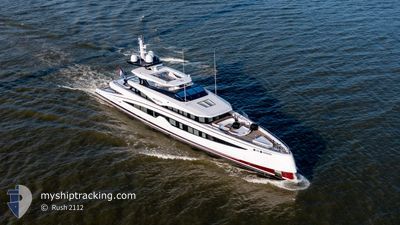
The vessel SPARTA (IMO: 9905198, MMSI: 244604671) is a Pleasure Craft It's sailing under the flag of [NL] Netherlands.
In this page you can find informations about the vessels current position, last detected port calls, and current voyage information. If the vessels is not in coverage by AIS you will find the latest position.
The current position of SPARTA is detected by our AIS receivers and we are not responsible for the reliability of the data. The last position was recorded while the vessel was in Coverage by the Ais receivers of our vessel tracking app.
The current draught of SPARTA as reported by AIS is 3.6 meters
Weather
| Temperature | 2.3°C / 36.14°F |
|---|---|
| Wind Speed | 9 knots |
| Direction | 102° ESE |
| Pressure | 1019.4 hPa |
| Humidity | 76.8 % |
| Cloud Coverage | 100 % |
Featured Company
Last Port Calls
| Port | Arrival | Departure | Time In Port |
|---|---|---|---|
| 2025-02-05 15:56 | |||
| 2024-12-04 12:06 | 2025-02-05 08:11 | ||
| 2024-12-04 08:10 |
Most Visited Ports (Last year)
| Port | Arrivals | |
|---|---|---|
| 6 | ||
| 2 | ||
| 1 |
Last Trips
| Origin | Departure | Destination | Arrival | Distance | |
|---|---|---|---|---|---|
| 2025-02-05 09:11 | 2025-02-05 16:56 | 80.03 nm | |||
| 2024-12-04 09:10 | 2024-12-04 13:06 | 25.54 nm |
Events
| Tid | Event | Detaljer | Position / Dest | Information |
|---|---|---|---|---|
| 2025-02-07 11:31 | Status ändrad | Moored Under way using engine |
51.79381 / 4.61781
[NL] S GRAVENDEEL
|
Fart: Kurs: 19° |
| 2025-02-05 16:38 | Destination ändrad | SGRAVENDEEL SEATRIAL |
51.79382 / 4.61783
[NL] S GRAVENDEEL
|
Fart: Kurs: 19° |
| 2025-02-05 15:57 | STOPPAR förflyttning |
51.79107 / 4.62134
[NL] S GRAVENDEEL
|
Fart: Kurs: 184° |
|
| 2025-02-05 15:56 | ANLÄNDER HAMN |
|
51.79165 / 4.62167
[NL] S GRAVENDEEL
|
Fart: 3.3 kn Kurs: 195° |
| 2025-02-05 13:28 | STARTAR förflyttning | 0.97 nm, South East of HOEK VAN HOLLAND |
51.96484 / 4.14177
SEATRIAL
|
Fart: 8.3 kn Kurs: 124.4° |
| 2025-02-05 13:08 | STOPPAR förflyttning | 0.68 nm, South East of HOEK VAN HOLLAND |
51.96762 / 4.13478
SEATRIAL
|
Fart: 0.3 kn Kurs: 124° |
| 2025-02-05 11:47 | STARTAR förflyttning | 8.36 nm, North West of OUDDORP |
51.88603 / 3.76072
SEATRIAL
|
Fart: 13.8 kn Kurs: 36.3° |
| 2025-02-05 11:45 | STOPPAR förflyttning | 8.36 nm, North West of OUDDORP |
51.88440 / 3.75866
SEATRIAL
|
Fart: 0.3 kn Kurs: 47° |
| 2025-02-05 08:11 | AVGÅTT HAMN |
|
51.79001 / 4.62469
SEATRIAL
|
Fart: 2.4 kn Kurs: 12° |
| 2025-02-05 08:11 | STARTAR förflyttning |
51.79024 / 4.62403
[NL] S GRAVENDEEL
|
Fart: 3.4 kn Kurs: 57° |