
SPEED
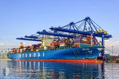
Container Ship
Current Trip
| Time Travelled | 8 days |
|---|---|
| Remaining Time | --- |
| Distance Travelled | 1638.53 nm |
| Remaining Distance | 871.86 nm |
| AVG Speed | 12.4 Knop |
| MAX Speed | 18.3 Knop |
| AVG Wind | 19.1 knots |
| MAX Wind | 26 knots |
| MIN Temp | 6.5°C / 43.7°F |
| MAX Temp | 24.6°C / 76.28°F |
| Djupgående | 13.7 m |
| Position mottagen | 1 d sen |
Current Position
| Longitud | 114.11272° |
|---|---|
| Latitude | 22.25789° |
| Status | Under way using engine |
| Fart | 13.3 Knop |
| Kurs | 159.6° |
| Område | South China Sea |
| Station | T-AIS |
| Position mottagen | 1 d sen |
Info
Information
The current position of SPEED is in South China Sea with coordinates 22.25789° / 114.11272° as reported on 2025-02-09 10:59 by AIS to our vessel tracker app. The vessel's current speed is 13.3 Knop and is heading at the port of SINGAPORE. The estimated time of arrival as calculated by MyShipTracking vessel tracking app is 2025-02-13 04:00 LT
The vessel SPEED (IMO: 9475698, MMSI: 241313000) is a Container Ship that was built in 2012 ( 13 År gammal ). It's sailing under the flag of [GR] Greece.
In this page you can find informations about the vessels current position, last detected port calls, and current voyage information. If the vessels is not in coverage by AIS you will find the latest position.
The current position of SPEED is detected by our AIS receivers and we are not responsible for the reliability of the data. The last position was recorded while the vessel was in Coverage by the Ais receivers of our vessel tracking app.
The current draught of SPEED as reported by AIS is 13.7 meters
Weather
| Temperature | 24.7°C / 76.46°F |
|---|---|
| Wind Speed | 19 knots |
| Direction | 24° NNE |
| Pressure | 1013.6 hPa |
| Humidity | 87.7 % |
| Cloud Coverage | 100 % |
Featured Company
Last Port Calls
| Port | Arrival | Departure | Time In Port |
|---|---|---|---|
| 2025-02-02 13:41 | 2025-02-03 02:02 | 12 h | |
| 2025-01-25 18:13 | 2025-01-27 19:46 | 2 d | |
| 2025-01-21 06:17 | 2025-01-23 01:53 | 1 d | |
| 2025-01-12 14:45 | 2025-01-14 02:33 | 1 d | |
| 2024-12-01 11:41 | 2024-12-05 10:09 | 3 d | |
| 2024-12-01 09:32 |
Most Visited Ports (Last year)
| Port | Arrivals | |
|---|---|---|
| 24 | ||
| 5 | ||
| 4 | ||
| 3 | ||
| 3 | ||
| 2 |
Last Trips
| Origin | Departure | Destination | Arrival | Distance | |
|---|---|---|---|---|---|
| 2025-01-28 04:46 | 2025-02-02 21:41 | 733.60 nm | |||
| 2025-01-23 09:53 | 2025-01-26 03:13 | 786.51 nm | |||
| 2025-01-14 10:33 | 2025-01-21 14:17 | 2879.90 nm | |||
| 2024-12-05 11:09 | 2025-01-12 22:45 | 12893.22 nm | |||
| 2024-12-01 10:32 | 2024-12-01 12:41 | 11.27 nm |
Events
| Tid | Event | Detaljer | Position / Dest | Information |
|---|---|---|---|---|
| 2025-02-09 11:02 | Status ändrad | Default Under way using engine |
22.24806 / 114.11715
SGSIN PWBGB
|
Fart: 13.3 kn Kurs: 159.6° |
| 2025-02-09 10:59 | UTANFÖR täckningsområde |
22.25789 / 114.11272
South China Sea
SGSIN PWBGB
|
Fart: 13.3 kn Kurs: 159.6° |
|
| 2025-02-09 10:43 | Djupgående ändrat | 13.7 12.6 |
22.31635 / 114.08768
SGSIN PWBGB
|
Fart: 14.7 kn Kurs: 159.4° |
| 2025-02-09 10:43 | Destination ändrad | SGSIN PWBGB CNSHK |
22.31635 / 114.08768
SGSIN PWBGB
|
Fart: 14.7 kn Kurs: 159.4° |
| 2025-02-09 10:43 | ETA ändrat | 2025/02/13 04:00 2025/02/08 11:00 |
22.31635 / 114.08768
SGSIN PWBGB
|
Fart: 14.7 kn Kurs: 159.4° |
| 2025-02-09 10:06 | Status ändrad | Under way using engine Default |
22.34537 / 113.95577
CNSHK
|
Fart: 15.3 kn Kurs: 110° |
| 2025-02-09 10:01 | Status ändrad | Default Under way using engine |
22.35107 / 113.93532
CNSHK
|
Fart: 15.3 kn Kurs: 112.5° |
| 2025-02-09 10:01 | Status ändrad | Under way using engine Default |
22.35167 / 113.93358
CNSHK
|
Fart: 14.6 kn Kurs: 123° |
| 2025-02-09 09:41 | I täckningsområde |
22.35167 / 113.93358
South China Sea
|
Fart: 15.3 kn Kurs: 112.5° |
|
| 2025-02-09 09:17 | STARTAR förflyttning | 0.55 nm, South West of CHIWAN |
22.45384 / 113.87695
CNSHK
|
Fart: 6.4 kn Kurs: 179° |