
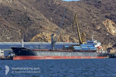
STAR II
Bulk Carrier
Current Trip
| Time Travelled | 8 days |
|---|---|
| Remaining Time | 1 h, 38 mins |
| Distance Travelled | 1477.83 nm |
| Remaining Distance | 238.04 nm |
| AVG Speed | 8.4 Knop |
| MAX Speed | 11.6 Knop |
| AVG Wind | 11.7 knots |
| MAX Wind | 31 knots |
| MIN Temp | 6.5°C / 43.7°F |
| MAX Temp | 16.3°C / 61.34°F |
| Djupgående | 5.2 m |
| Position mottagen | 1 d sen |
Current Position
| Longitud | 29.49029° |
|---|---|
| Latitude | 41.28216° |
| Status | Under way using engine |
| Fart | 10.5 Knop |
| Kurs | 86.8° |
| Område | Black Sea |
| Station | T-AIS |
| Position mottagen | 1 d sen |
Info
Information
The current position of STAR II is in Black Sea with coordinates 41.28216° / 29.49029° as reported on 2025-03-08 09:20 by AIS to our vessel tracker app. The vessel's current speed is 10.5 Knop and is heading at the port of CONSTANTA. The estimated time of arrival as calculated by MyShipTracking vessel tracking app is 2025-03-10 02:27 LT
The vessel STAR II (IMO: 9476068, MMSI: 636021503) is a Bulk Carrier that was built in 2007 ( 18 År gammal ). It's sailing under the flag of [LR] Liberia.
In this page you can find informations about the vessels current position, last detected port calls, and current voyage information. If the vessels is not in coverage by AIS you will find the latest position.
The current position of STAR II is detected by our AIS receivers and we are not responsible for the reliability of the data. The last position was recorded while the vessel was in Coverage by the Ais receivers of our vessel tracking app.
The current draught of STAR II as reported by AIS is 5.2 meters
Weather
| Temperature | 9.5°C / 49.1°F |
|---|---|
| Wind Speed | 3 knots |
| Direction | 129° SE |
| Pressure | 1015.3 hPa |
| Humidity | 68.1 % |
| Cloud Coverage | 88 % |
Featured Company
Last Port Calls
| Port | Arrival | Departure | Time In Port |
|---|---|---|---|
| 2025-02-28 16:31 | 2025-03-01 23:22 | 1 d | |
| 2025-02-13 04:38 | 2025-02-15 16:52 | 2 d | |
| 2025-01-15 18:55 | 2025-01-19 09:01 | 3 d |
Most Visited Ports (Last year)
| Port | Arrivals | |
|---|---|---|
| 13 | ||
| 5 | ||
| 4 | ||
| 3 | ||
| 3 | ||
| 2 |
Last Trips
| Origin | Departure | Destination | Arrival | Distance | |
|---|---|---|---|---|---|
| 2025-01-19 12:01 | 2025-02-13 07:38 | 1105.21 nm | |||
| 2024-12-27 19:16 | 2025-01-15 21:55 | 919.70 nm |
Events
| Tid | Event | Detaljer | Position / Dest | Information |
|---|---|---|---|---|
| 2025-03-08 09:22 | Status ändrad | Default Under way using engine |
41.28241 / 29.49609
RO CND
|
Fart: 10.5 kn Kurs: 86.8° |
| 2025-03-08 09:20 | UTANFÖR täckningsområde |
41.28216 / 29.49029
Black Sea
|
Fart: 10.5 kn Kurs: 86.8° |
|
| 2025-03-08 07:50 | Byter havsområde | Turkish part of the Black Sea Turkish part of the Sea of Marmara |
41.23219 / 29.15066
Black Sea
|
Fart: 9.7 kn Kurs: 56.6° |
| 2025-03-08 03:23 | STARTAR förflyttning | 11.12 nm, South East of YESILKOY |
40.79260 / 28.94255
RO CND
|
Fart: 3.1 kn Kurs: 102° |
| 2025-03-08 00:11 | STOPPAR förflyttning | 11.44 nm, South West of MALTEPE |
40.78547 / 28.94425
RO CND
|
Fart: 0.3 kn Kurs: 126° |
| 2025-03-07 01:35 | Status ändrad | Under way using engine Default |
40.76201 / 28.05177
RO CND
|
Fart: 9.6 kn Kurs: 80° |
| 2025-03-07 01:26 | Status ändrad | Default Under way using engine |
40.75784 / 28.02134
RO CND
|
Fart: 9.6 kn Kurs: 80.2° |
| 2025-03-07 01:19 | Status ändrad | Under way using engine Default |
40.75453 / 27.99749
RO CND
|
Fart: 9.8 kn Kurs: 80° |
| 2025-03-07 00:36 | Status ändrad | Default Under way using engine |
40.73496 / 27.84351
RO CND
|
Fart: 10.1 kn Kurs: 80.3° |
| 2025-03-07 00:33 | Status ändrad | Under way using engine Default |
40.73340 / 27.83192
RO CND
|
Fart: 10.1 kn Kurs: 82° |