

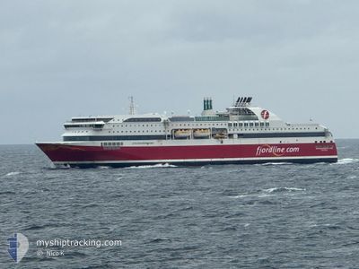
STAVANGERFJORD
Ro-Ro/Passenger Ship
Current Trip
| Time Travelled | 13 mins |
|---|---|
| Remaining Time | 11 h, 36 mins |
| Distance Travelled | 1.94 nm |
| Remaining Distance | 181.64 nm |
| AVG Speed | --- |
| MAX Speed | --- |
| AVG Wind | 17.9 knots |
| MAX Wind | 17.9 knots |
| MIN Temp | 10.9°C / 51.62°F |
| MAX Temp | 10.9°C / 51.62°F |
| Djupgående | 6.5 m |
| Position mottagen | 1 m sen |
Current Position
| Longitud | 5.52577° |
|---|---|
| Latitude | 58.89043° |
| Status | Under way using engine |
| Fart | 17.7 Knop |
| Kurs | 195° |
| Område | North Sea |
| Station | T-AIS |
| Position mottagen | 1 m sen |
Information
The current position of STAVANGERFJORD is in North Sea with coordinates 58.89043° / 5.52577° as reported on 2025-06-10 19:26 by AIS to our vessel tracker app. The vessel's current speed is 17.7 Knop and is heading at the port of HIRTSHALS. The estimated time of arrival as calculated by MyShipTracking vessel tracking app is 2025-06-11 09:04 LT
The vessel STAVANGERFJORD (IMO: 9586605, MMSI: 219347000) is a Ro-Ro/Passenger Ship that was built in 2013 ( 12 År gammal ). It's sailing under the flag of [DK] Denmark.
In this page you can find informations about the vessels current position, last detected port calls, and current voyage information. If the vessels is not in coverage by AIS you will find the latest position.
The current position of STAVANGERFJORD is detected by our AIS receivers and we are not responsible for the reliability of the data. The last position was recorded while the vessel was in Coverage by the Ais receivers of our vessel tracking app.
The current draught of STAVANGERFJORD as reported by AIS is 6.5 meters
Weather
| Temperature | 10.9°C / 51.62°F |
|---|---|
| Wind Speed | 18 knots |
| Direction | 326° NW |
| Pressure | 1011.5 hPa |
| Humidity | 80.4 % |
| Cloud Coverage | --- |
Featured Company
Last Port Calls
| Port | Arrival | Departure | Time In Port |
|---|---|---|---|
| 2025-06-10 19:19 | 2025-06-10 21:15 | 1 h | |
| 2025-06-10 12:47 | 2025-06-10 14:01 | 1 h | |
| 2025-06-10 06:48 | 2025-06-10 07:23 | 34 m | |
| 2025-06-09 18:05 | 2025-06-09 19:58 | 1 h | |
| 2025-06-09 13:04 | 2025-06-09 14:31 | 1 h | |
| 2025-06-09 07:43 | 2025-06-09 09:26 | 1 h | |
| 2025-06-08 19:19 | 2025-06-08 21:22 | 2 h | |
| 2025-06-08 12:47 | 2025-06-08 14:07 | 1 h | |
| 2025-06-08 06:48 | 2025-06-08 07:34 | 46 m | |
| 2025-06-07 18:05 | 2025-06-07 19:57 | 1 h |
Most Visited Ports (Last year)
| Port | Arrivals | |
|---|---|---|
| 357 | ||
| 355 | ||
| 312 | ||
| 175 | ||
| 1 |
Last Trips
| Origin | Departure | Destination | Arrival | Distance | |
|---|---|---|---|---|---|
| 2025-06-10 14:01 | 2025-06-10 19:19 | 103.90 nm | |||
| 2025-06-10 07:23 | 2025-06-10 12:47 | 103.20 nm | |||
| 2025-06-09 19:58 | 2025-06-10 06:48 | 181.86 nm | |||
| 2025-06-09 14:31 | 2025-06-09 18:05 | 70.79 nm | |||
| 2025-06-09 09:26 | 2025-06-09 13:04 | 70.76 nm | |||
| 2025-06-08 21:22 | 2025-06-09 07:43 | 182.52 nm | |||
| 2025-06-08 14:07 | 2025-06-08 19:19 | 103.28 nm | |||
| 2025-06-08 07:34 | 2025-06-08 12:47 | 103.36 nm | |||
| 2025-06-07 19:57 | 2025-06-08 06:48 | 182.47 nm | |||
| 2025-06-07 14:26 | 2025-06-07 18:05 | 71.02 nm |
Events
| Tid | Event | Detaljer | Position / Dest | Information |
|---|---|---|---|---|
| 2025-06-10 19:15 | AVGÅTT HAMN |
|
58.93072 / 5.56902
HIRTSHALS
|
Fart: 13 kn Kurs: 297° |
| 2025-06-10 19:10 | STARTAR förflyttning |
58.92233 / 5.58392
[NO] TANANGER
|
Fart: 3.3 kn Kurs: 349° |
|
| 2025-06-10 17:23 | STOPPAR förflyttning |
58.92475 / 5.58205
[NO] TANANGER
|
Fart: 0.3 kn Kurs: 54° |
|
| 2025-06-10 17:20 | Destination ändrad | HIRTSHALS RISAVIKA |
58.92895 / 5.57347
[NO] TANANGER
|
Fart: 11.7 kn Kurs: 136° |
| 2025-06-10 17:20 | ETA ändrat | 2025/06/11 06:00 2025/06/10 17:30 |
58.92895 / 5.57347
[NO] TANANGER
|
Fart: 11.7 kn Kurs: 136° |
| 2025-06-10 17:19 | ANLÄNDER HAMN |
|
58.92967 / 5.57213
[NO] TANANGER
|
Fart: 12.3 kn Kurs: 135.1° |
| 2025-06-10 12:01 | AVGÅTT HAMN |
|
60.39918 / 5.28963
RISAVIKA
|
Fart: 11.9 kn Kurs: 299° |
| 2025-06-10 11:57 | STARTAR förflyttning |
60.39392 / 5.30507
[NO] BERGEN
|
Fart: 4.7 kn Kurs: 307° |
|
| 2025-06-10 10:56 | STOPPAR förflyttning |
60.39282 / 5.30843
[NO] BERGEN
|
Fart: 0.2 kn Kurs: 47° |
|
| 2025-06-10 10:47 | ANLÄNDER HAMN |
|
60.39497 / 5.28563
[NO] BERGEN
|
Fart: 13.1 kn Kurs: 109.1° |